-
Day 125 – Cable ants and rock tumblers

Jan. 8
Joshua Tree Village
Total driving so far 5,537 miles / 8,859 km
http://Our-Joshua Tree-hangout-on-google.maps
What the heck are cable ants and rock tumblers? … I did not know either before visiting Joshua Tree National Park. Up to this point I was only aware of the album cover of that famous U2 album.
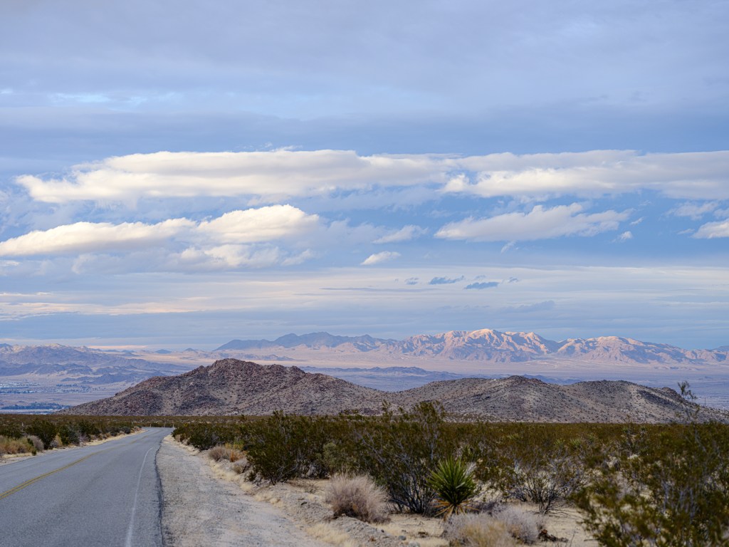
We decided to leave the California central coast after the massive flooding in the Santa Cruz area and more rain forecasted for the week of Jan-9th. Joshua Tree National Park was on our to-be-seen list, and its desert climate makes it very appealing for a January visit. 449 miles / 718 km, a Saturday of driving, and we were there.
On Sunday we headed for the first time into the park and we saw a lot of cable ants.
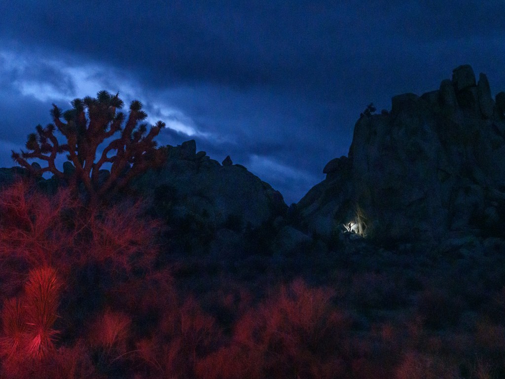
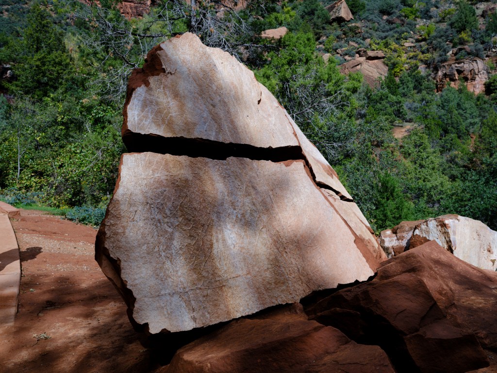
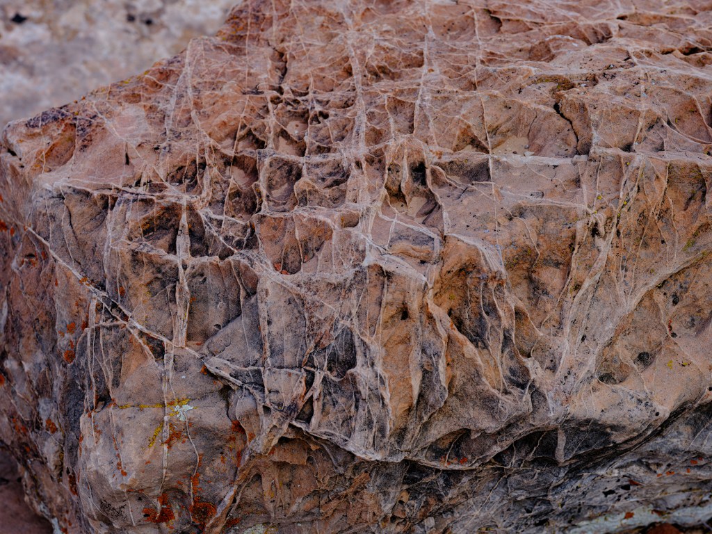
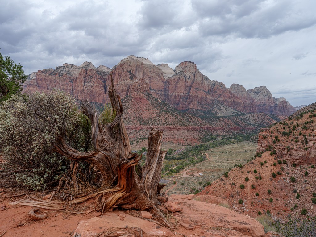
And the park is all about shapes.
Strange shapes; and quiet, calming shapes; amazing colors; sparse but diverse vegetation; a kind of underwater world that emerged into the alternative existence of a desert.
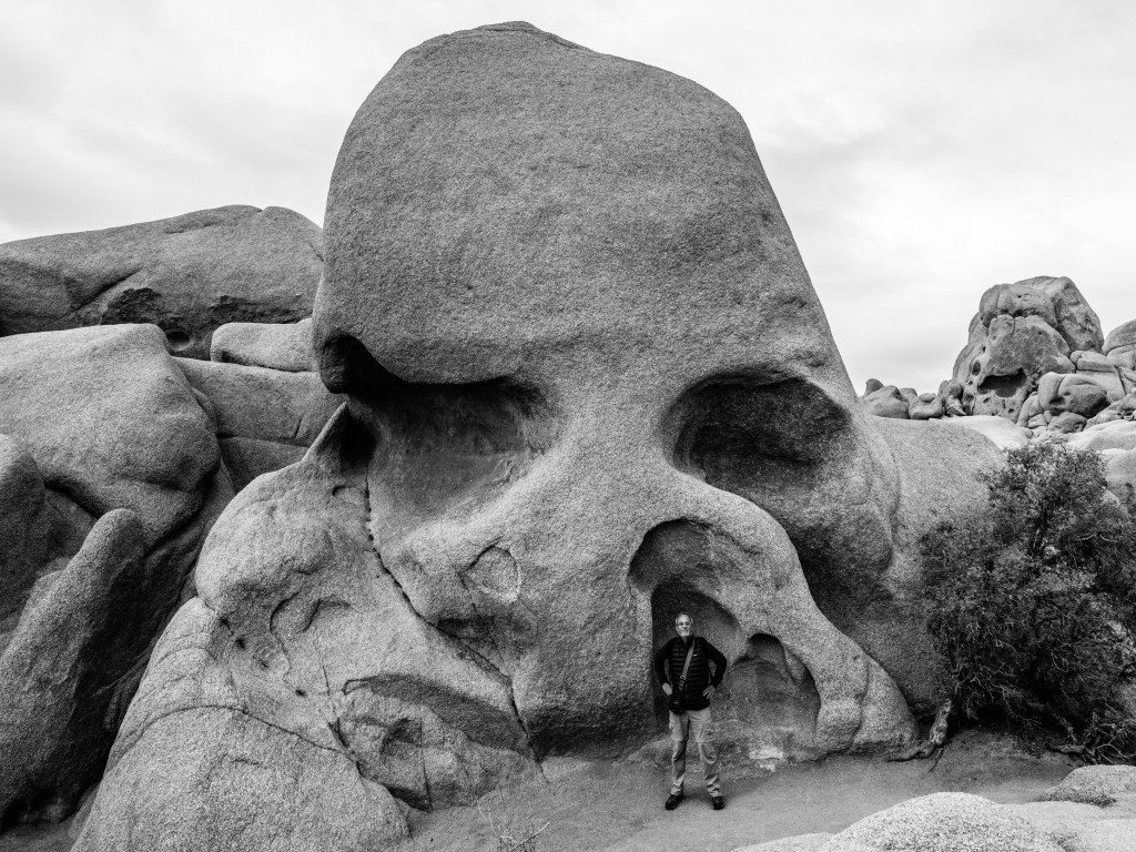
Skull rock, a classic instagram location; this is after sun set, so amazingly no other people around except the model & the photographer 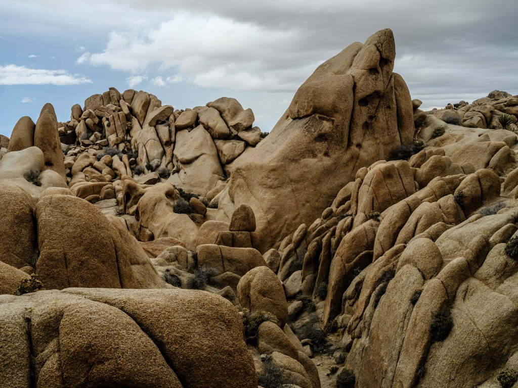
amazing shapes everywhere 
did I say ‘amazing shapes’ … you should guess who the photographer was … 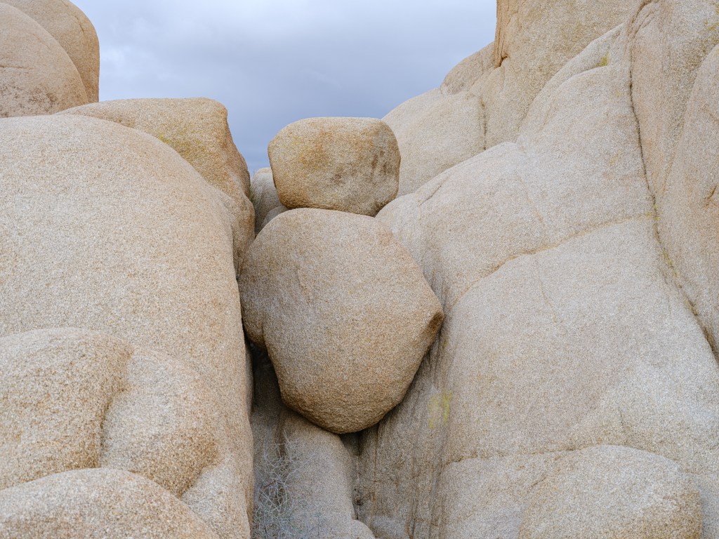
a more meditative formation of which there are many 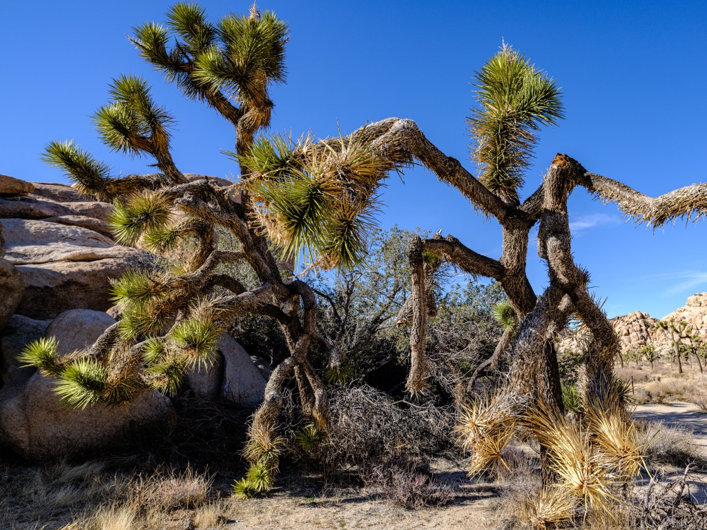
one XT-version of the classic Joshua Tree Shapes, colors, big land, silence, all the ingredientsfor my personal ‘magic mushroom’ when taking my cameras out, popping two 128 GB cards into my Fuji medium format high resolution monster, loading 120 film into my Mamiya7 rangefinder (10 exposures, that’s it) and search for that special capture of … something.
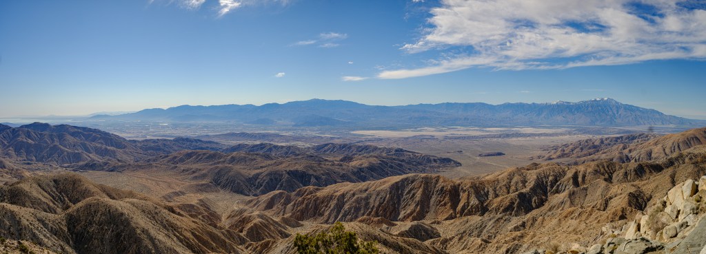
Key’s view at 5,185 feet / 1,700m sea level, the park’s highest point 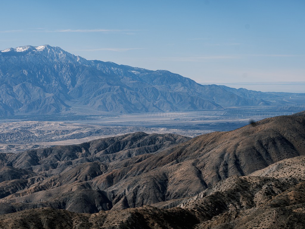
large wind farms on the foot of the San Gorgonio Mountain – great ! Key’s point offers a great view on Palm Spring, the Coachella valley, Salton Lake to the left and the snow-covered peak of the 11,500-foot / 3,500m high San Gorgonio Mountain to the right. Over 35 miles of view.
What is astonishing that on most days, despite the desert climate, the view is too hazy to see Palm Springs. Reason: smog from the coastal areas, Los Angeles, degrading air quality…
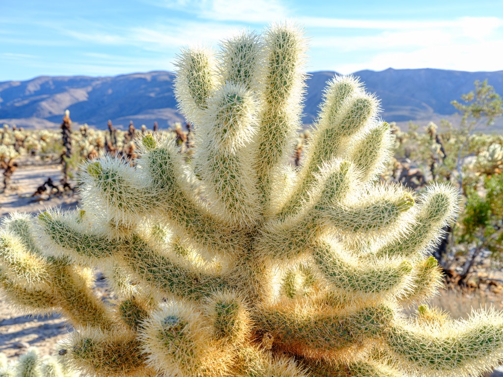
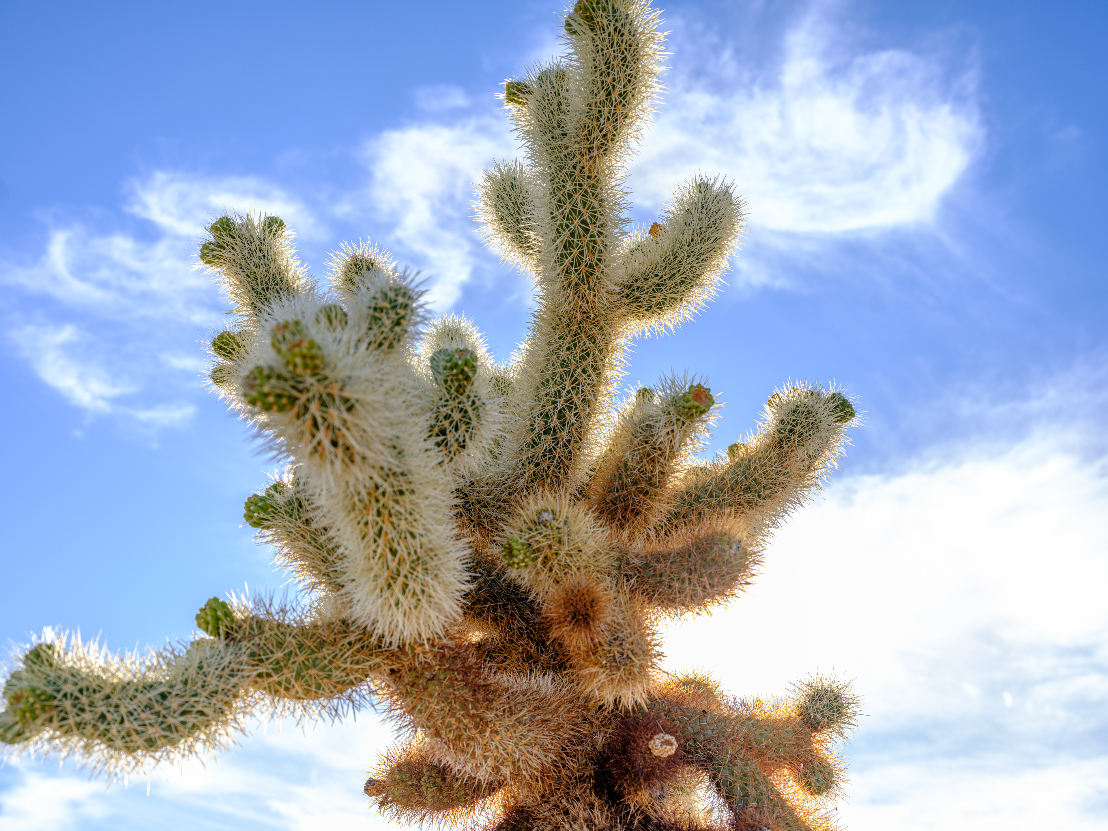
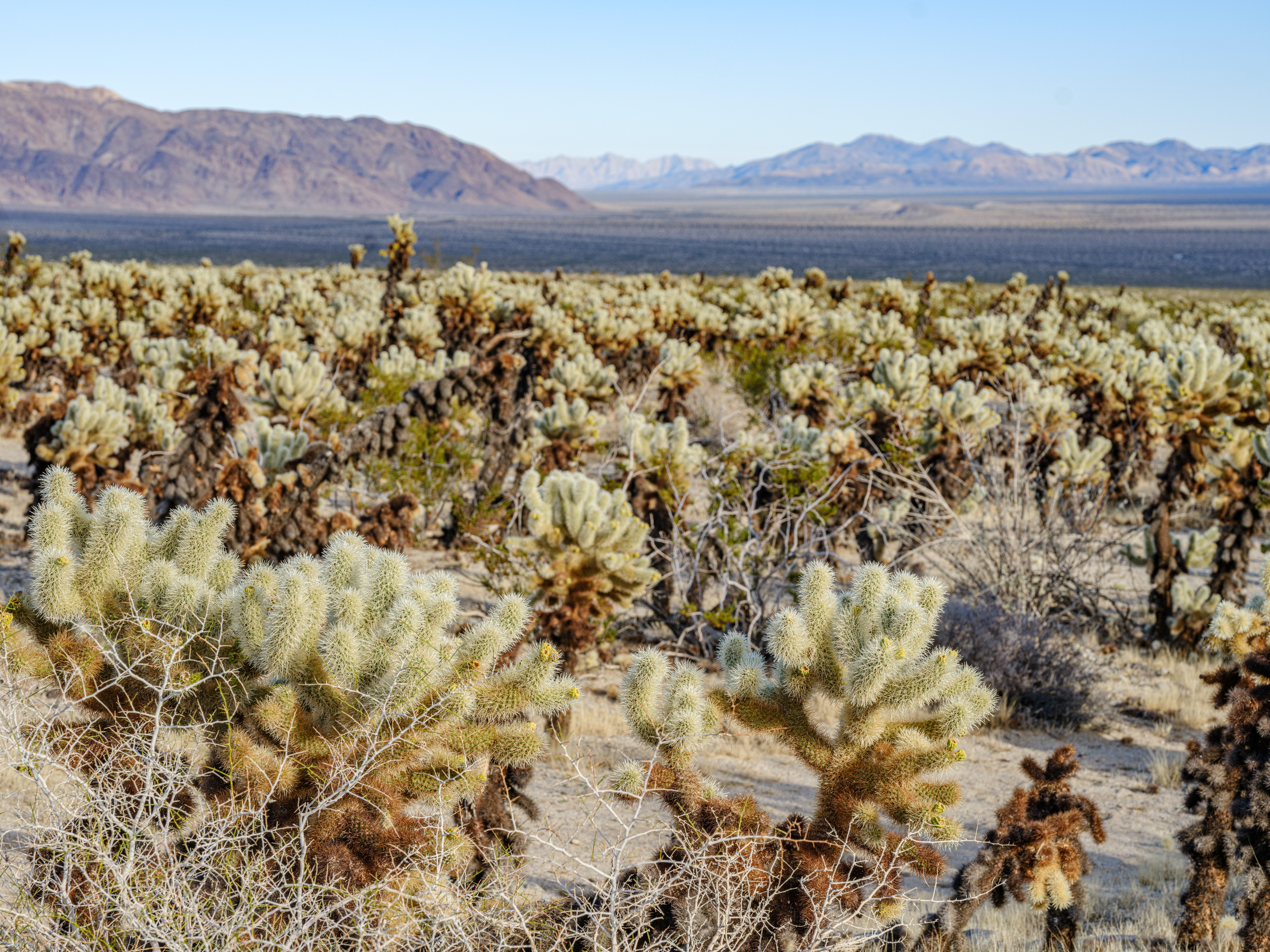
The underwater world really unfolds in what is called the ‘Cholla Cactus Garden’:
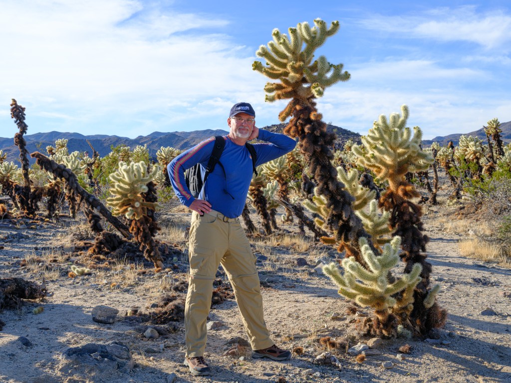
already in ‘mushroom’ photography ‘high’ These cylindrical cholla cacti grow across the park, but in the garden area named after them, there is a whole sea of them. They look like reef corals to me.
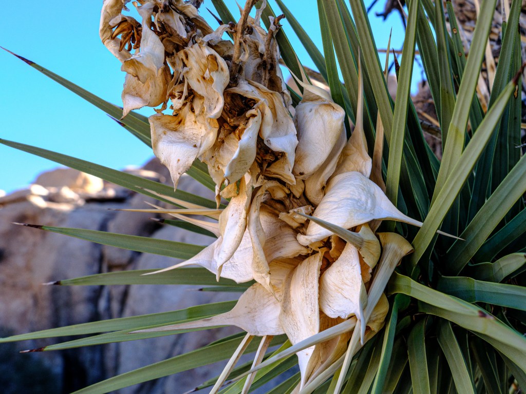
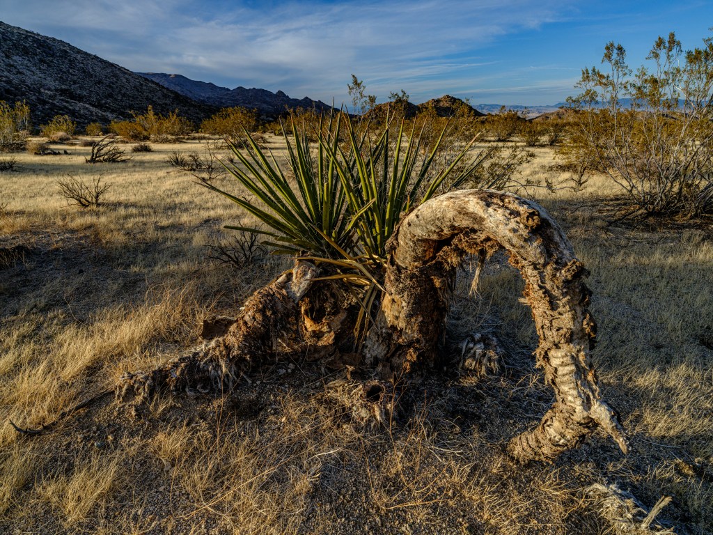
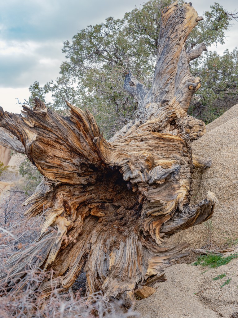
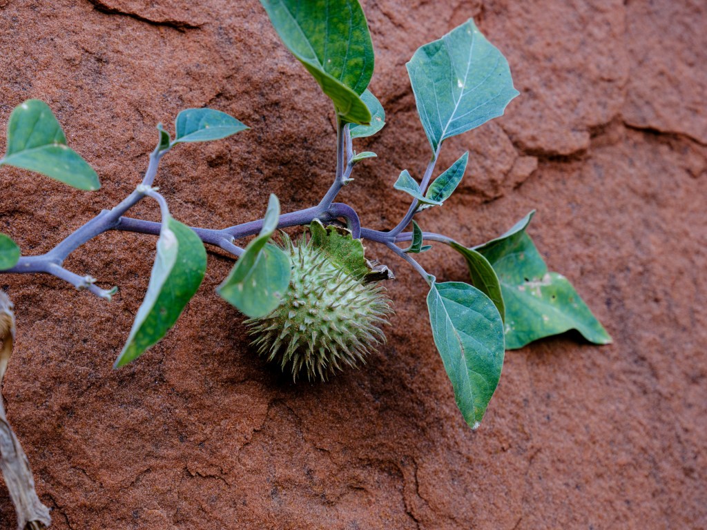
It is surprising how much different vegetation can be seen:

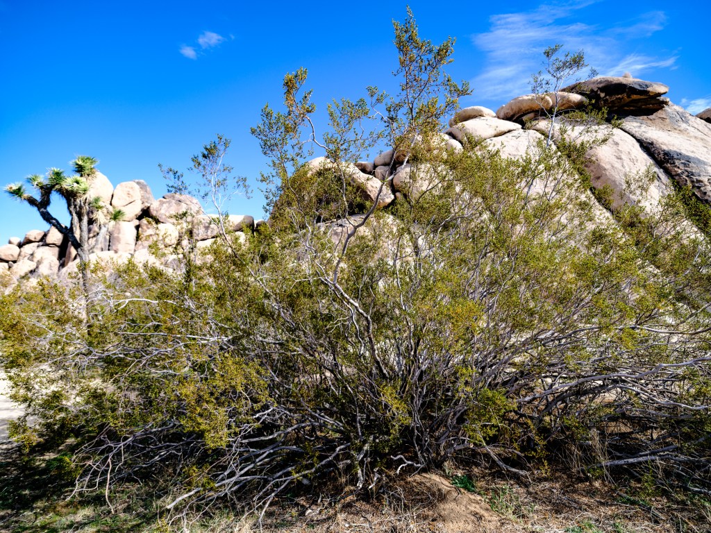
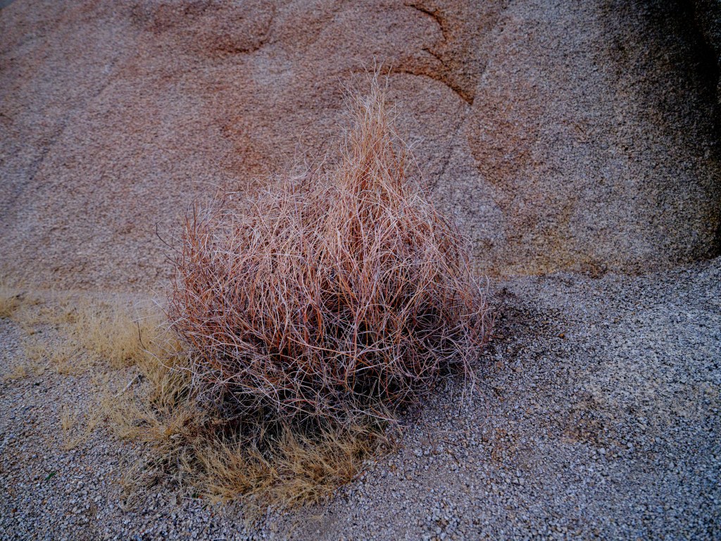
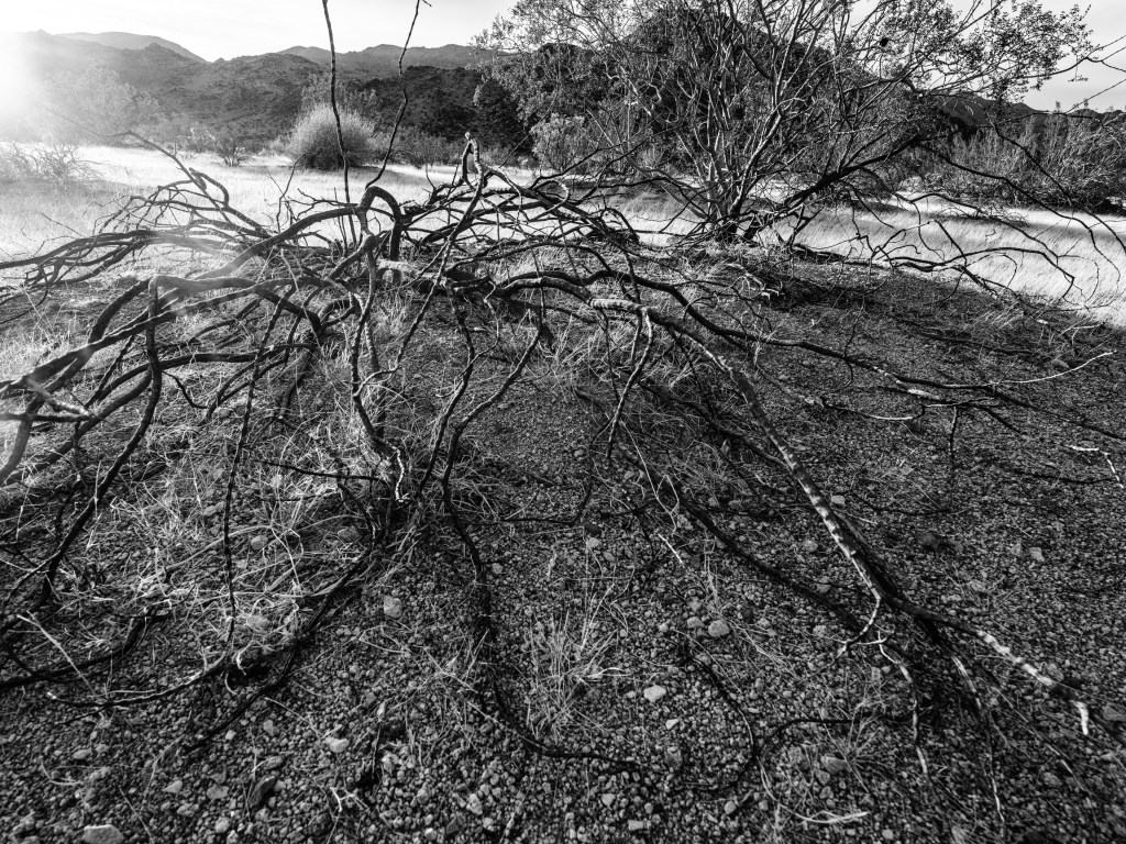
Withered plant stock provides exceptional shapes as well:
The view from the north entrance of the park towards north, Mojave desert, is also striking:
leaves us still to define what cable ants and rock tumblers are … here a clue, if you look carefully:
More to follow on Joshua Park.
— -
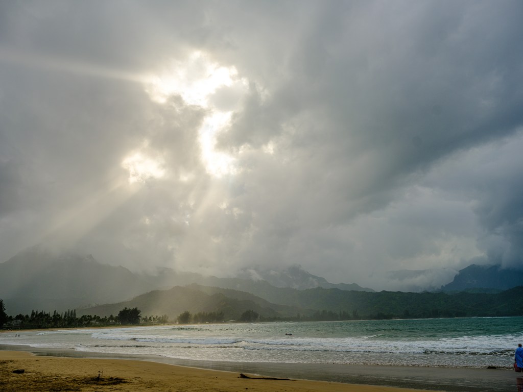
Day 111 – Aloha equals Paradise?

Dec. 26
Kalihiwai Bay, Kauai
Total driving so far 4,939 miles / 7,902 km
dream-villa-Kauai-on-google.maps
We are approaching nearly 4 weeks in Hawaii, staying on the north shores of Kauai, the most northern island of the archipelago:
I cannot describe Hawaii’s magic with a single sentence, since Kauai (and I guess the other islands too; Lanai for sure, which I have visited in the past) offers a special aura to visitors who want to see it.
Just skip the Hawaiian stereotypes we all know … surfers and big waves, coconuts (or coconut sunscreen), lei necklaces, hula dancing, luau festivals, cooking pigs in a pit, ukuleles, crying steel guitars, and close to that Elvis’ Blue Hawaii movie from 1961. (If you want to brush up on Elvis, try this: Elvis-Blue_Hawaii)
the classic pseudo Hawaiian style, a YouTube grab 
Elvis 1961, cover of his ‘Blue Hawaii’ album Luckily, Hawaii is different.
I can’t say how exactly it is different, that would require living in Hawaii. And I am not sure how different the islands are to each other, I speculate they are quite different. Kauai is more rainy, tropical than the other islands, green, lush, with amazing vegetations, and a bit less developed.
I asked nearly everybody I met and who lives on Kauai if Kauai is paradise.
I think the jury is still out on that. As expected, its not an anonymous ‘yes’, but its also not an anonymous ‘no’.
The Nature
Nothing for words, just take a look:
Hanalei beach 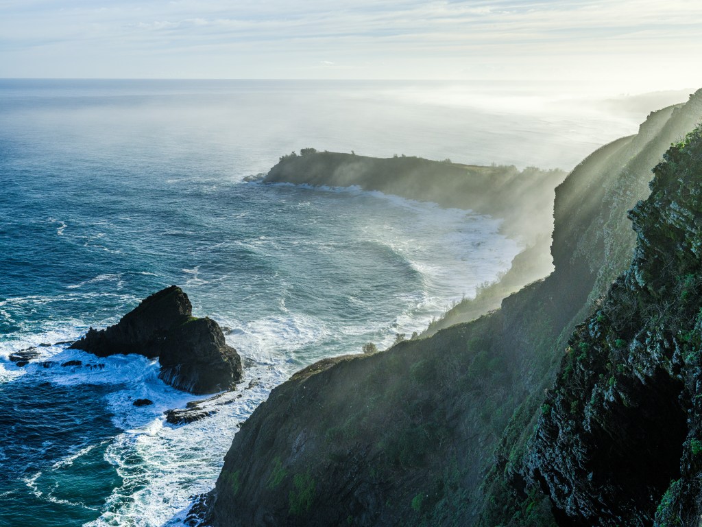
undisclosed area flight towards the Kilauea lighthouse 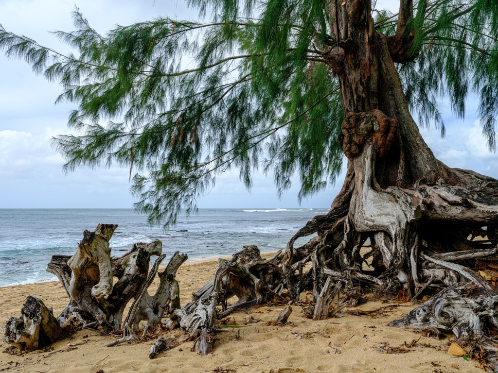
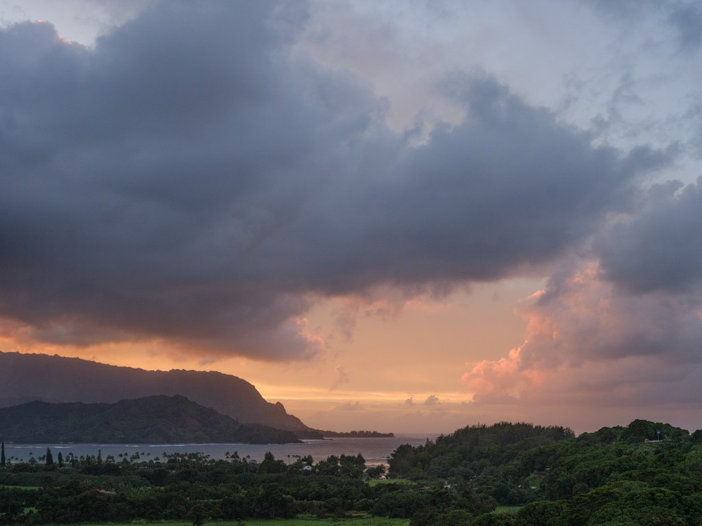
view from Princeville area on Hanalei beach The time warp
Kauai decelerates you.
Time runs more slowly. You decelerate. You look closer. You think in the moment, since nature is so overwhelming that all our errands, worries, ambitions, fears are so small in comparison. Call it “The National Park Effect”. I felt it very clearly in Yellowstone. People are relaxed, friendly, smiling, and everybody greets everybody when you pass by. You can’t do anything else than look and inhale …
and photograph :-):
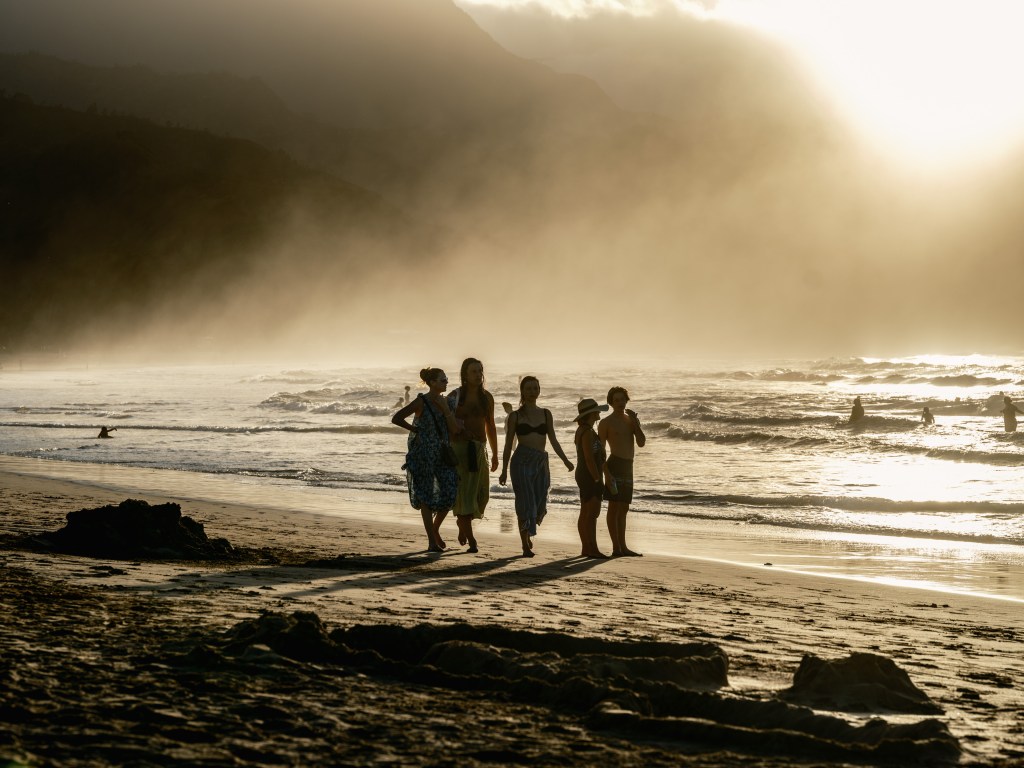
light, ocean, beach 
that happy smile 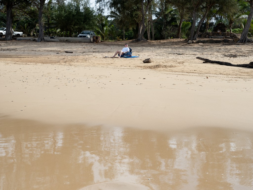
contemplating, slowed down 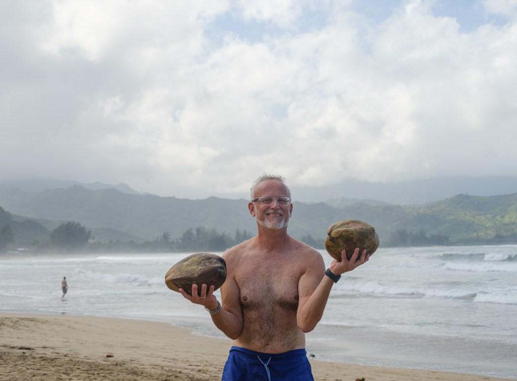
just happy about those coconuts 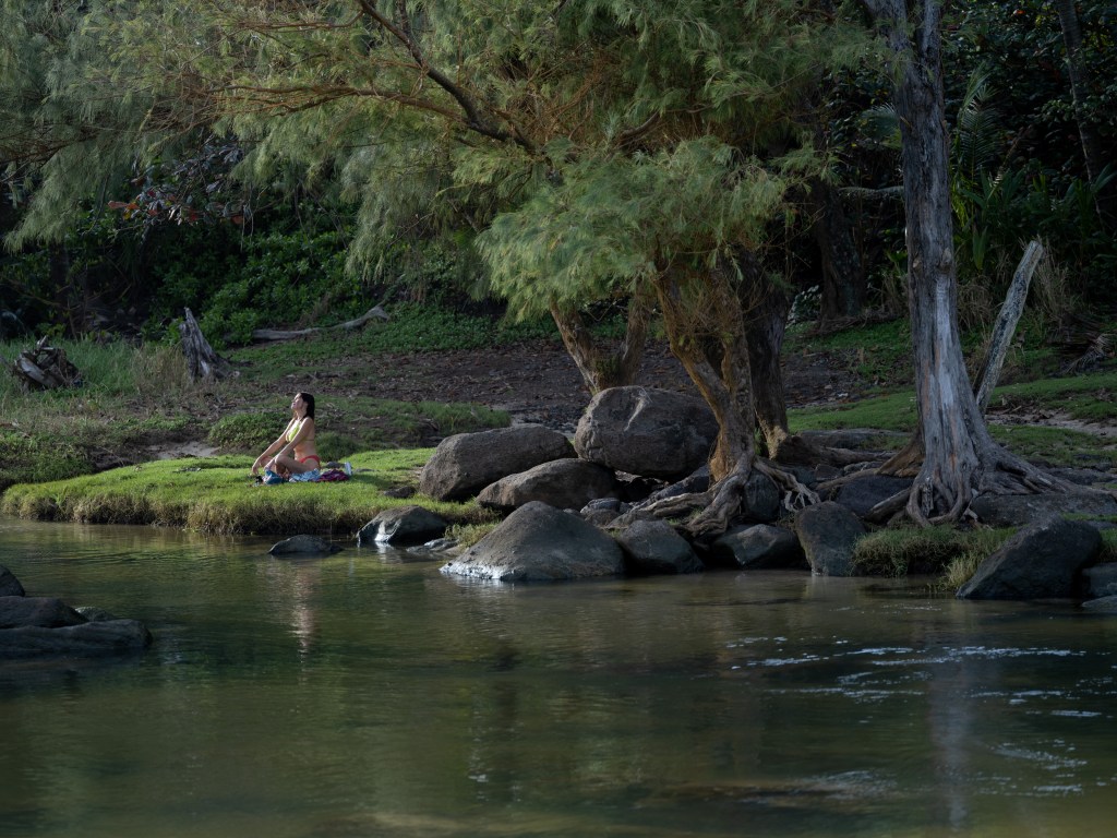

Surfers & surf
Yes, there is a ton of surfing going on. Its not a cliche, its part of the life style for many locals, it’s a true surf culture. Put the surf board in the truck, and go! If you walk along the parking lot of a public beach and you see trucks, not mustangs or sedans, you know all the people are locals.
Winter time is surfing time. The locals say the swell comes down from the Arctic Ocean, the reason the north shores have the big waves. The surf is stunning in its beauty, power and seductiveness. The telltale is that hardly no surfer seems to walk with the board into the water, they all run, obviously thinking ‘why wait any longer?’.
Locals surfing on Kalihiwai bay on Christmas Day 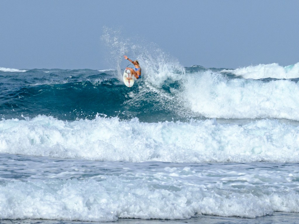
that girl rips thru the waves 
local dude waxing his board on the beach, his truck right behind him; he came to Hawaii as a small child 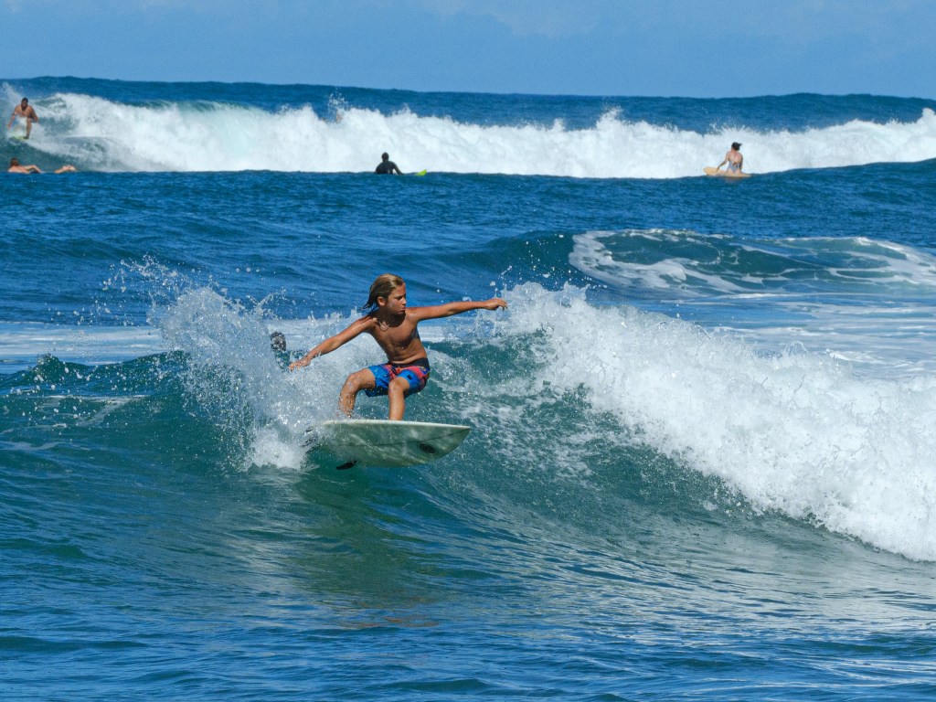
the ‘surf rats’ as our host called – respectfully – the young surfers 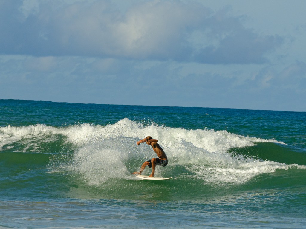
The surf is also quickly deadly. Rip curls are the killer. They pull you out in no time. Folks like myself are destined to underestimate how fast that can happen just a few meters into the water. Turning on the brain helps, or simply listen to the life guards (if a beach has life guards). Today, on December 26, we see the red rescue helicopter going back and forth, searching, on the outer rim of our bay. The search started yesterday and keeps going on for the second day. The locals say its now just about finding the dead body.
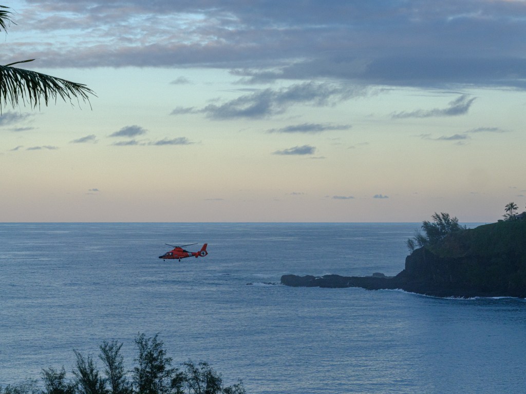

searching for a 56 year old man (according news) in the evening, and the day after Surfing makes you happy, though. No question about that. Water, waves, flying over water, what’s not to like…

body surfers ! Karin and Ewa in full action Chickens, cars & albatrosses
Chickens and cars have gone wild on Kauai. The chickens are feral, the cars similarly are all over the place by getting dumped anywhere, on the side of the road, on a property. Luckily, there are more wild chickens than dumped cars.
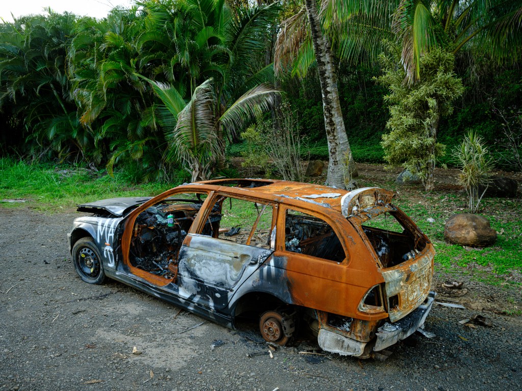
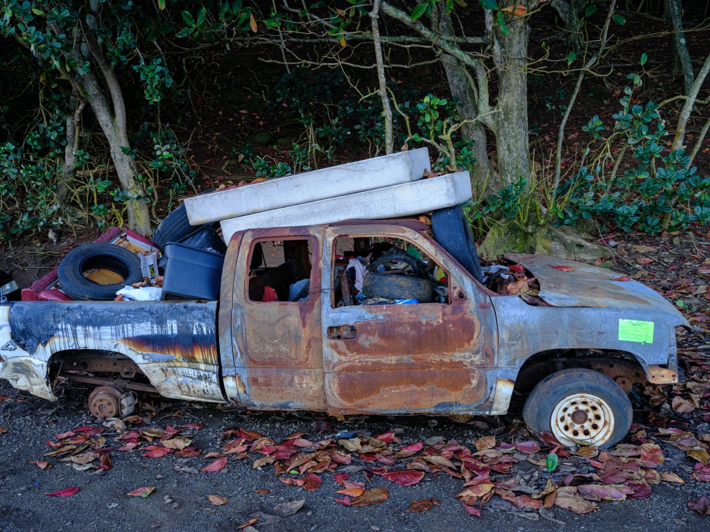
two from my Kauai dumped car image collection The local hearsay is that the chickens escaped from their coops during the hurricane Iwa in 1982 and hurricane Iniki in 1992. Go figure.
If Kauai would need an island animal, the chickens are clearly outperforming the albatrosses.

The albatrosses inhabit for example the Kilauea Point National Wildlife Refuge (https://www.fws.gov/refuge/kilauea-point). We caught up with them when our apartment host Claudia took us to the property of friends of hers close to that bird sanctuary. We caught them making out 🙂
Last but not least, something about food
Coconuts are abundant and tasty. They sell for $10 a pop on a street stand to make a point of how expensive food and groceries are. On average groceries in a store are 2x as expensive than in New Jersey, and this includes local grown products such as oranges. Crazy. Star fruits are delicious and beautiful. Food trucks are quite common and serve very nice food.
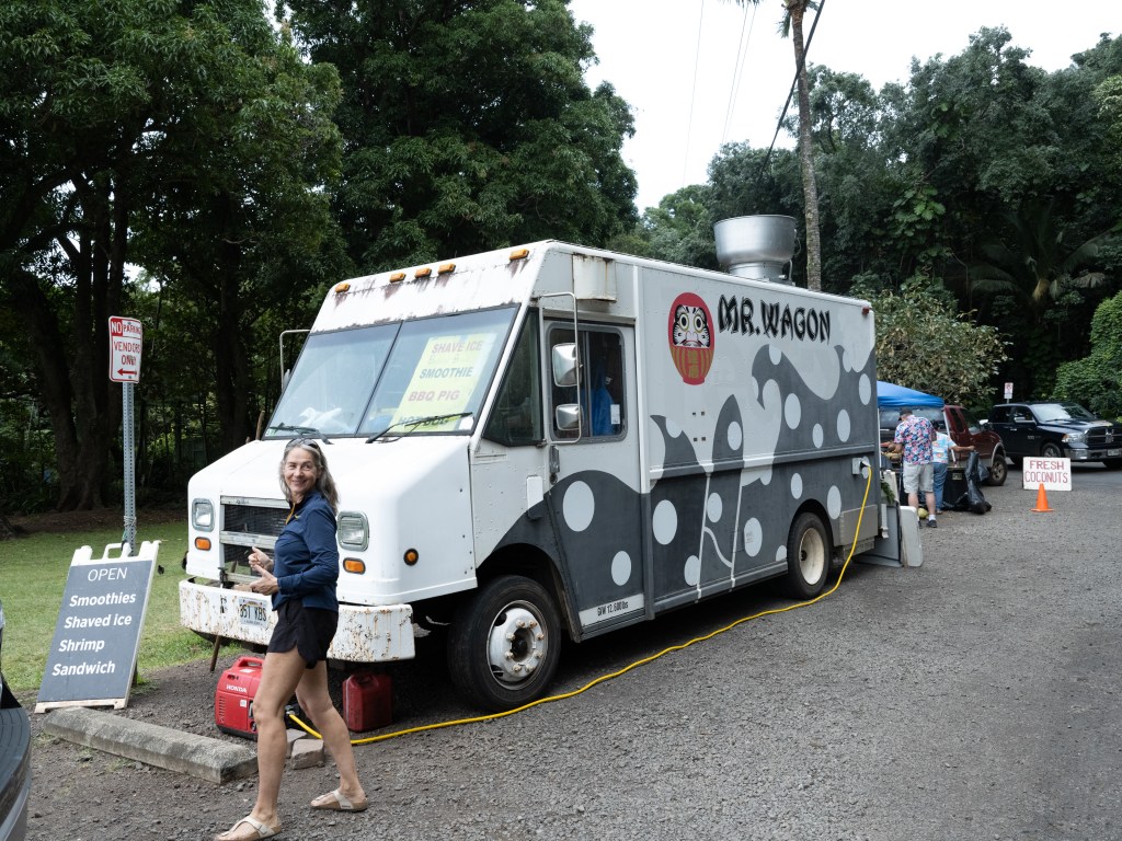
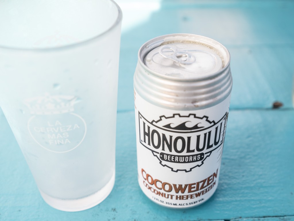
left: poke from a food truck / right: cocoweizen – an island version of wheat beer 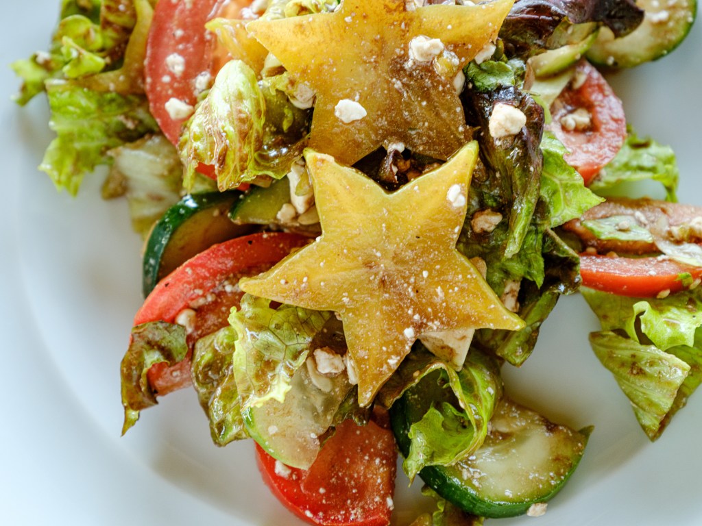
self-made salad spiced up with star fruits Fish can be delicious, but is also very expensive and locals complain that the ocean waters have been way too overfished. On days of high demand, restaurants might serve flown in fish. Also kind of crazy, considering that Kauai is in the middle of the Pacific Ocean.
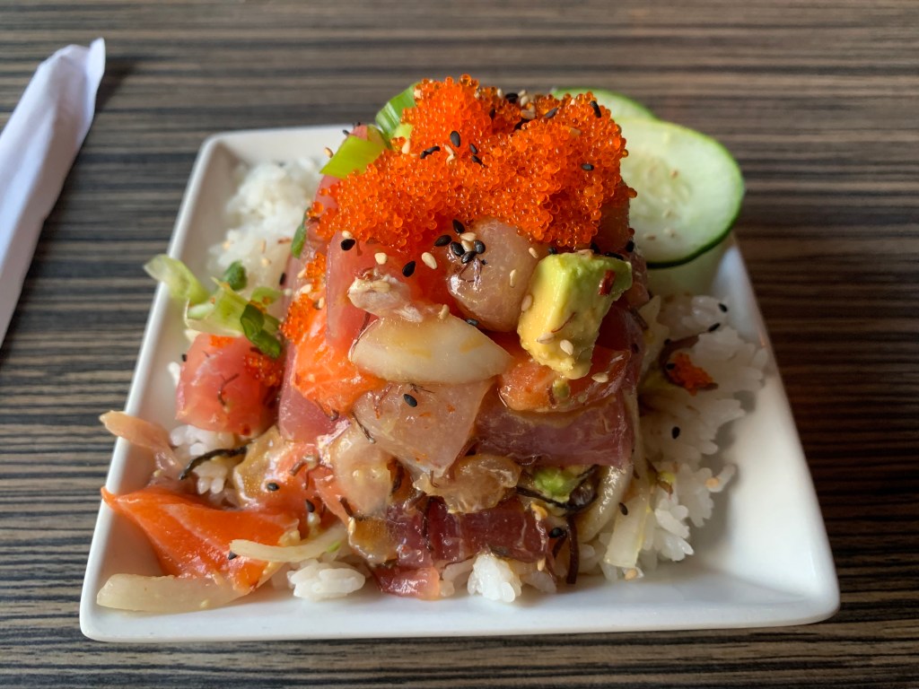
food truck served poke Is Kauai paradise?
I think its very close…
-
Day 82 – By order of Darth Vader

Nov. 27
Mount Tamalpais and Bolinas
Total driving so far 4,939 miles / 7,902 km
Bolinas-on-google.maps
A lot has happened since the Day 47 Schnitzeljagd post;
The Day 47 post was on front of Schnitzeljagd for weeks like Groundhog Day, since I got so busy with working, a week of business travel, us visiting national park places on weekends, buying a new car, registering the car with the New Jersey DMV as out-of-state purchase, watching the soccer world cup, and and and…
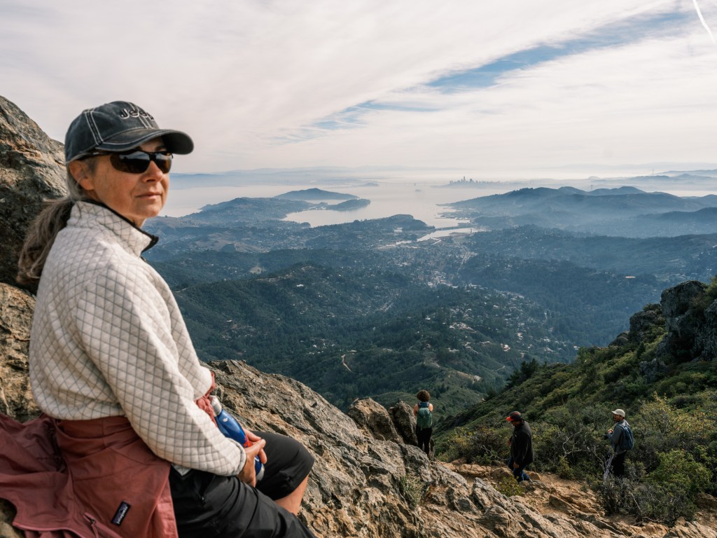
We started Day 82, the Sunday after Thanksgiving, from our current basecamp in San Francisco – the city is as great as we thought it will be (more on that later). We drove up to Mount Tamalpais in our super luxurious Grand Cherokee which nearly is a self-driving vehicle.
Mount “T” is of course very well known to the locals as a state park and recreational area, but I discovered it by chance on an excursion around 2011 on a business trip to biotech land in South San Francisco. Its a stunning area, and we have a self-made print in our living room back home from one of the wind swept trees on the golden hills of Mount T.
This is how it looked today, a bit hazy of course (and I was shooting into the sun):
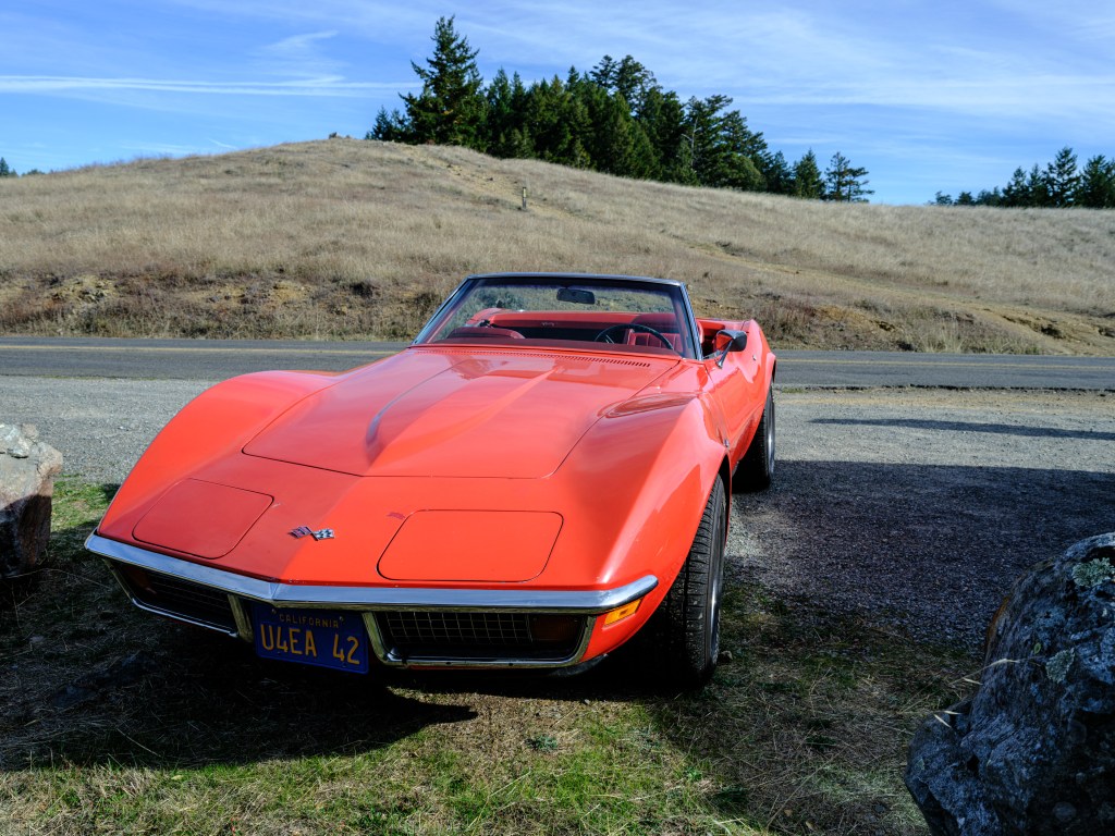
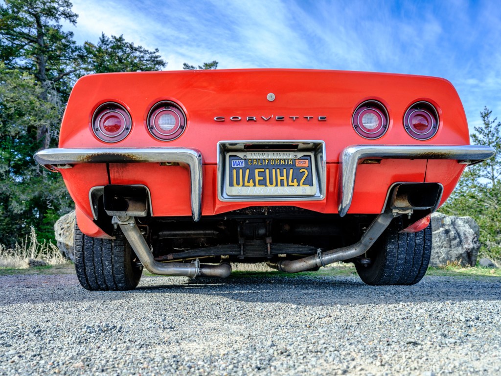
Mount Tamalpais East Peak Roaming around the hills of Mount T we saw this orange beauty (I am not a fan of the current Corvettes, but the classic Stingray ‘got it’):
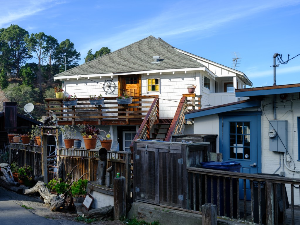
leaf springs, hm, but even with those the Stingray turned into a classic; not sure the exhaust pipes are supposed to run that close to the ground From Mount T we drove to an amazing village, that I had also discovered on this past business trip in search for food:
Bolinas … a living time capsule … a village where any road sign along California state route 1 that points the way into town has been torn down by local residents.
What happens in Bolinas ?
Surfing, most of all.
A little bit of tourism. But our waiter said that the Stinson Beach in the south and Point Reyes in the north ‘filter out’ most tourists, and only a few make it into Bolinas. Of course we were among those chosen ones.‘Filtering out tourists‘, that says it all.
Housing ranges from original homes in tear down condition to original-renovated and a few high end houses. To consider: water was in short supply already in the 50s according one ex-resident we chatted with. It is even more scarce today. In summer time, if a household uses too much water, the town just shuts down the water supply for that house.
(All you Lakers, running your lawn sprinklers at noon time, watch out what the future will bring.)
ocean house 
ocean house with boat 
fun details 
tear down (and car is for sale) 
entrance to a beautiful ocean front house 
American-Austrian style There are some other amazing sights in town, from the Grand Hotel to various classic cars:
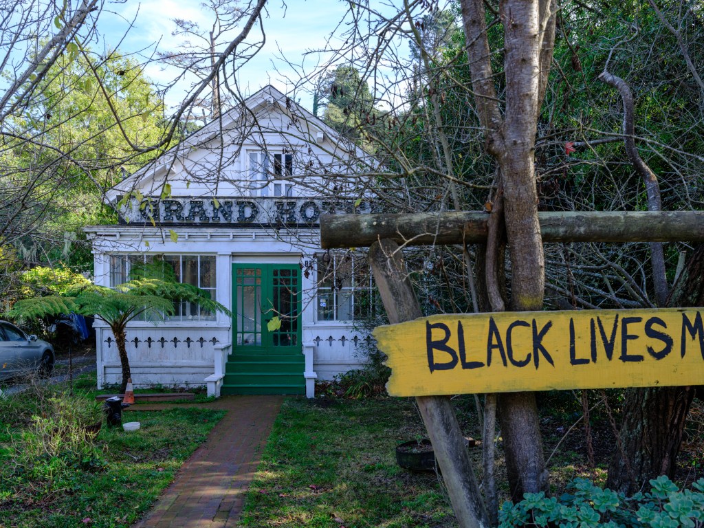
the politically engaged Grand Hotel 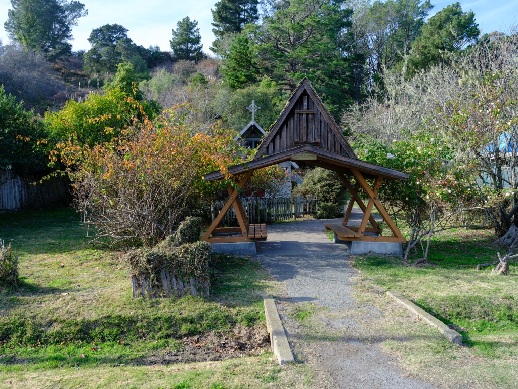
a church that fits perfectly in 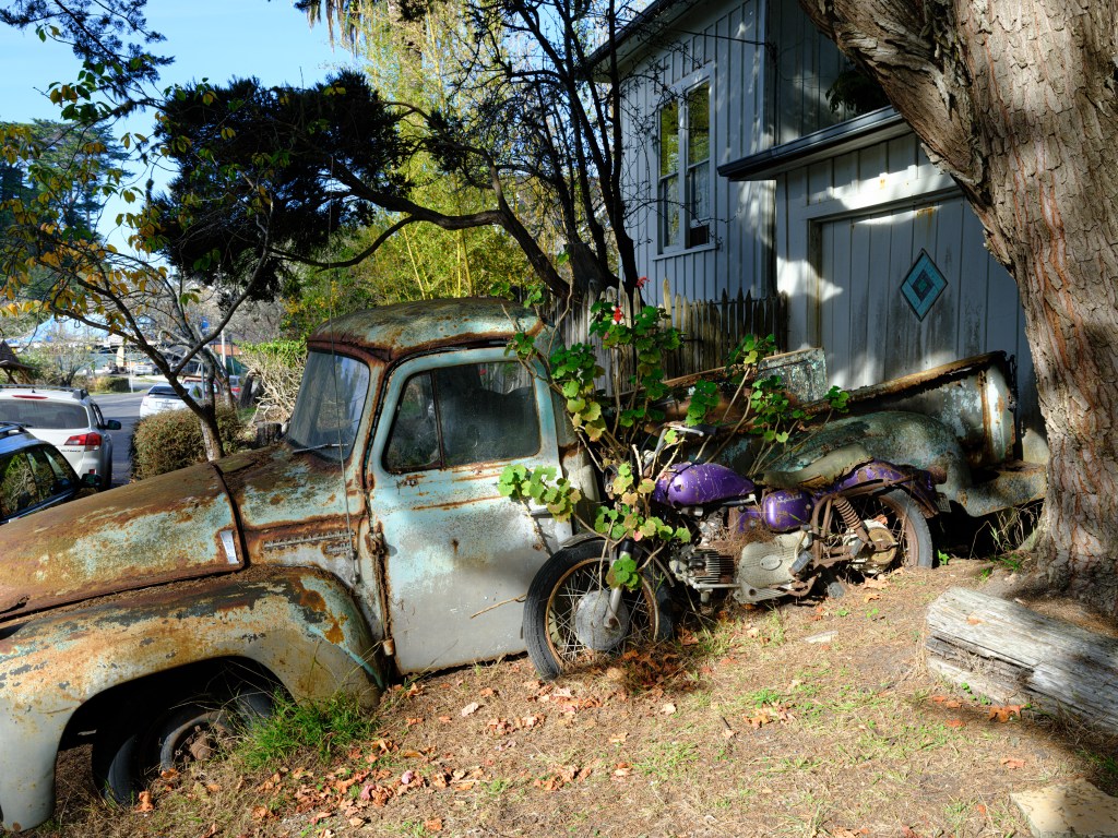
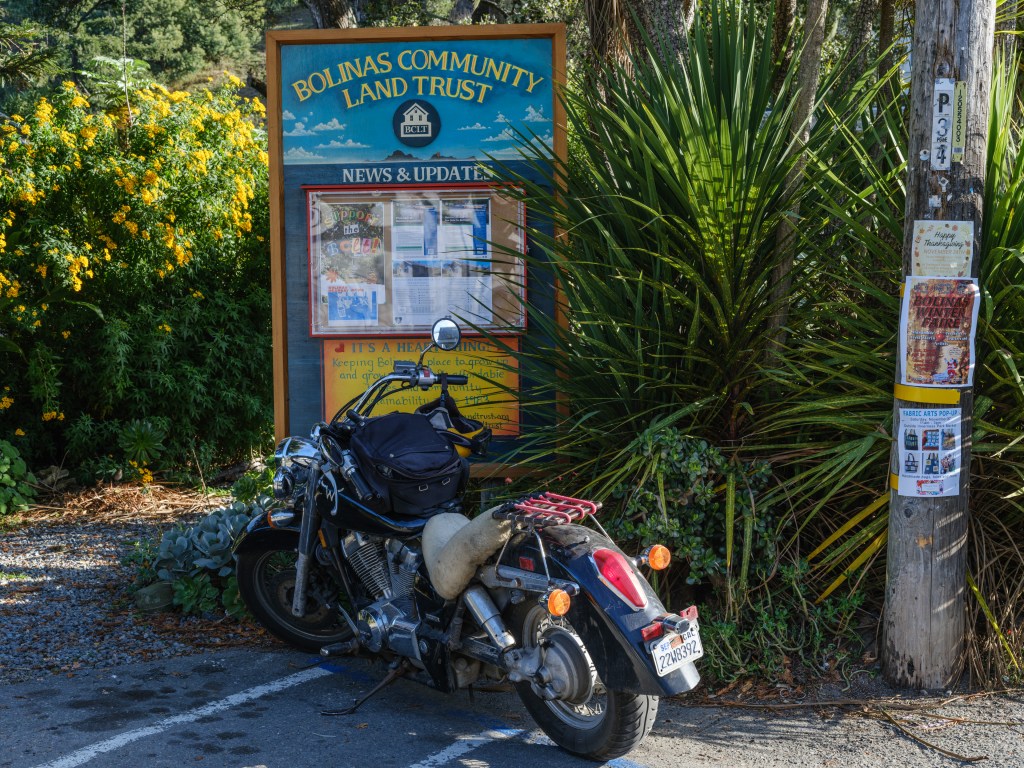
equally impressive to the old truck is the flower power motor bike 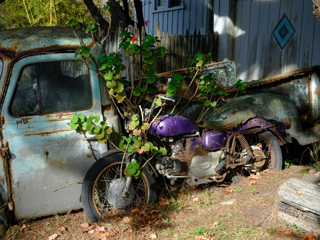
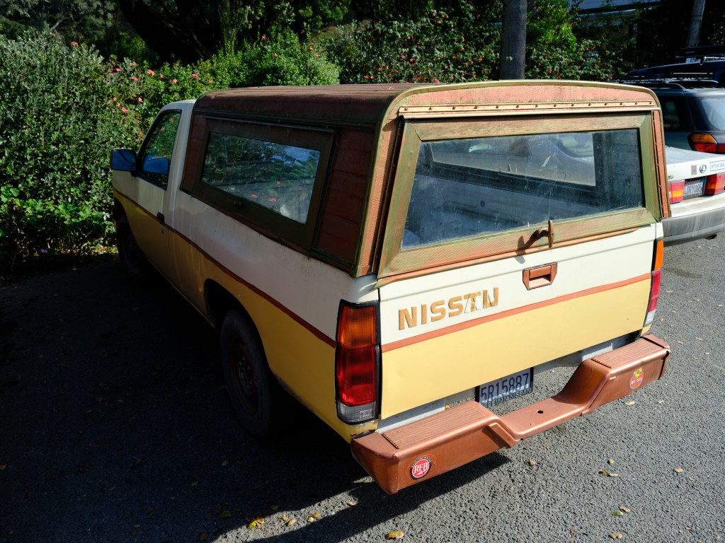
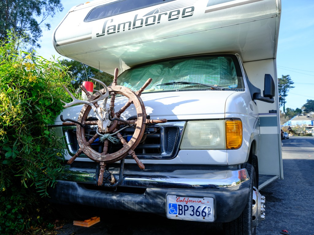
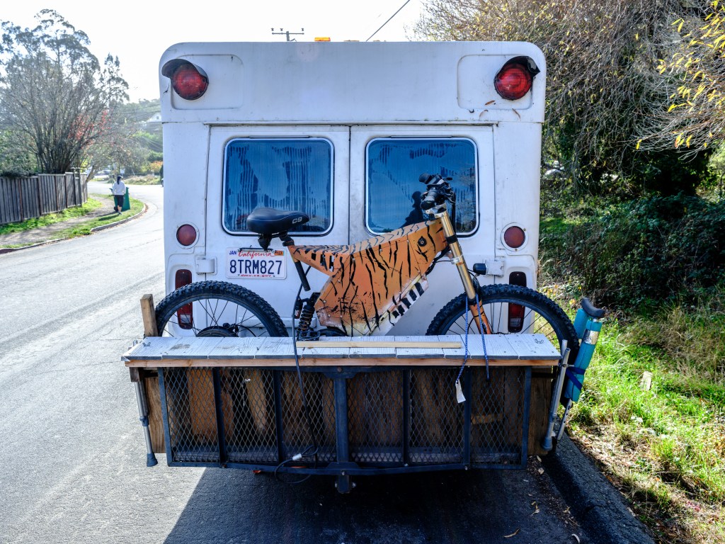
RV’s also exhibit a special flavor:

There is so much interesting stuff and people to see, it’s impossible to not be amazed by Bolinas:
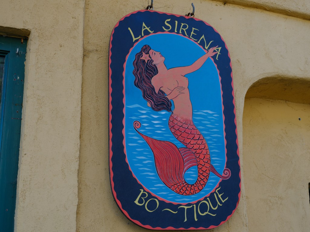
the Bo-tique 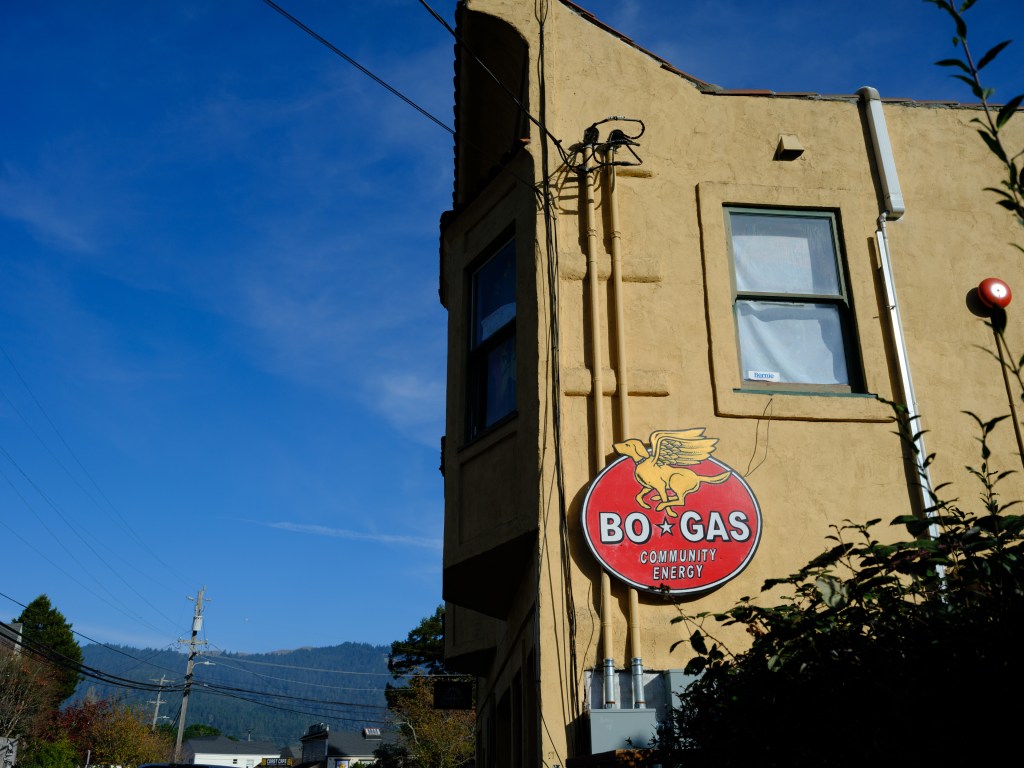
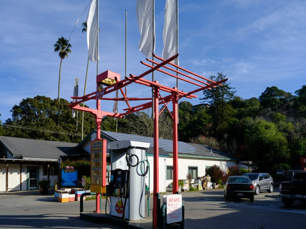
gas station (at $6.99 / gallon, by the way) 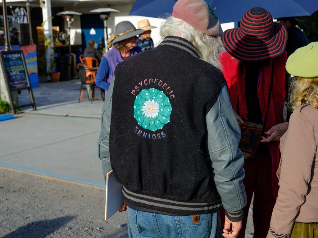
psychedelic seniors We finished off the day the same I had finished 10+ years ago, with an early dinner at Coast Cafe (www.coastcafebolinas.com); great food, locally caught fish and locally sourced ingredients:

Bolinas is a unique kind of place, as is so well expressed by the graffiti on the boat slip people walk down to get into the surf:
ART PERMITTED ON THE WALL
BY ORDER OF DARTH VADER -
Day 47 – We the Keepers

Oct. 23
Zion National Park /Utah
Total driving so far 4,158 miles / 6,653 km
http://Zion-south-entrance-on-google.maps
Improving today
Informing tomorrow
Protecting ForeverI like this thinking. Its strategic, sustainable, creative, thoughtful.
This is the mantra of the Zion National Park Forever Project, https://zionpark.org, and looking at the explosive growth of the Zion visitor numbers one can recognize the rationale for the project:
The park hit 5 million visitors in 2021, which is an enormous number and creates major challenges for the sustainability of the park, as well as the neighboring towns such as Springdale/UT.
Well, we added the count of 2 to the 2022 visitor number. Even though nearly the end of October, the park was quite busy on Saturday, giving an idea how terribly crowded it must be during the high season in summer.
The absurdity of tourism – we like to travel, but we don’t like to see others traveling to the same places we do. The anti-human tourism bias.
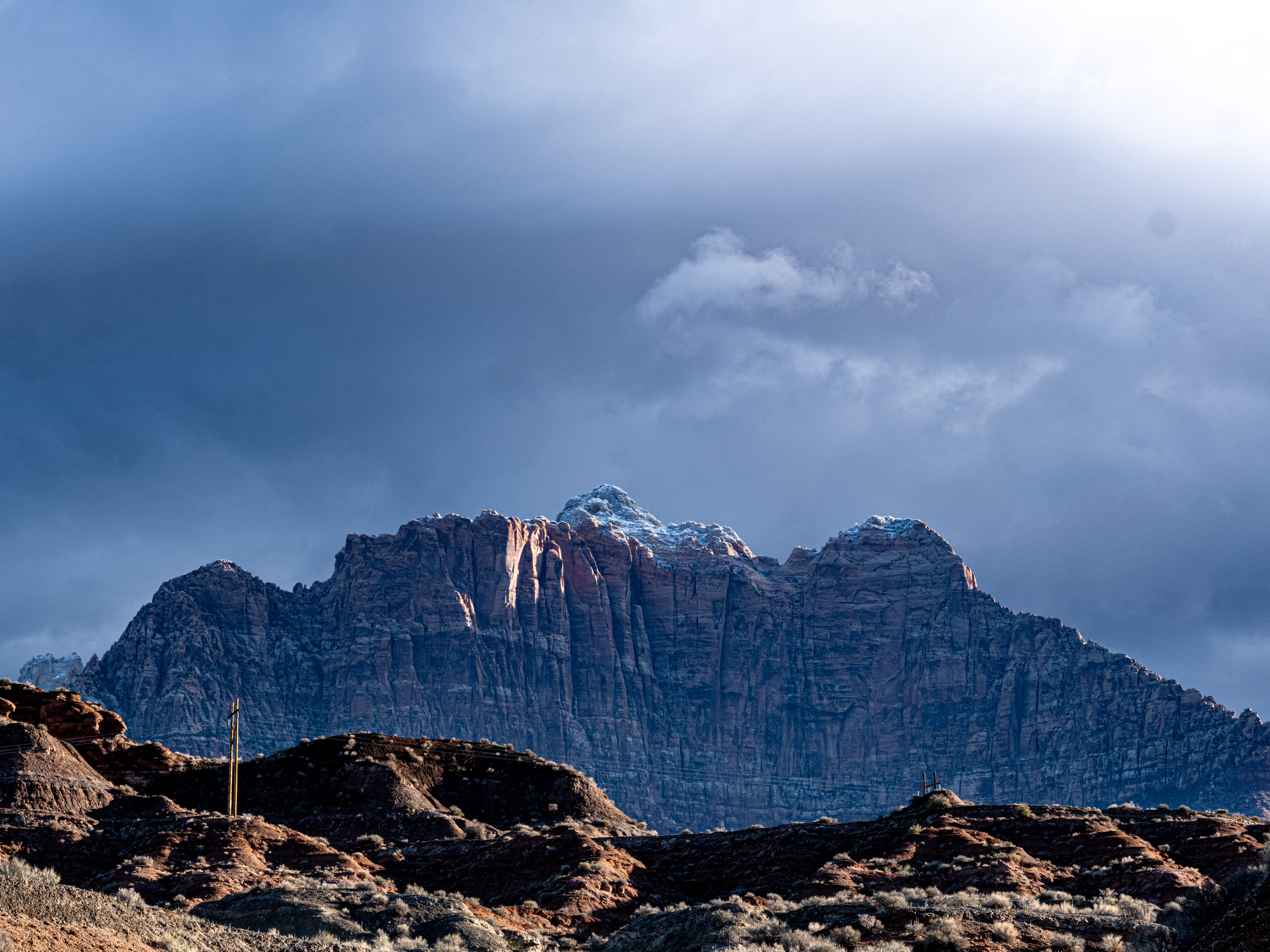
Sunday was less busy, since it had rained during the night, the temperature dropped from 66F / 19C to 52F / 11C as high temperature. The mountain tops were covered with small snow caps on Sunday.
Both visit days were absolutely fabulous.
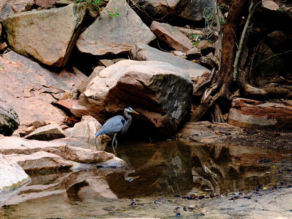
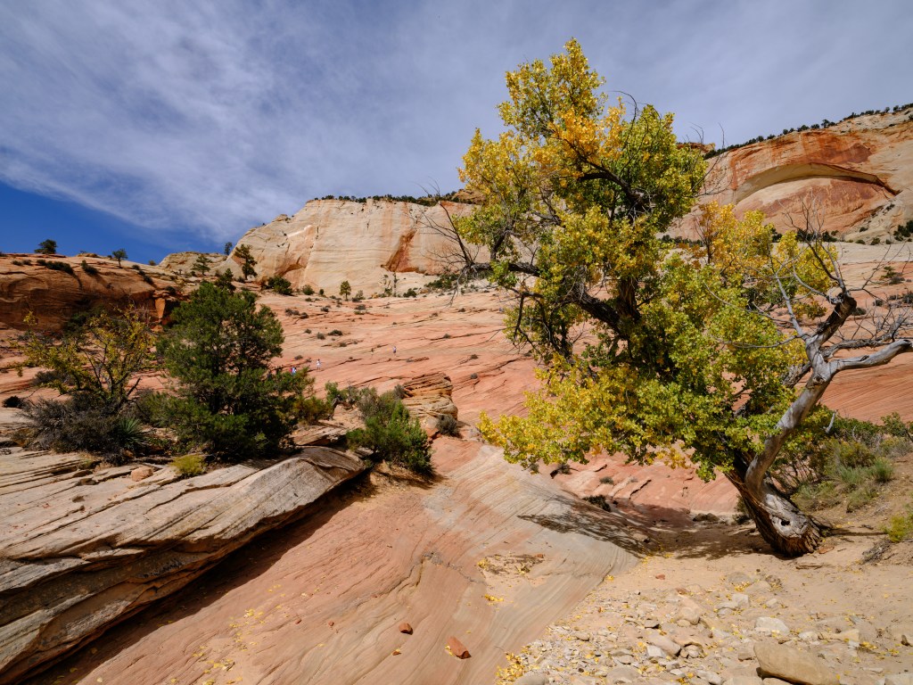
Zion offers such a enormous views of big landscape, colors, stunning rock formations, the Virgin river, ponds, waterfalls, trees, bushes, flowers and wildlife, and the weather changes very quickly.
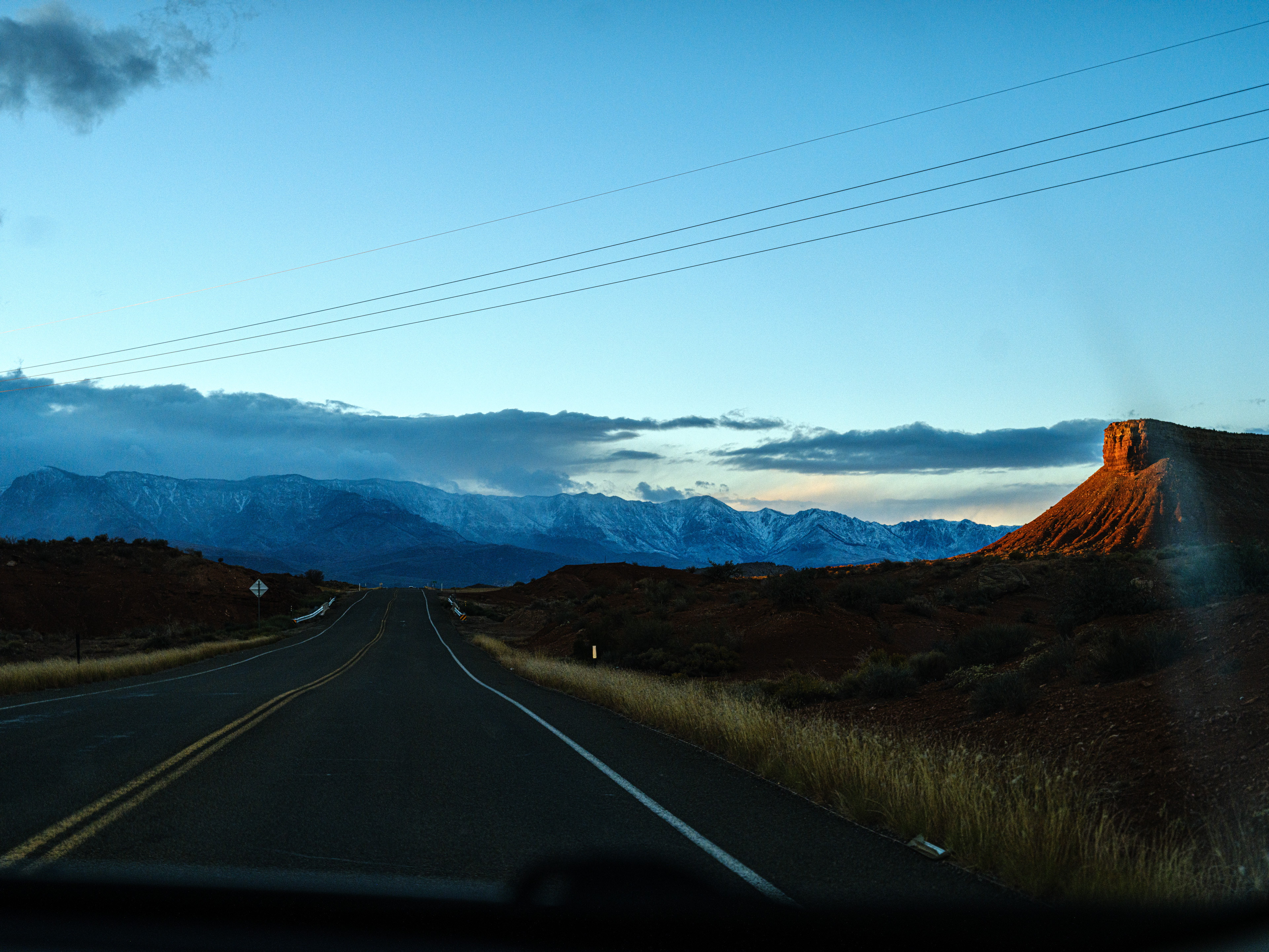
Even when driving from our hotel in La Verkin to Zion, and when driving back, we got spoiled with amazingly beautiful landscape and a dramatic light I have hardly seen in New Jersey:

Wide angle and panorama photography is one attempt to capture the majestic views:
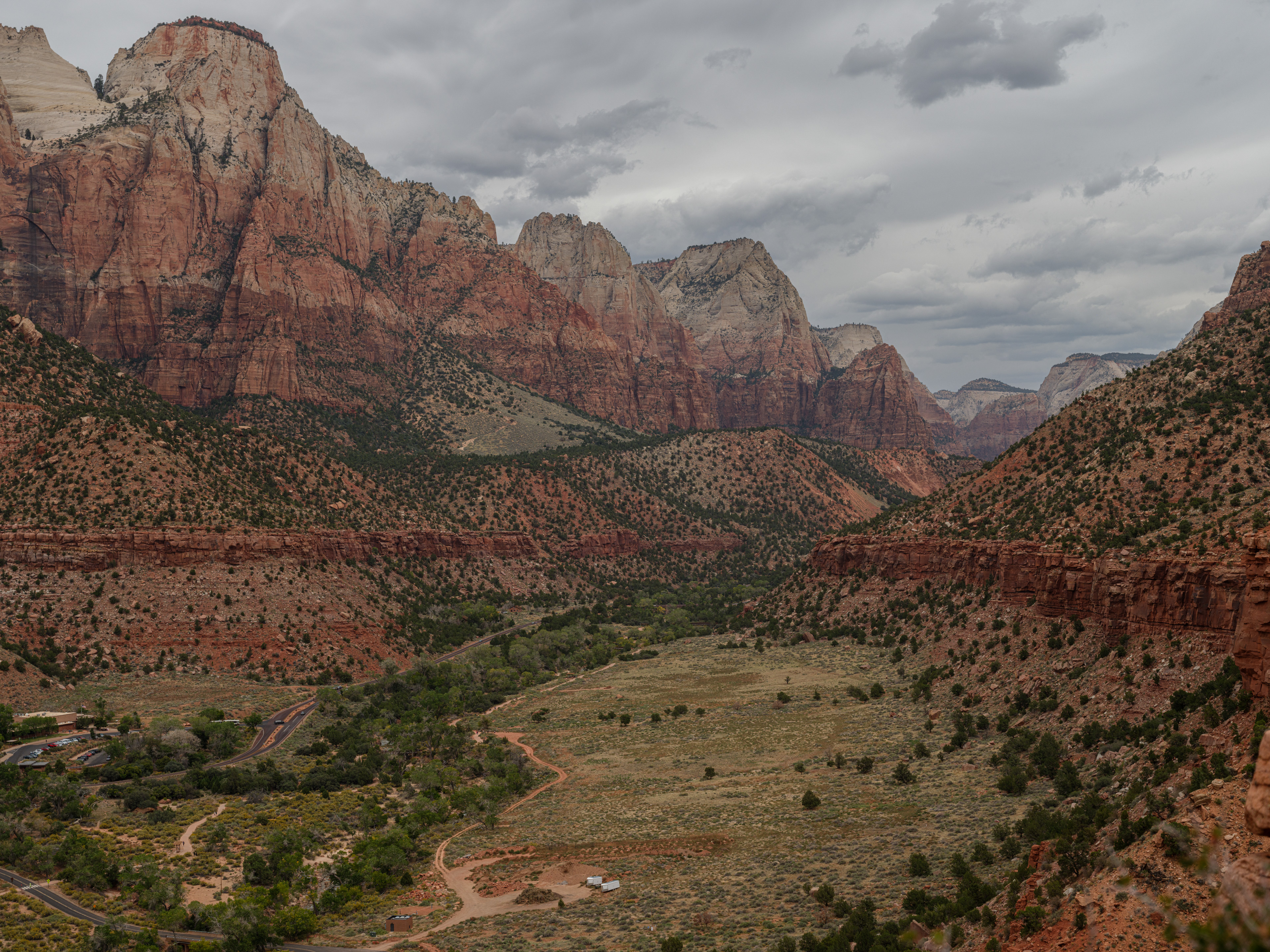
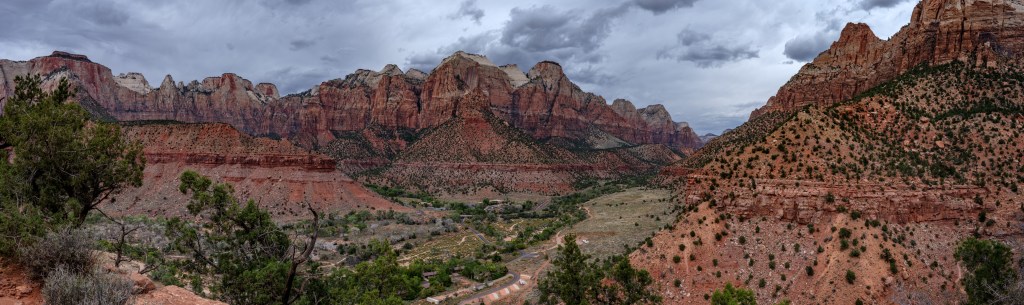
above: view from the top of the Watchtower trail into the Zion main canon and Virgin River 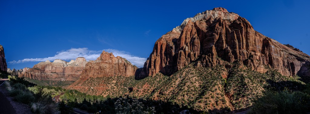
above: view on the mountain range opposite the switchbacks leading up the amazing tunnel 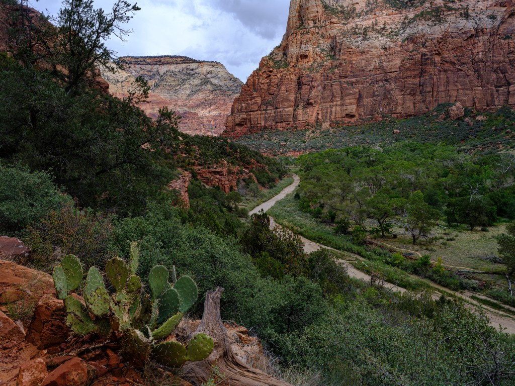
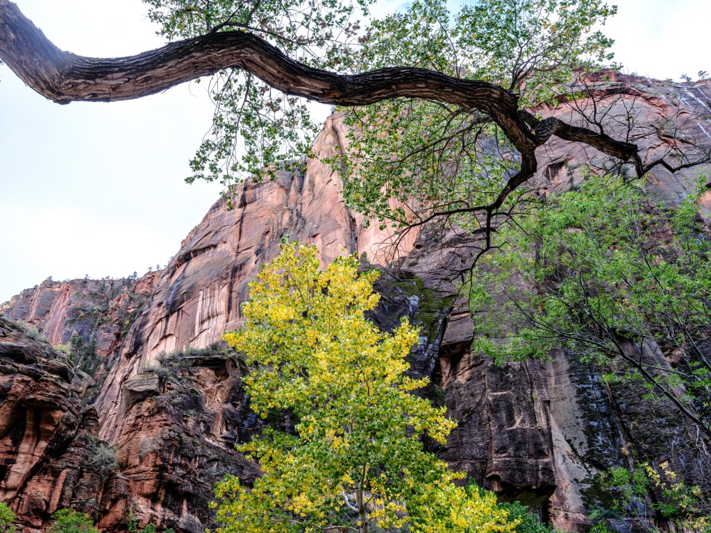
Zion also offers endless opportunities for drawing smaller vignettes of the many diverse corners and habitats and creating abstracts of many kinds:

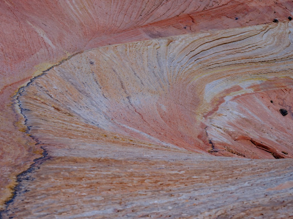
And finally back to larger views:

above: view on the Checkerboard Mesa in the background 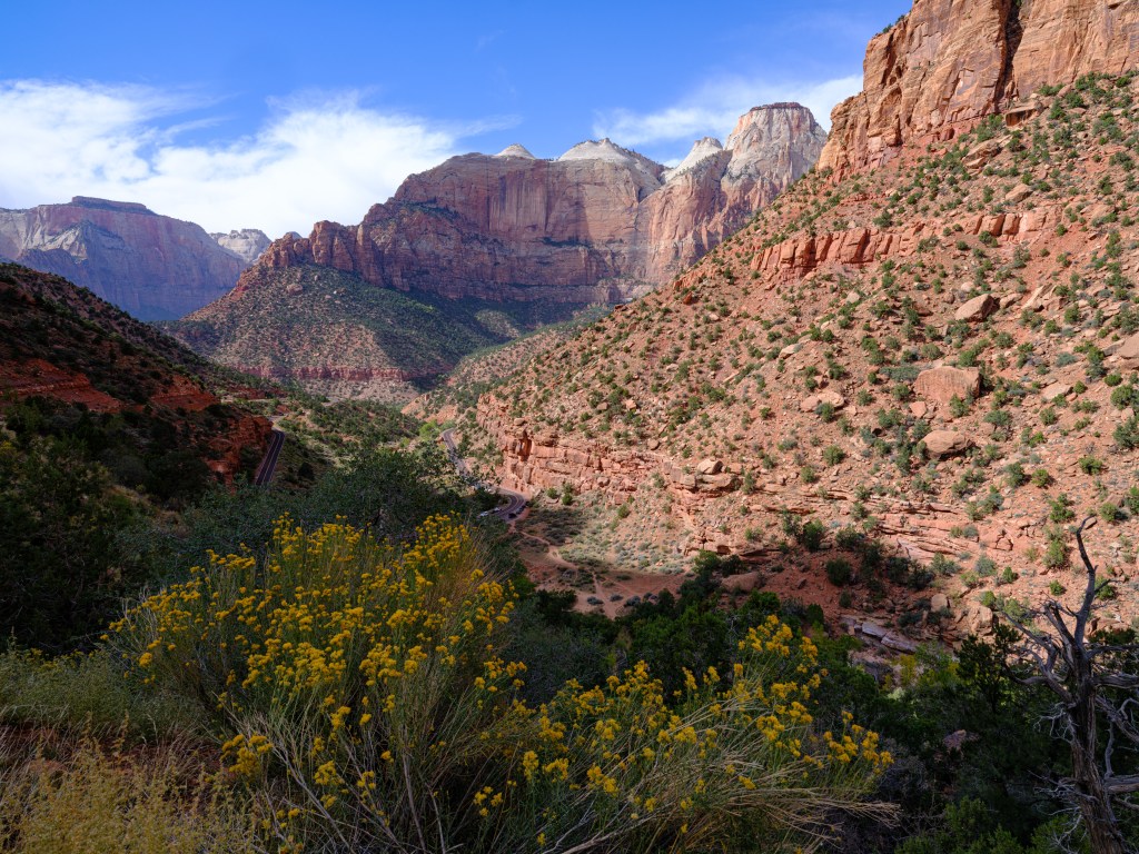

And finishing off the series of vistas and vignettes with one of my favorites:
another view from Watchman -
Day 41 – He/she/it never looked so good

Oct. 17
Grand Teton National Park / Utah
Total driving so far 3,578 miles / 5,725 km
http://Teton-lookout-on-google.maps
Our Jeep has now about 158,888 km on the odometer and a quite mixed history. When we bought it new in 2015, the bluetooth / radio unit had to be replaced three consecutive times. For the first replacement unit the wait lasted for over three weeks. Add an axle problem, hatch door lock issue, cylinder head oil leak issue, sunroof closing mechanism issue and more, sometimes it felt like a ‘lemon’.
But it has been holding up very well so far on our trip, fingers crossed, as we drive sometimes into remote areas on dirt roads.
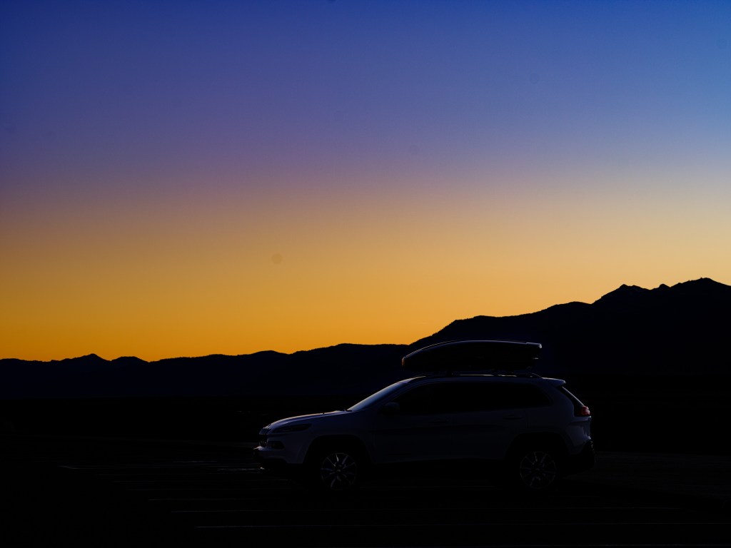
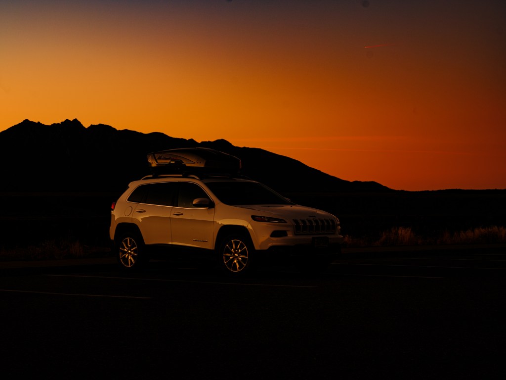
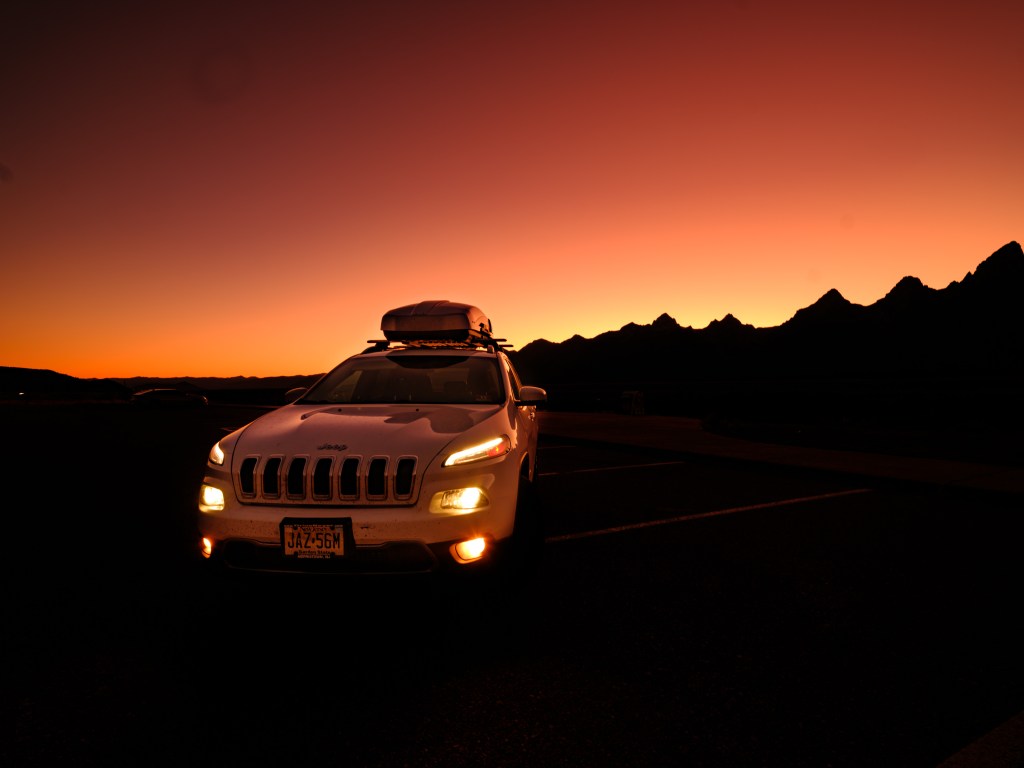
Hence I decided to shoot some good looking photographs of our “Jazzy” car (that is a word play related to the license plate on our family cars for the last 22 years). And it never looked so good before.
Is the Jeep an ‘it‘?
I think so, but its funny with gender and cars. In German language it is ‘Das’ auto, with ‘Das’ being the gender neutral article. But the Porsche is ‘Der’ Porsche, the male article; maybe just male chauvinism for a sports car. The service rep at my Mountain Lakes car dealership consistency refers to the Porsche as a ‘she’. Maybe she (she, the service rep) is just fitting against the male bias. Go figure…
Here are some of the photographs, taken in the Grand Teton National Park.
When is Fiat / Chrysler calling me to contract me for a car shoot (in Italy, please) and advertising campaign ??
-
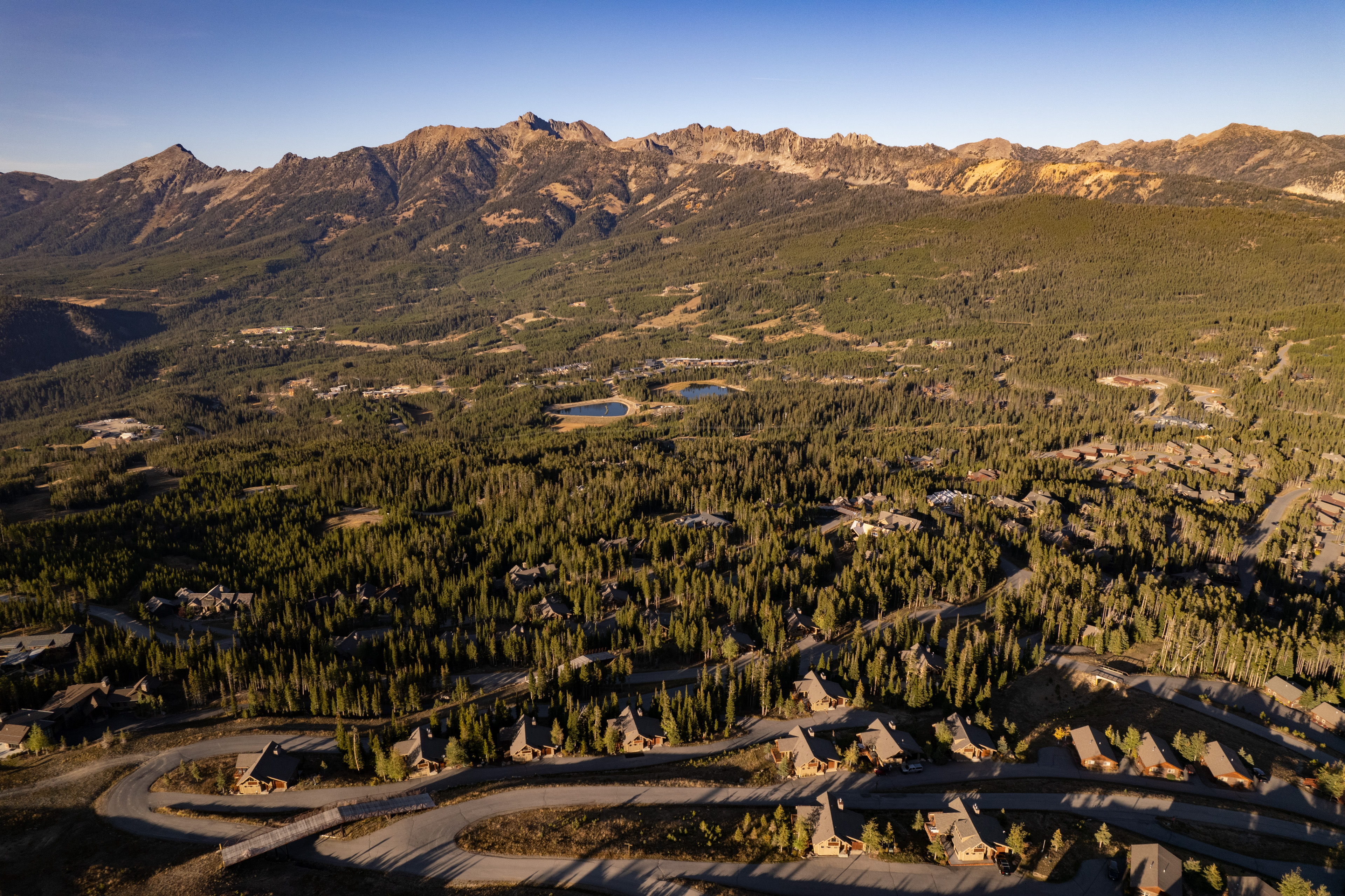
Day 37 – A better Austria, does it exist?

Oct. 13
Big Sky / Montana
Total driving so far 3,372 miles / 5,395 km
http://our Big Sky airbnb-on-google.maps
“Austria is a landlocked country in the southern part of Central Europe, lying in the Eastern Alps“
ref: https://en.wikipedia.org/wiki/Austria.
If wikipedia says so, its very likely the truth, since its quite an authority (disclaimer: the author is a regular wiki donor, and has an indirect affiliation with wikipedia).
But is it really true? It started getting confusing driving around over the last days; road / river / mountains, that is the theme in the Austrian Alps.
Houses that could be located in Austria:

And hiking felt like being at home, with areas that looked like being in the Alps or in lower Austria’s ‘Waldviertel’:
one could think in the early morning, no coffee yet, that this a deer aka ‘Hirsch‘
(my Swedish friends, forgive me, please)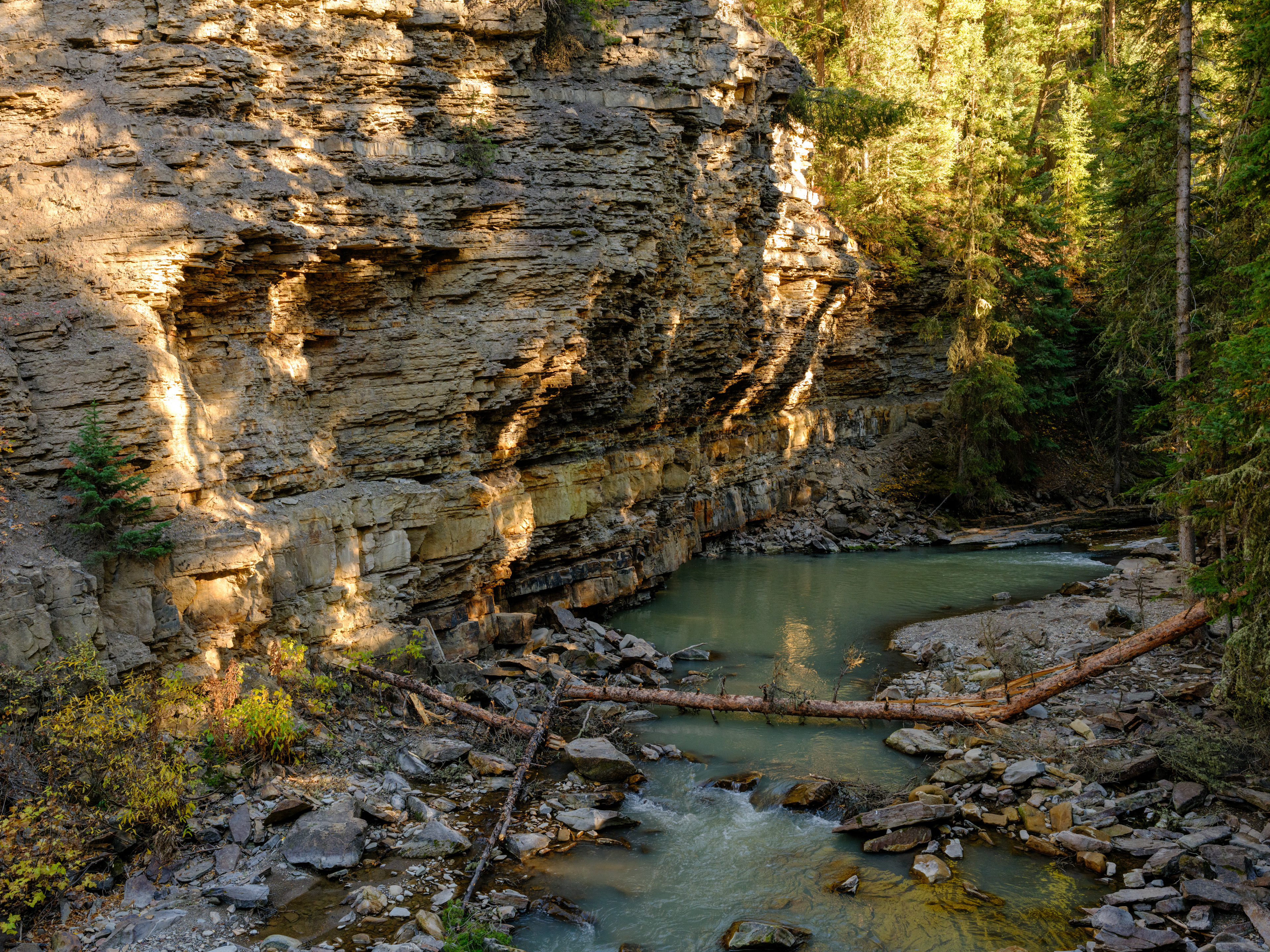
But then you see stuff like this and its abundantly clear that this can’t be Austria, so Karin & Peter, wake up !

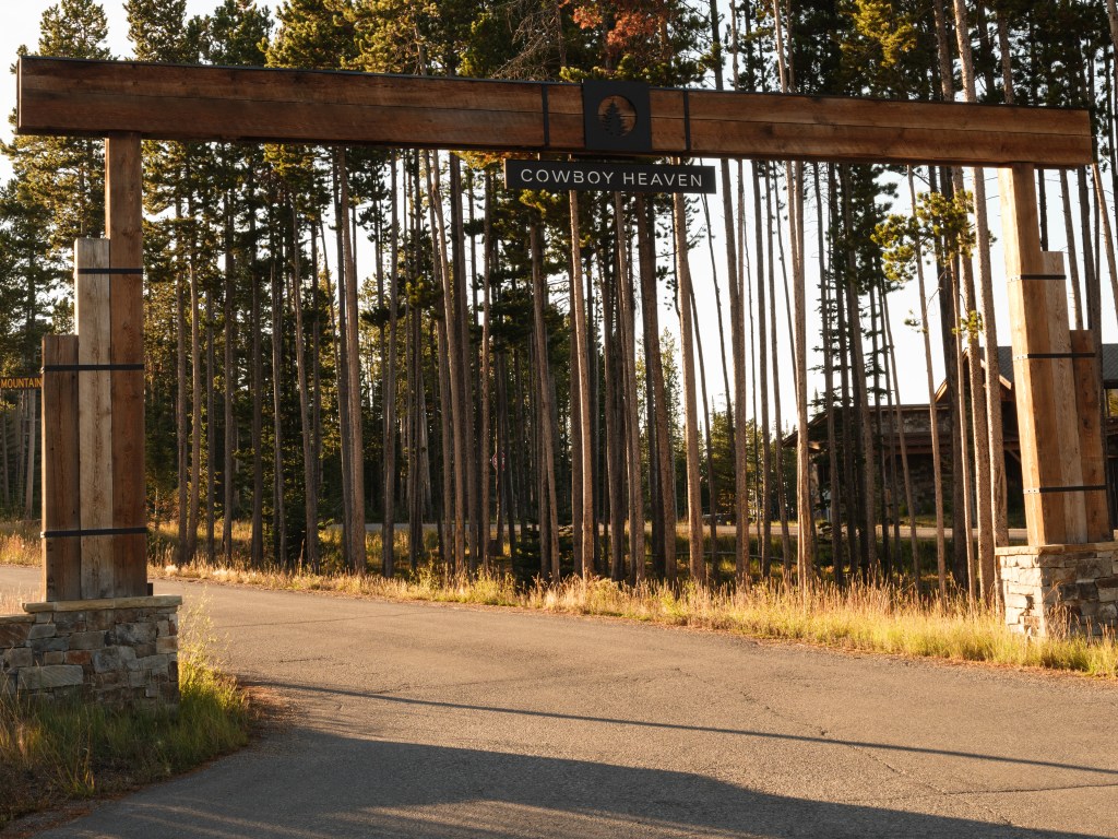
there is no ‘Cowboy Heaven’ in good old Austria Yep, this is Montana, a quite amazing US state.
The scale of the country, and also the commercial development going on in the countryside, is in its own league. Take Big Sky, where we were staying, as example. ‘Lone Peak’ (Lone-Peak-on-visit-BigSky) is towering over Big Sky and its flanks are getting plastered with multi-million $ houses (the ‘expensive’ ones can run up to $40 million). Related fact: Big Sky is not a municipality, there is no elected town or city board, that controls the activities in the place and the surrounding area. It is owned by a single development company, Boyne Resort, and those people call the shots.
flight over the flanks of Lone Peak towards Big Sky That’s how you do business in America, real business, baby.
I was digging up some facts about this beautiful state:
Montana – population of 1.1 million people ; land area of 380,832 km²; 12% of the population is of non-white original, with Native Americans representing with 6% the largest share of that demography.
Meanwhile, Austria…:
Population of 8.92 million people; land area of 82,409 km²; 19% of the population has at least one parent of migrant background.So to put size and population into relationship to each other:
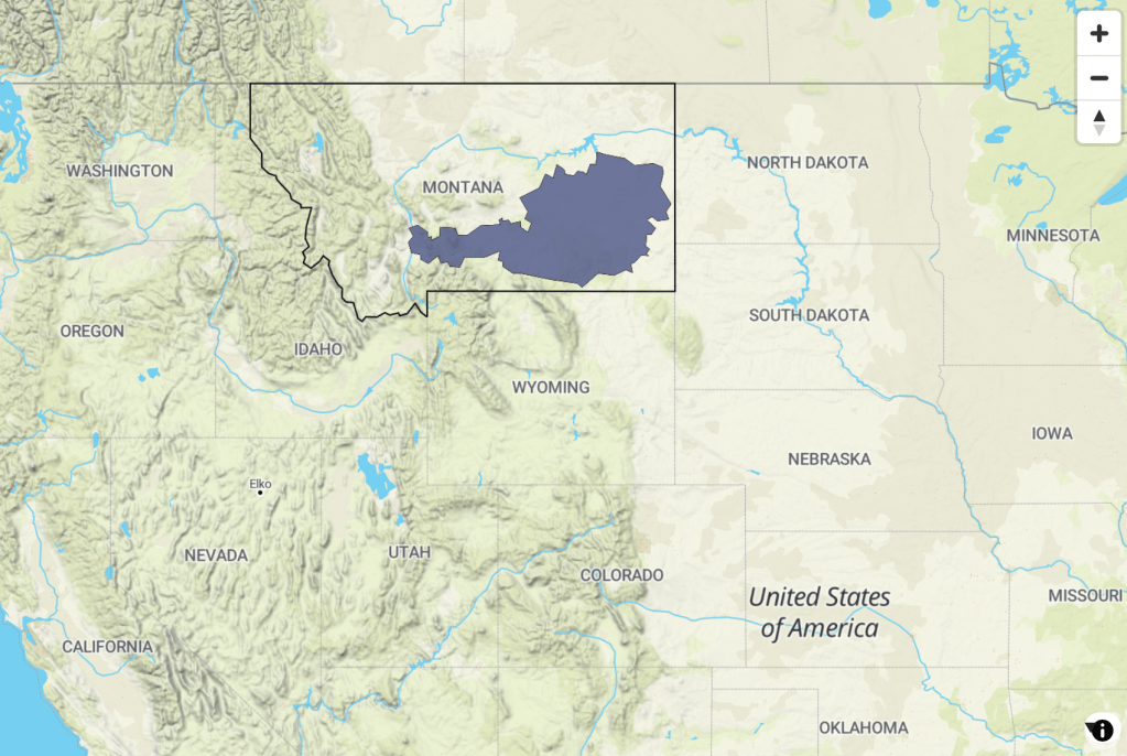
Austria is 4.6x smaller than Montana (by the way, Montana is the 4th largest state in the US).
Austria has an 8x larger population than Montana.
Austria’s capital is very well know, Vienna, which is not so much true for Helena, Montana’s capital.
Really surprising: Austria’s population is about 3x more diverse than Montana’s. I find that astonishing, Austria being more diverse than a US state.
Is Montana the ‘better’ Austria … no, just very different, but also similar in many of its geographic features.
And, no doubt, really beautiful:


What’s next … Grand Teton is next !
-
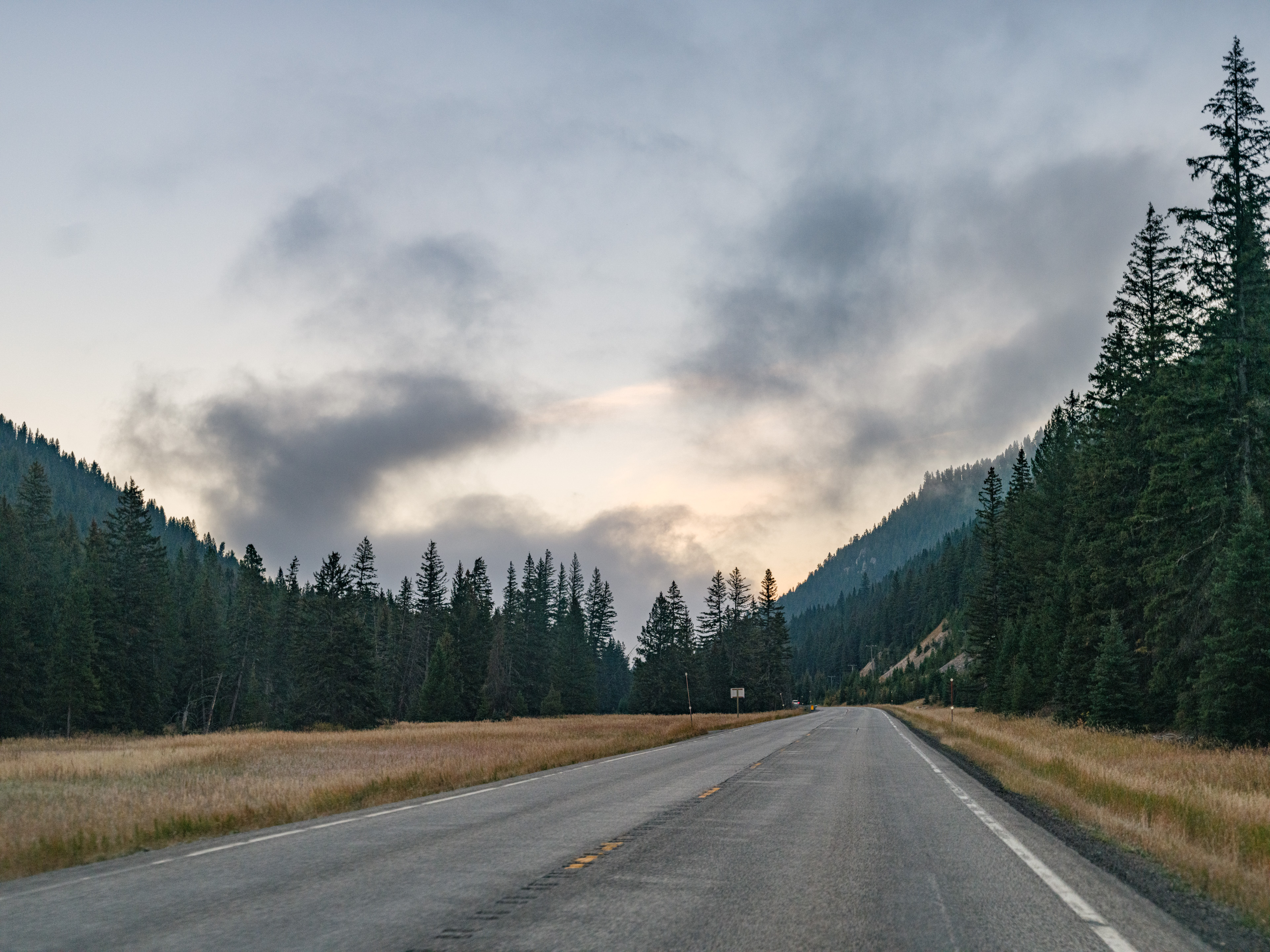
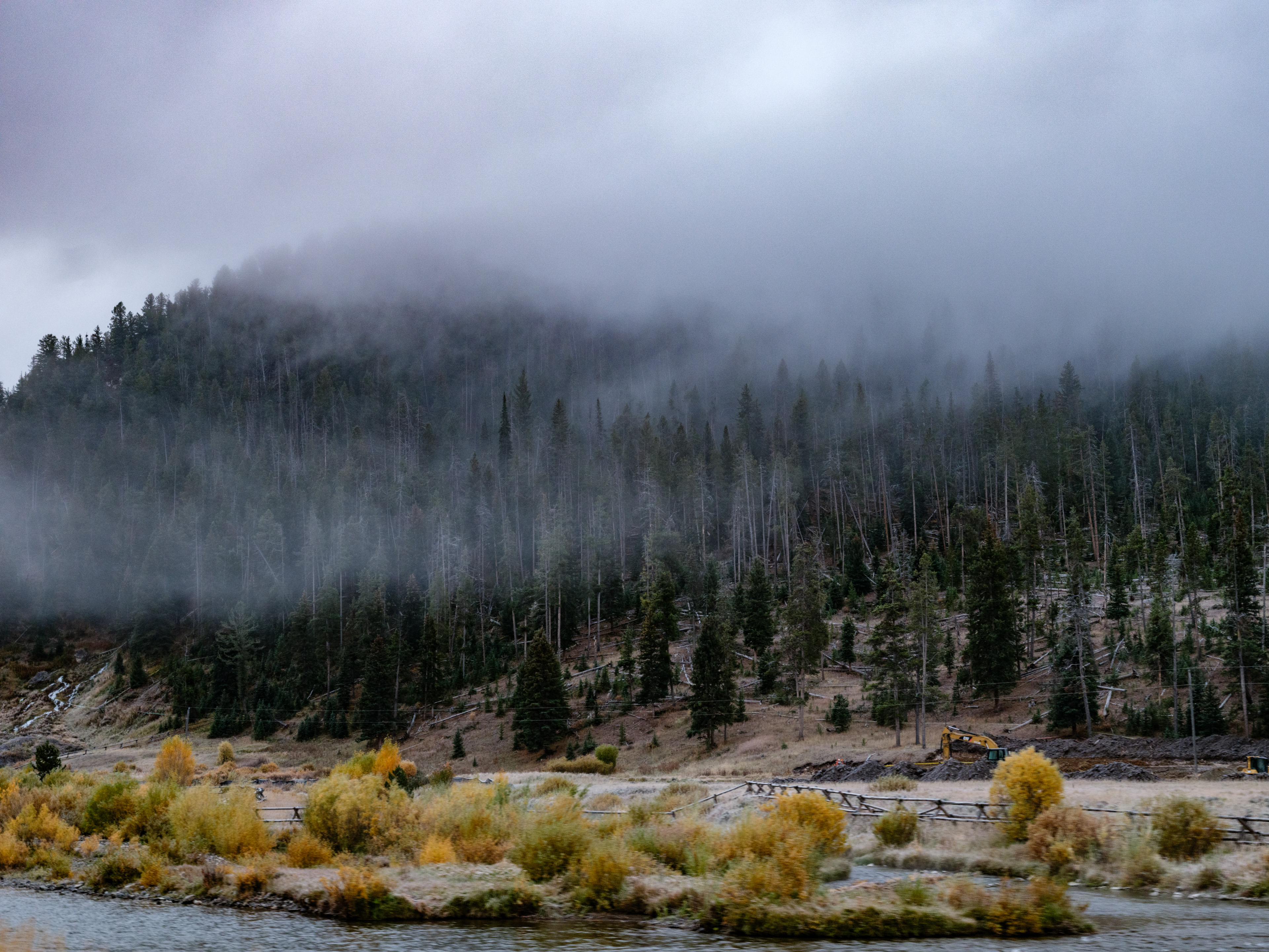
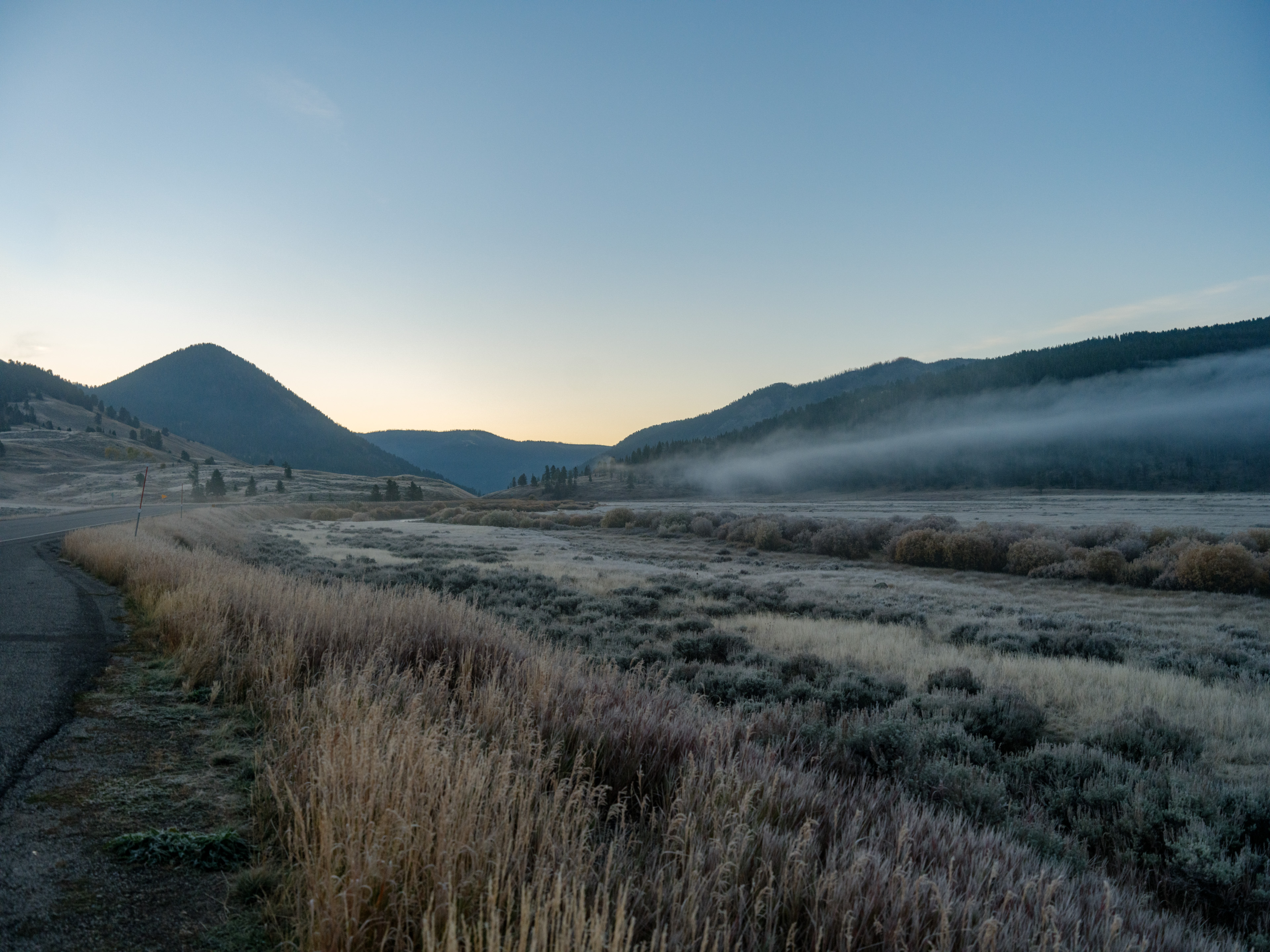
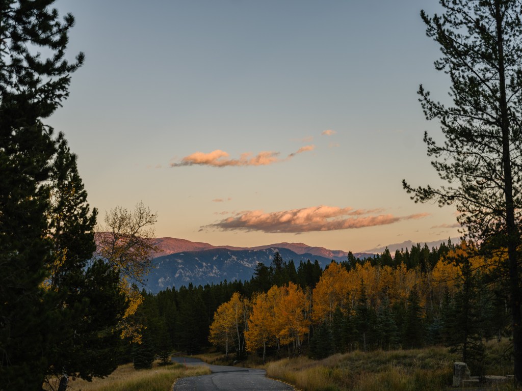
Day 32 – Speechless in Wyoming

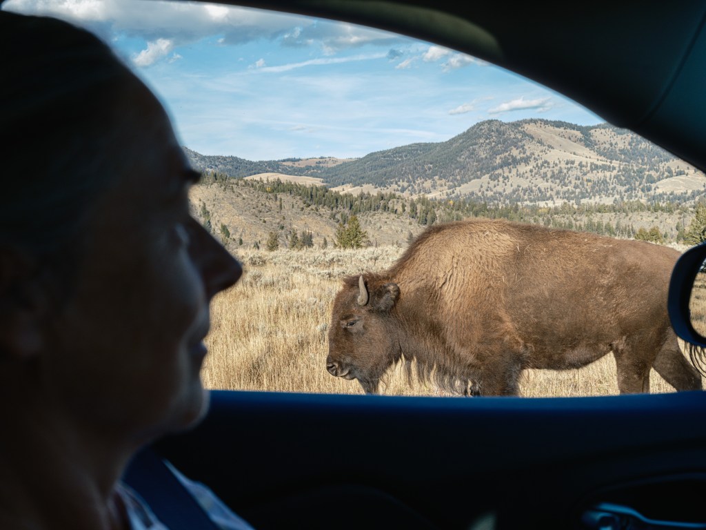
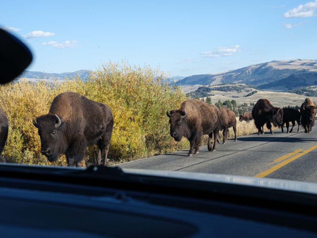
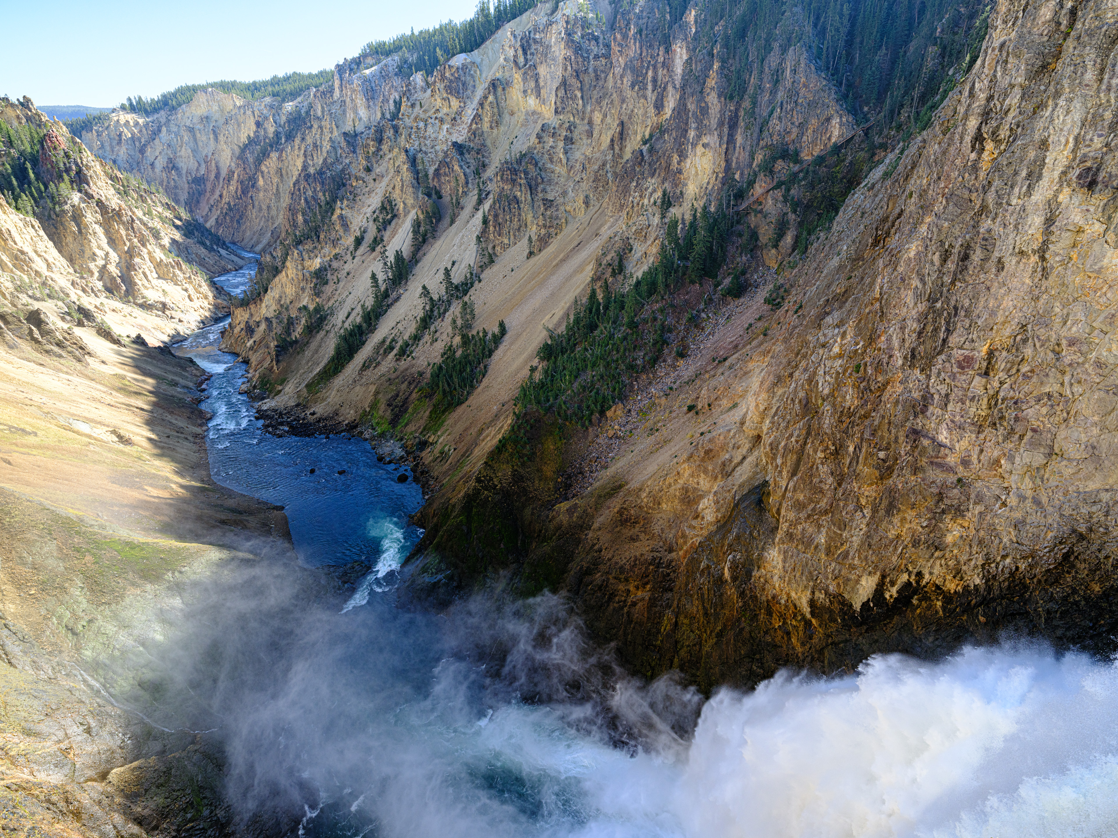
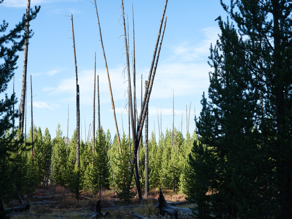
Oct. 8
Yellowstone National Park
Total driving so far 3,264 miles / 5,222 km
Yellowstone Park west entrance-on-google.maps
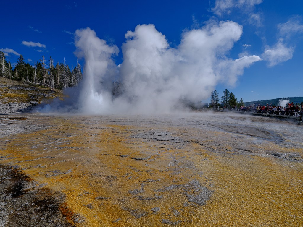
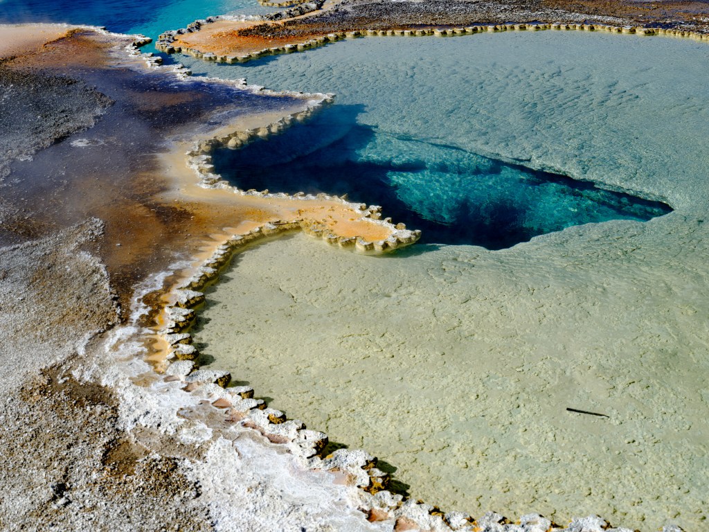
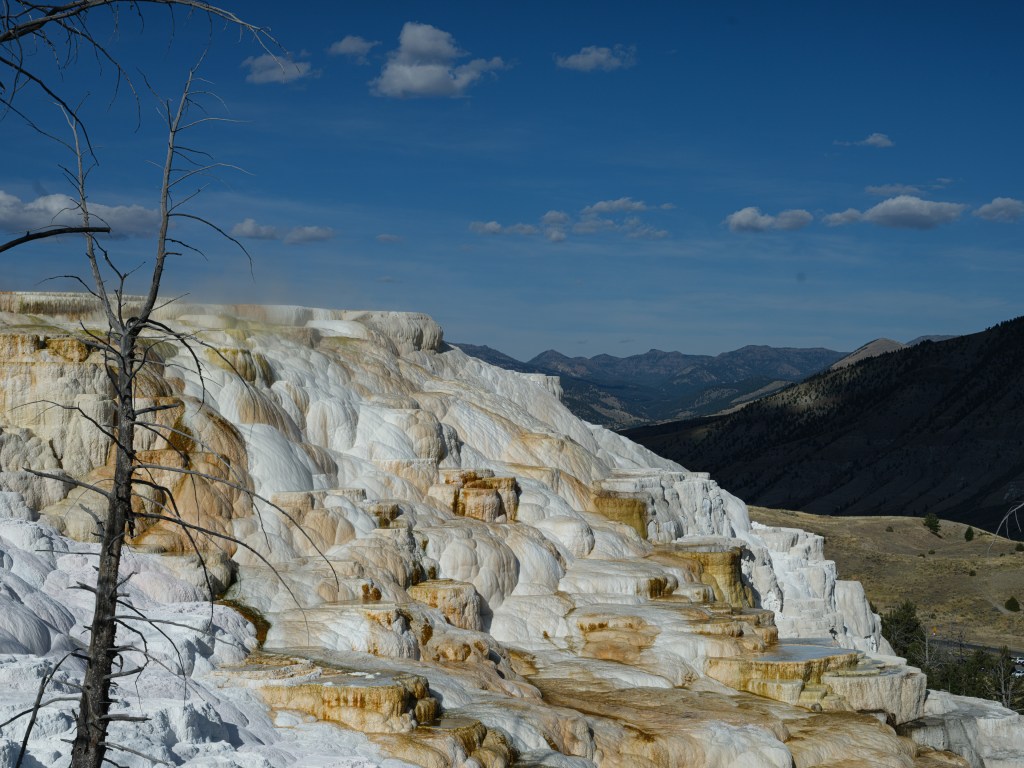
Three days in Yellowstone Park makes one stoned in the best possible manner.
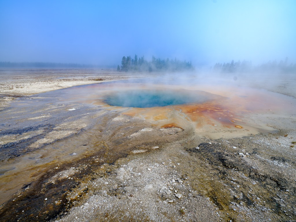
Yellowstone is really THE PARK.
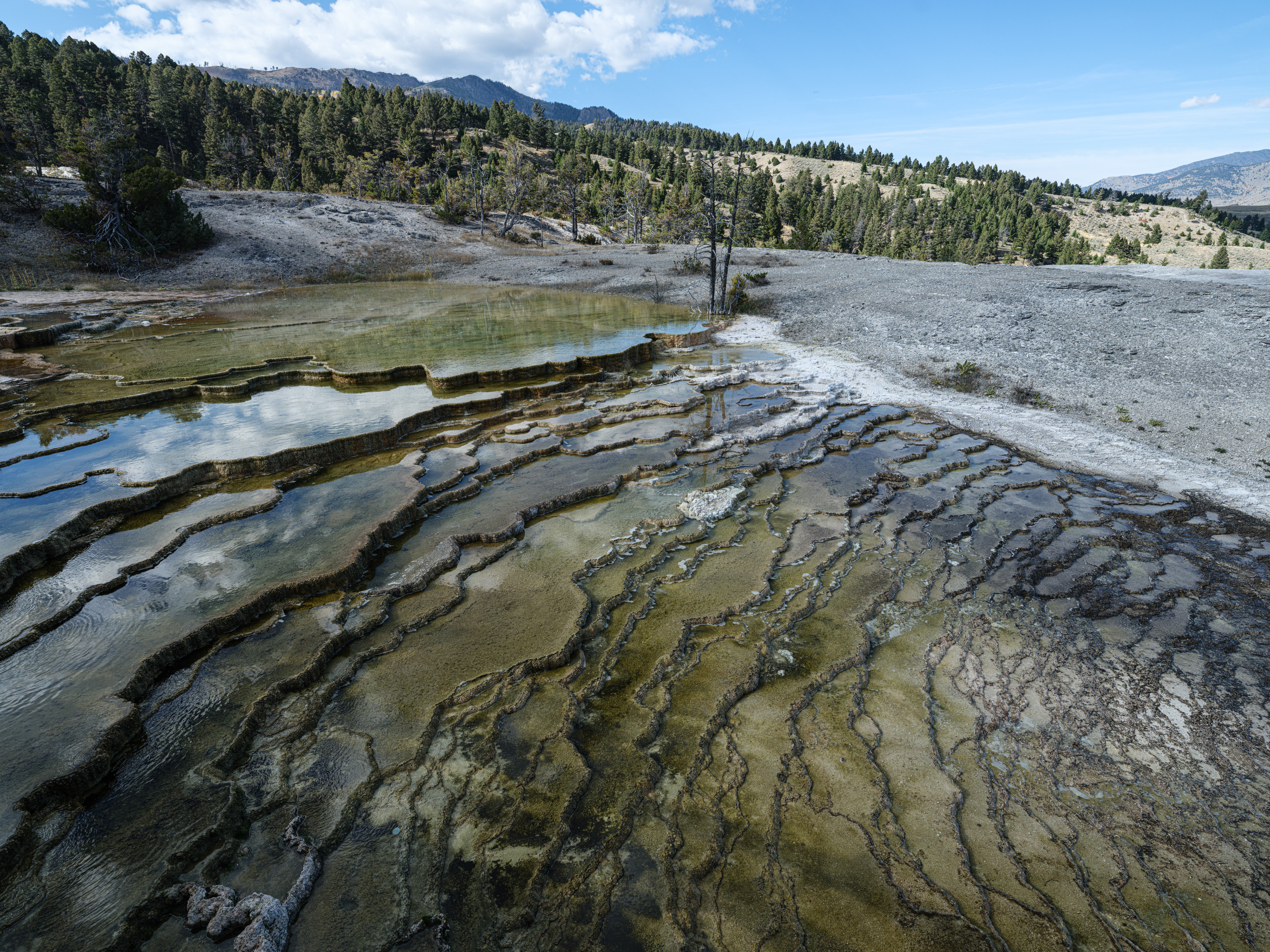
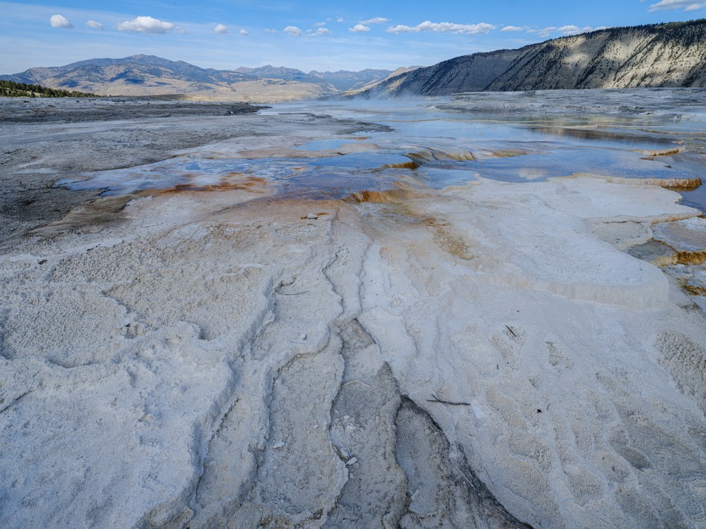
‘Stoned’ in the sense of grounded in your head by the power of nature; the incredible beauty; the diversity of the park; its not just one thing like geysers and buffalos, its that plus crystal clear rivers, mountain ranges, rolling hills, grass lands, bad lands, craters, elks, grizzlies, hot springs, terraces, reflection pools, steam baths, canyons, huge ravens, mud pots, meadows, wonderful trees, burned trees, dead trees, waterfalls, desert spots, and and and…

early morning in Montana, gassing up our Jeep Also very remarkable is the impeccable infrastructure. Not the typical American pragmatism of ‘get a job done’, the National Park Service rather provides the infrastructure with a clear attention to beauty and details. I am a huge fan of the NPS by now. My tax dollars used in the best possible manner. And I keep sponsoring them with the childish fun of buying park stickers in their stores.
another sticker bought Equally remarkable is the politeness among park visitors. You greet each other, wether on a hike, in a visitor center, in a parking lot. People seem genuinely to enjoy the park, themselves, each other. The Park Life and Attitude.
Yellowstone Park is really too big for a blog post.
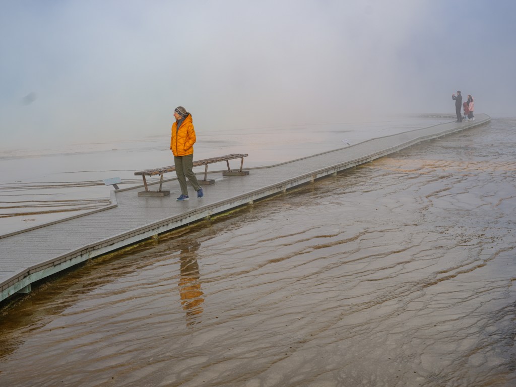
I am finishing this post with a bunch of photographs. On day one, Saturday, I wasn’t happy with the photos I made when I downloaded them in the evening. I think I was too overwhelmed, and just kept pressing the shutter button. Day two was then very different – I got it, I started to get the park, and I consider these photographs to be among the best landscapes images I have made in 20 years of photographing. On day three, I felt kind of visually filled up already, images are not as good as one day two. I recommend looking at the day two images on a laptop, desktop or tablet, the phone screen doesn’t really allow taking in the enormous beauty.
Day One:
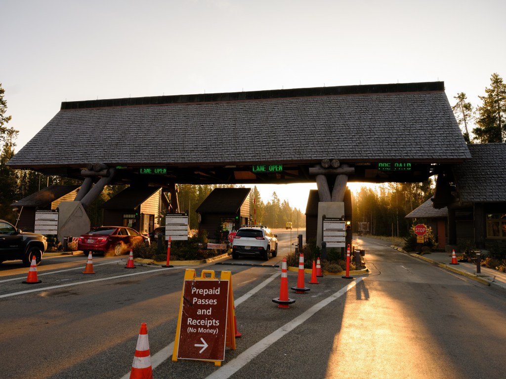

entering the park, excited like when I was six year old and waited for my Christmas gifts; it was very cold that morning, I had managed to forget my warm clothes; that is why you see Karin in an anorak and myself in short pants 

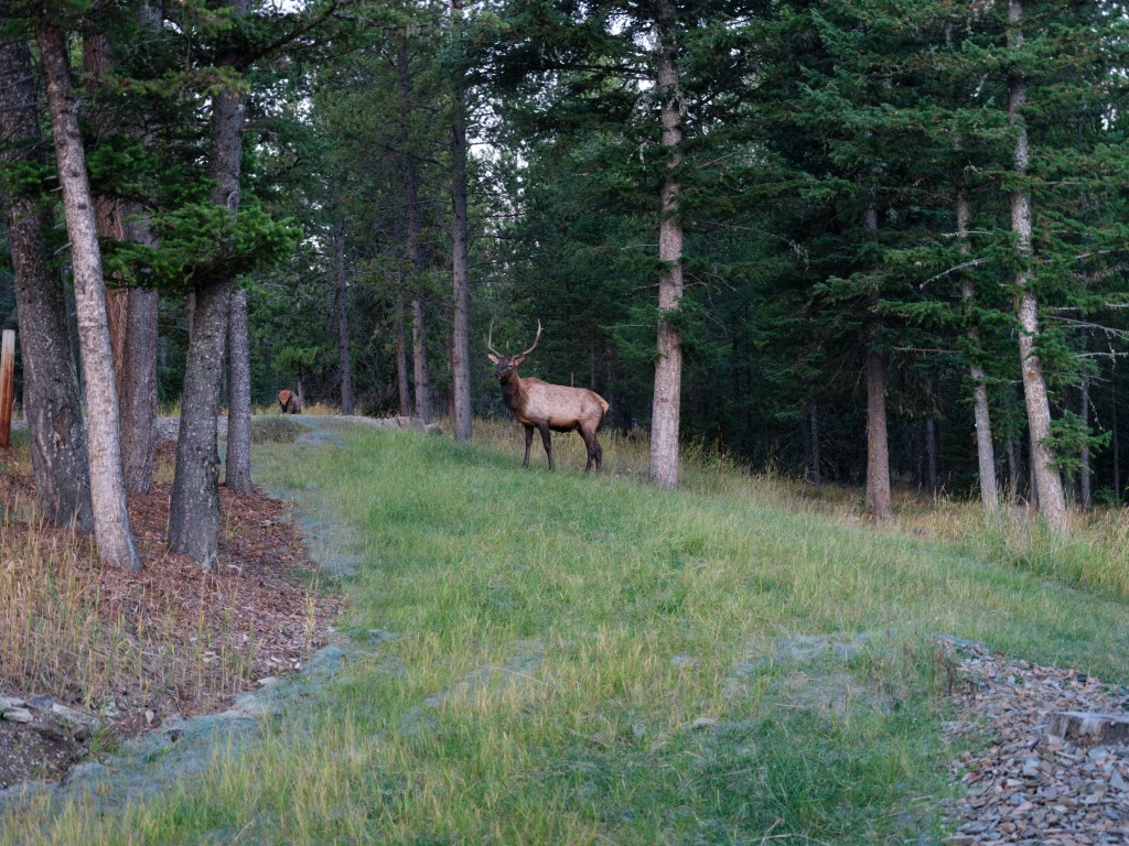
for the uninitiated (I know what I am talking about), this is an elk, not a moose… 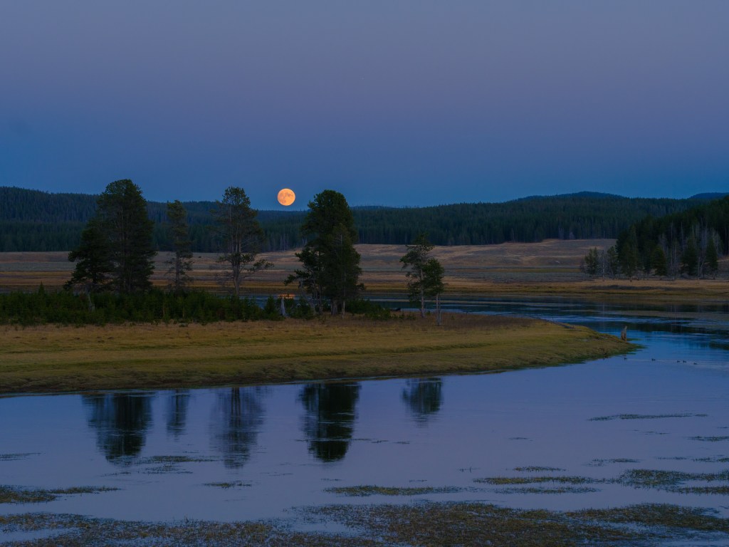

finishing day one in the Hayden valley, happy and exhausted; the park is at 6,000+ feet / 2,000+ meters sea level, so running around is more tiring
Now onto Day Two, with some of my favorite images:
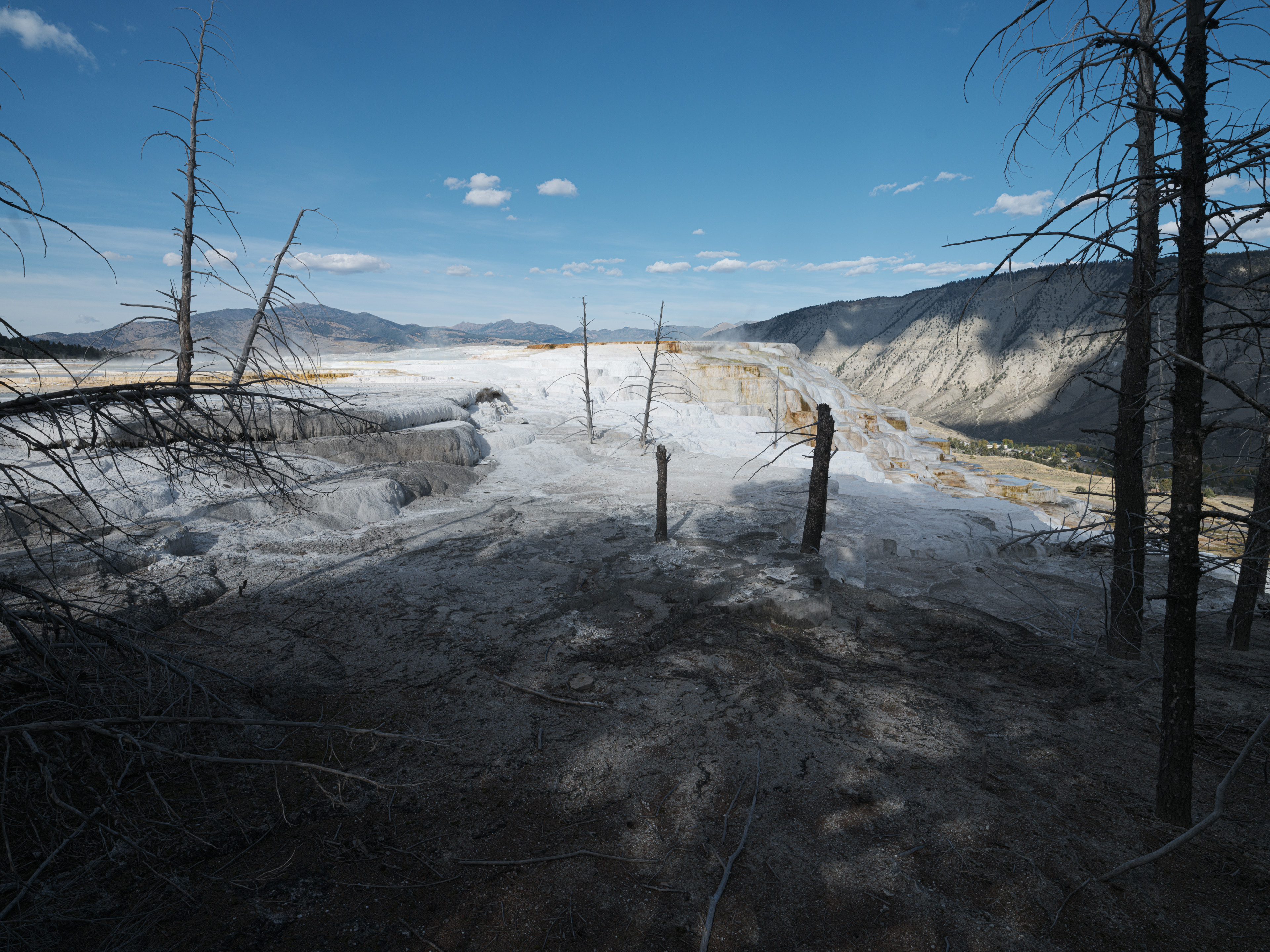

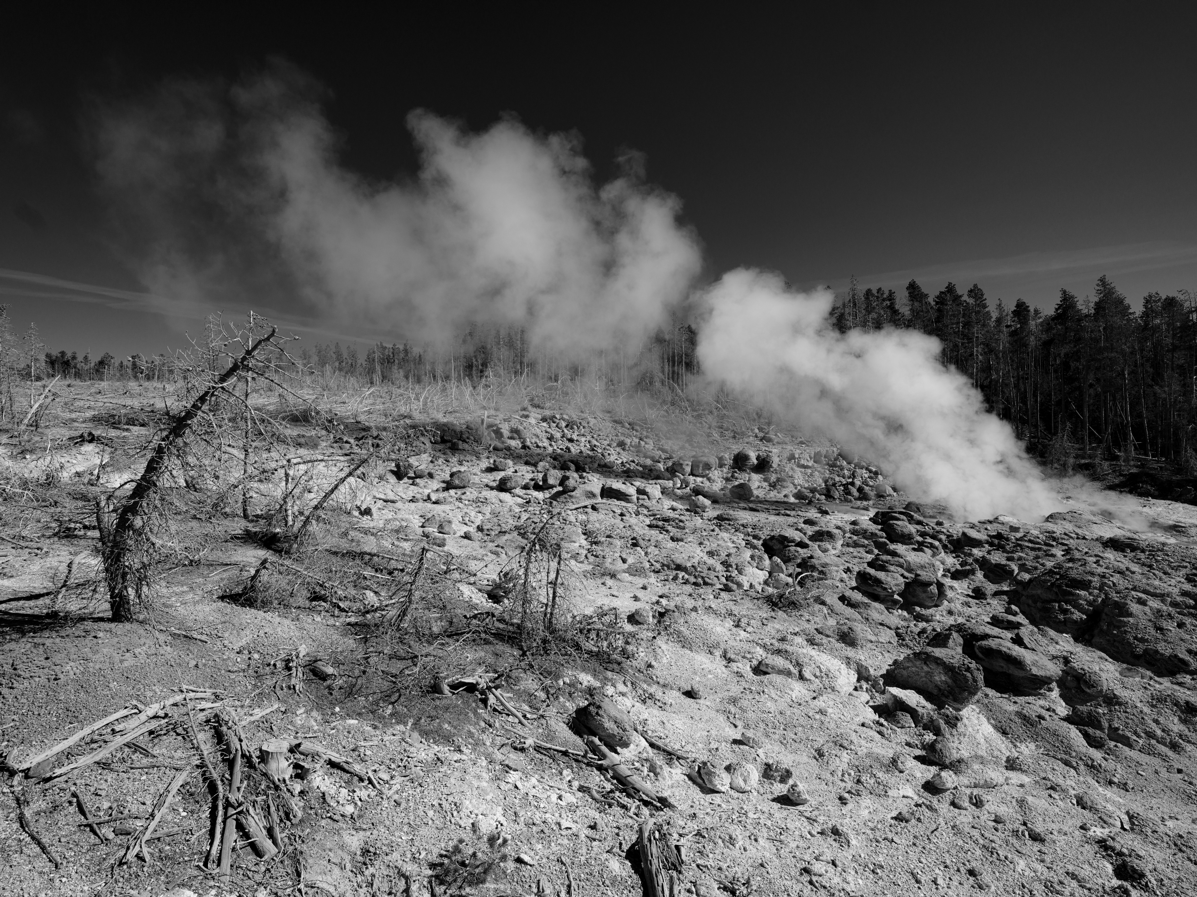
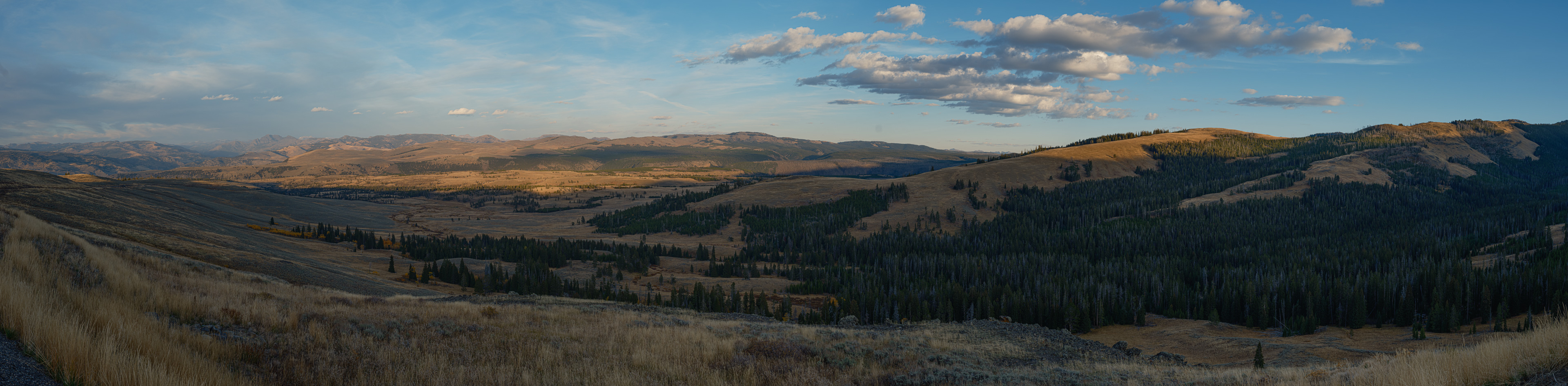
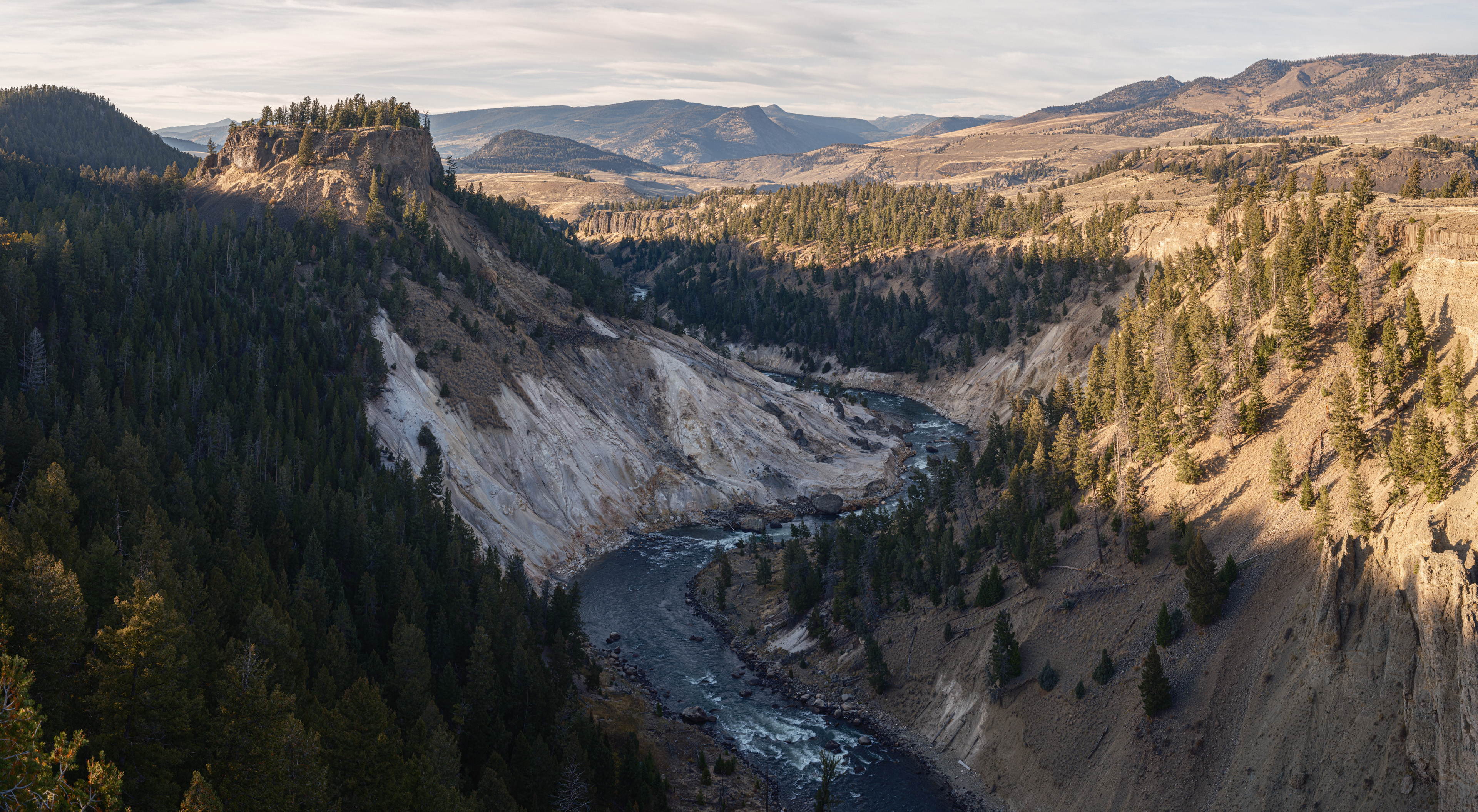
visible even without the spotter qualities of an eyesight only 1% of the population have Day Three, Monday, I took a day off from work:


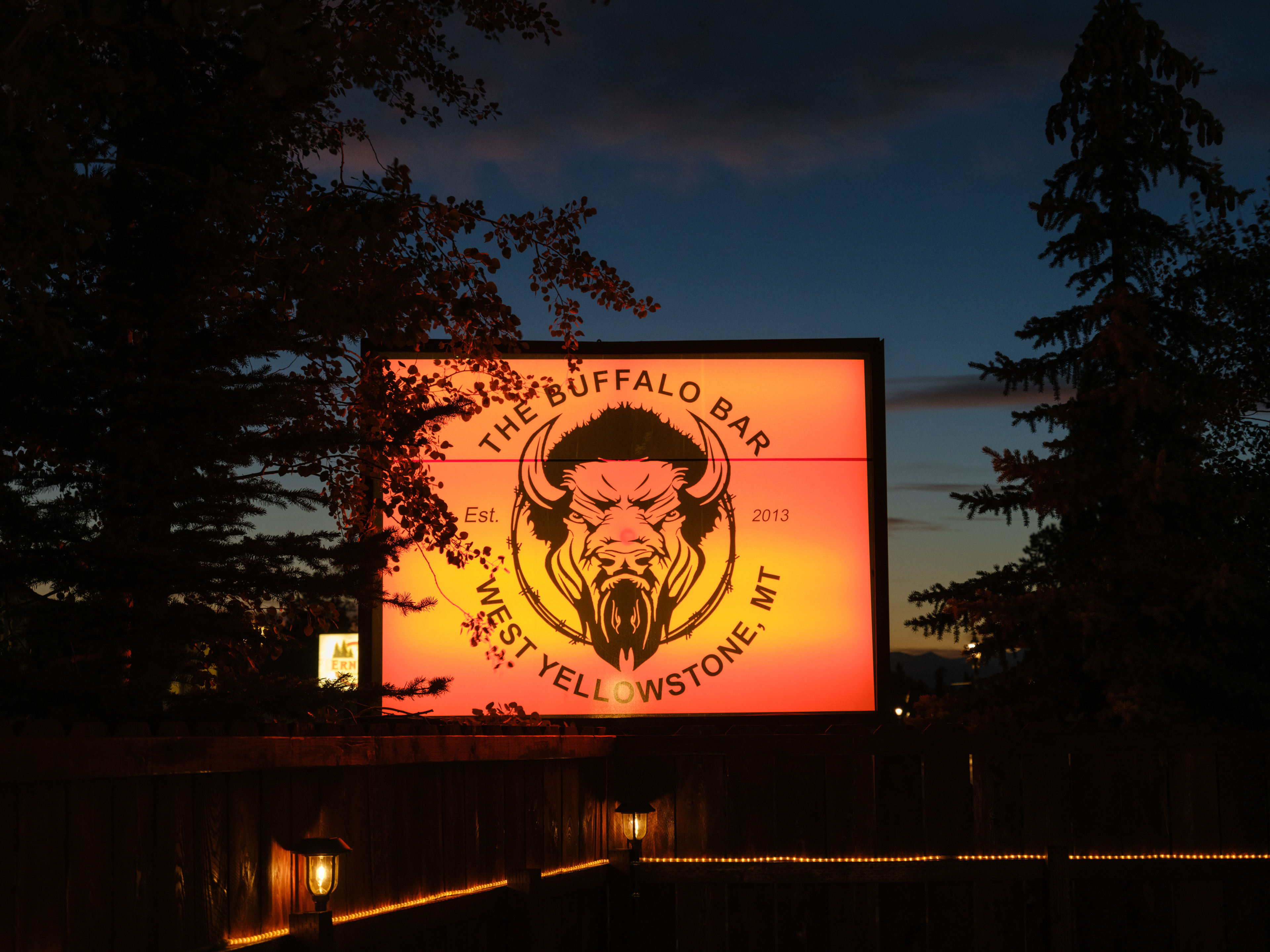
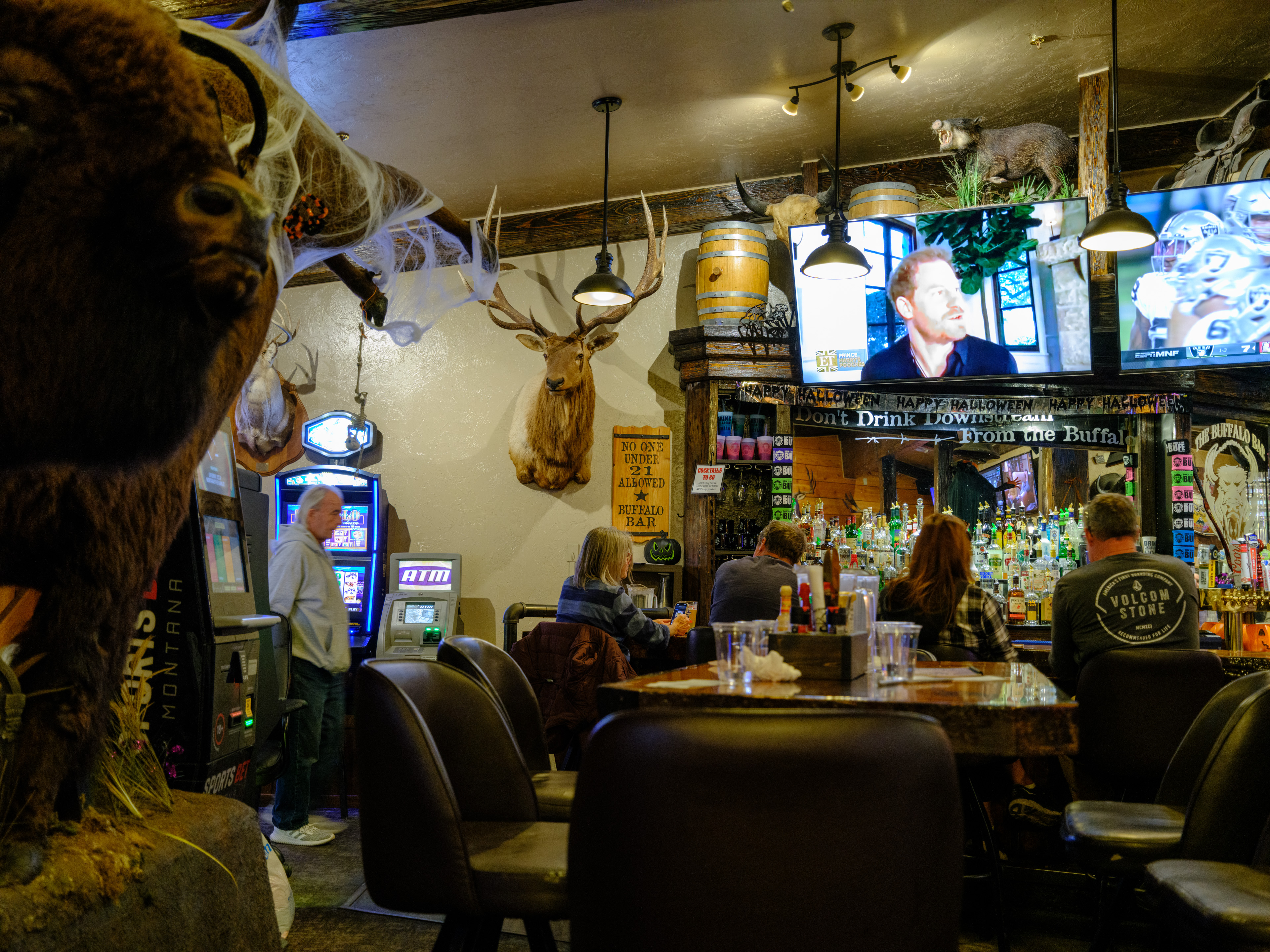
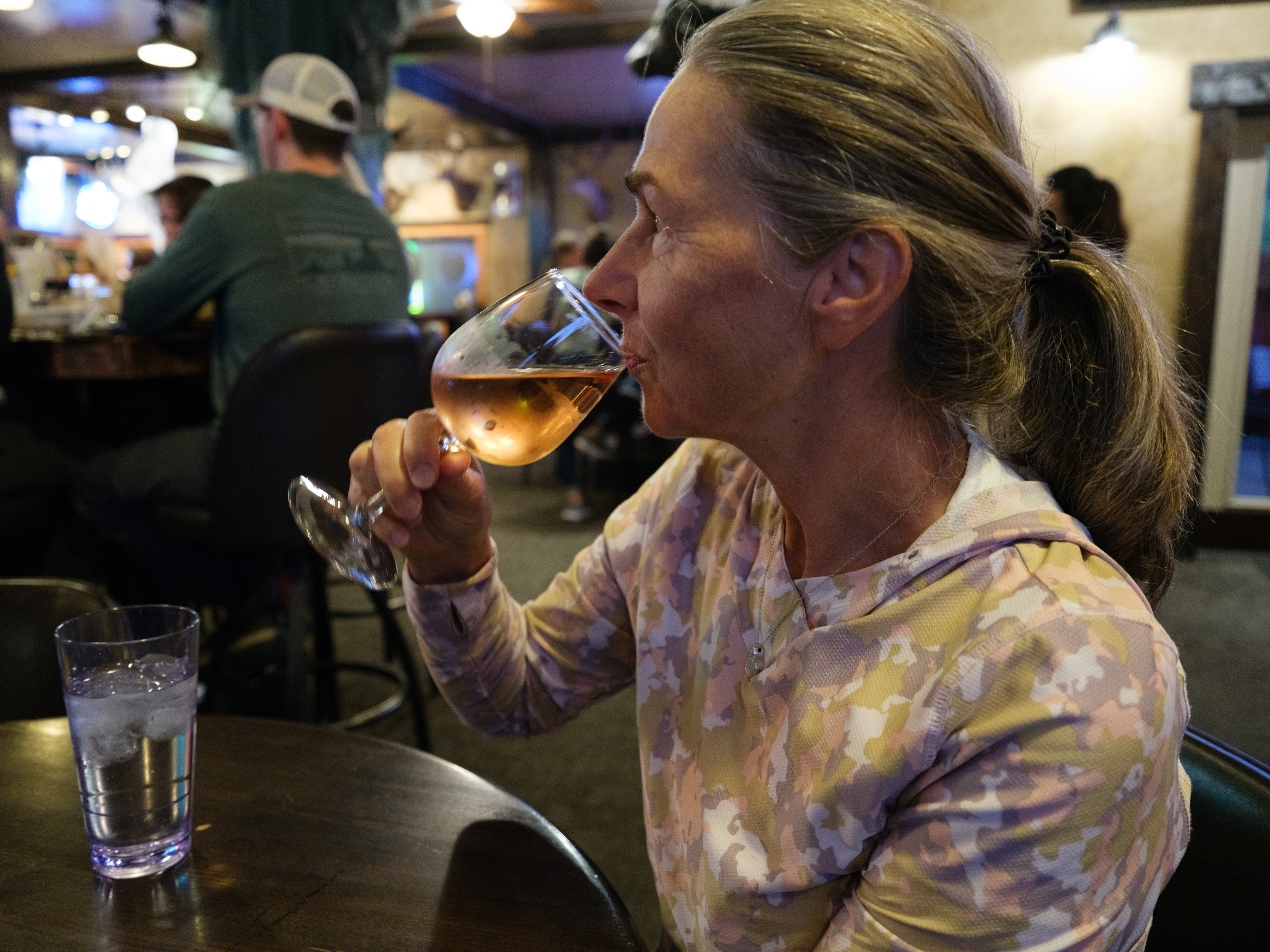
Finishing off the three days in a local hangout in West Yellowstone town:
-
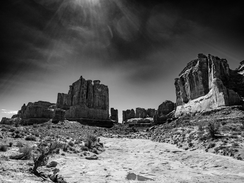
Day 25 – Gossiping on Utah’s Park Avenue

Oct. 1
Arches National Park/Utah
Total driving so far 2,552 miles / 4,083 km.
Arches-National-Park-on-google.maps
Saturday was one of the most amazing days on the Schnitzeljagd; we had picked our Grand Junction basecamp partly due to the proximity to the Arches National Park. We have been visiting the park before in the early 2000s with a very memorable hike where we got lost and young Carla thought we are going to die. Carla’s whatsApp comment to our second trip was ‘a childhood trauma unlocked‘; well at least trip # 1 was memorable for her too.
Arches is mind blowing; it reminds me on Egypt and a visit to the Valley of the Queens.
(Talking about memorable life events, I ran into Karin on that trip to Egypt for the first time).
The mighty scale of the rock formations, their astonishing shapes, the pureness and crispness of the sky, the intensive glow of the red rocks, this all is jaw dropping.
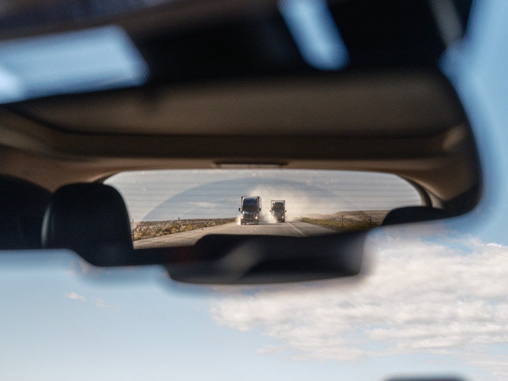
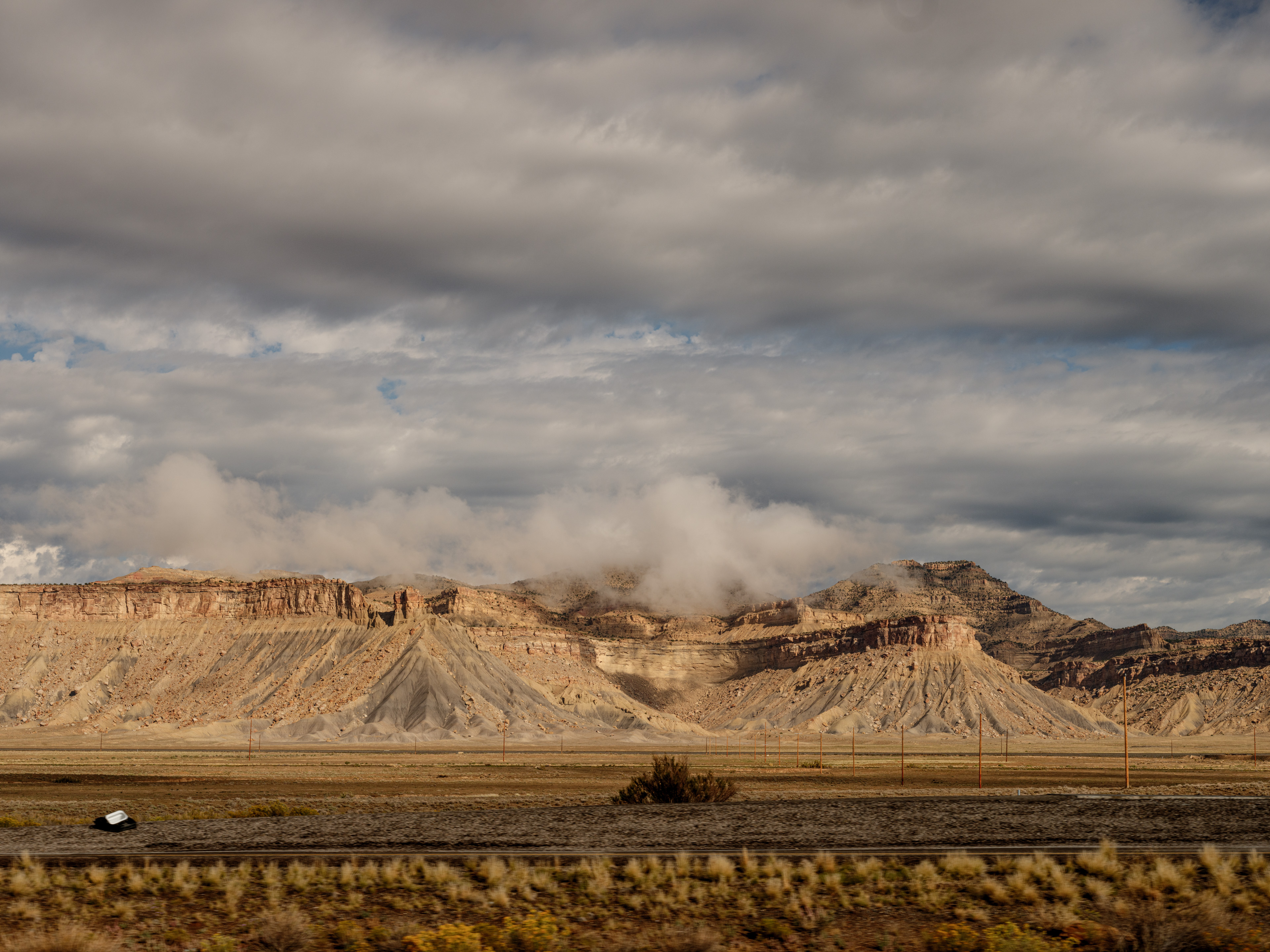
lookin back on Park Avenue canyon; Aches grounds you in a good way. Already the drive from Grand Junction to Arches along I70 was visually amazing. We started with a thunderstorm darkening the sky:

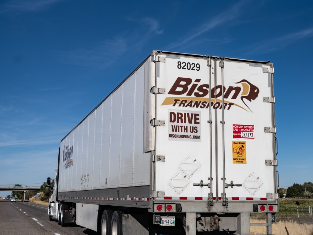
right outside of Grand Junction on I70 The huge trucks on the road seemed unimpressed from the rain and battled for supremacy:
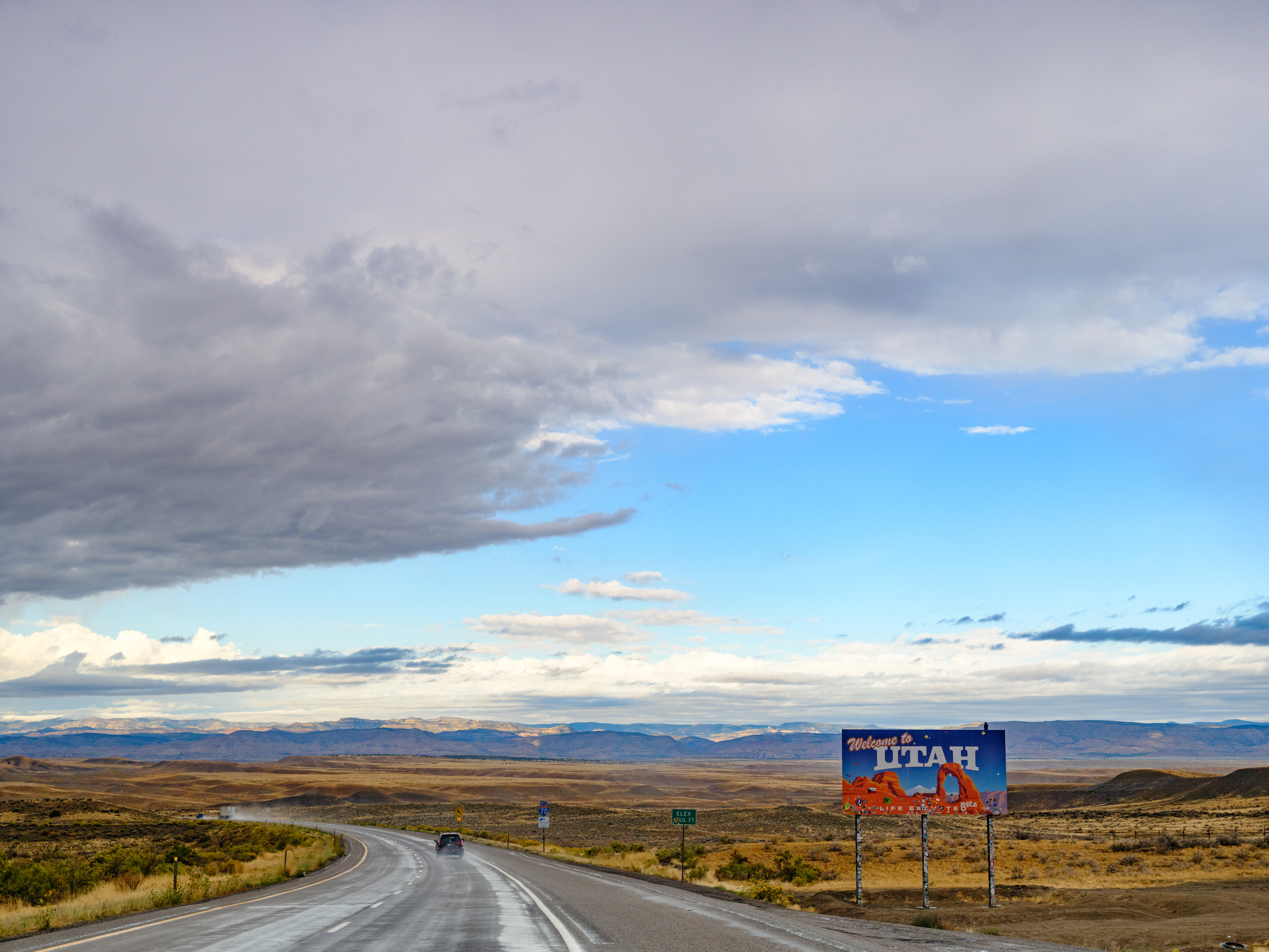
We entered Utah and it got even more impressive:
Finally the park; there is timed entry until Oct. 3, so we had to buy a $2 ticket the day before. The wait at the entrance was still about 20min. The park was not busy, but not empty either. Visiting during high season must require solid nerves, though.
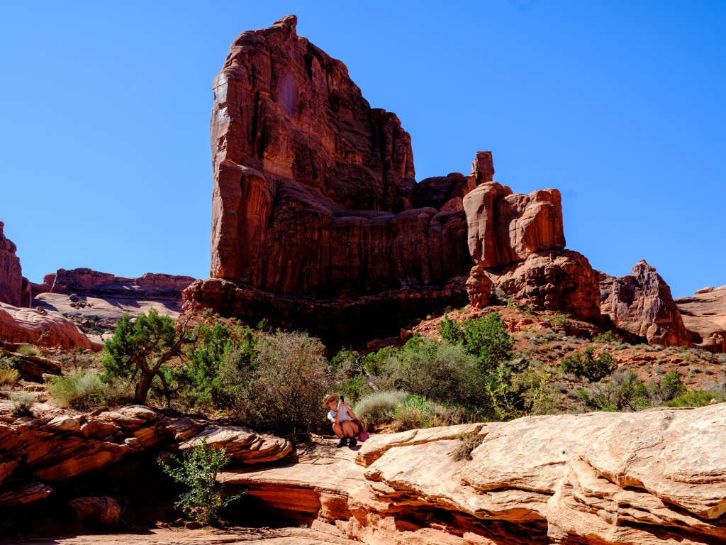
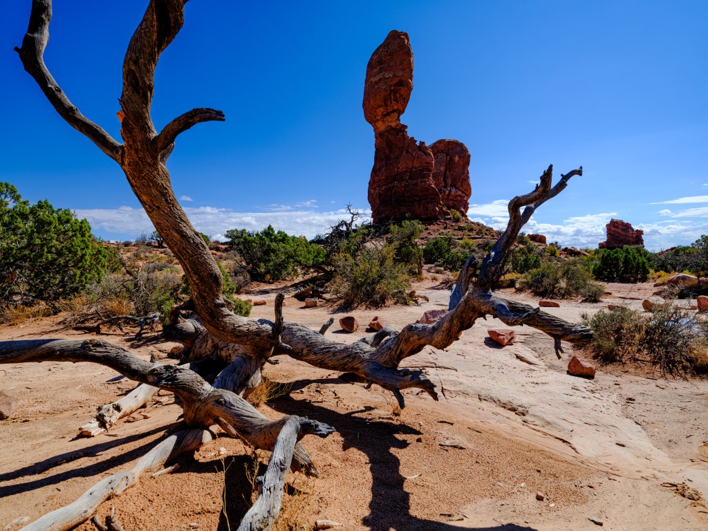
The different rock formations and arches … Park Avenue right at the beginning of the park is one of my favorites. The Three Gossips, The Organ, The Courthouse, brilliant names. The Gossips seem indeed to talk to each other since thousands of years.
Click on the images to see them in larger scale; it seems worthwhile…
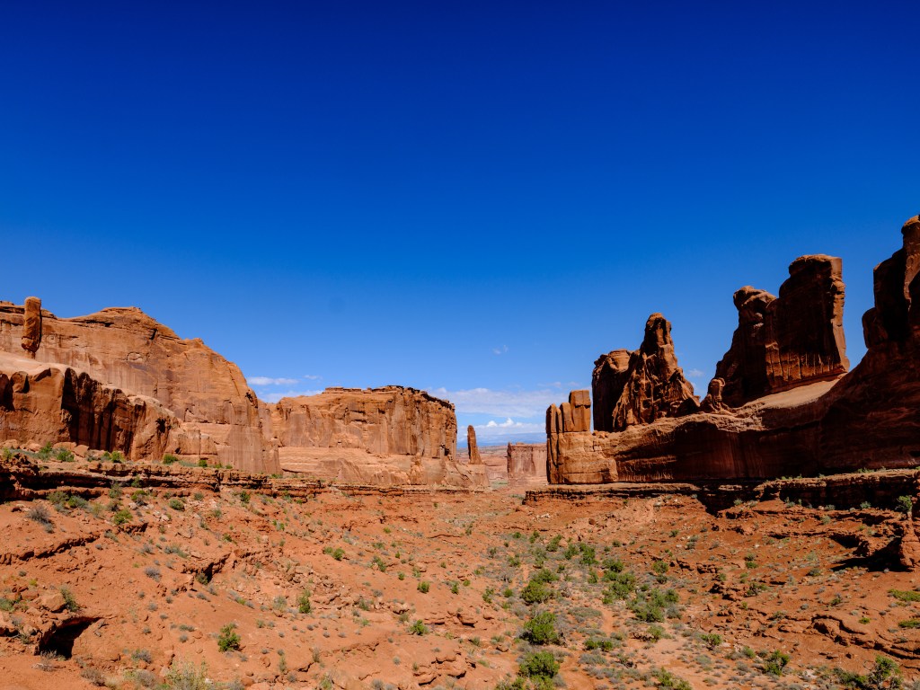
Park Avenue from the canyon entrance 
The incredible Three Gossips 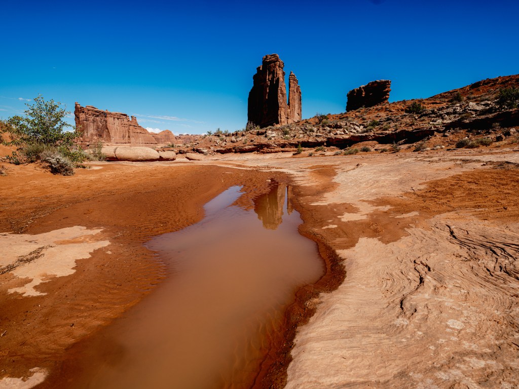
The Organ, at the end of Park Avenue; some rare rainfall the night before 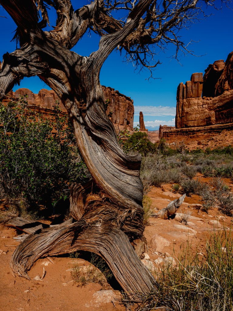
iPhone photographer One heads from one amazing are to the next by driving along a 26 miles long park road. The hikes to the arches and rock structures are short, but the sun is intensive at 5,000 feet / 1,500 m sea elevation, and one feels a bit the height. It all adds up to being really ‘toasted’ at the end the of the day.
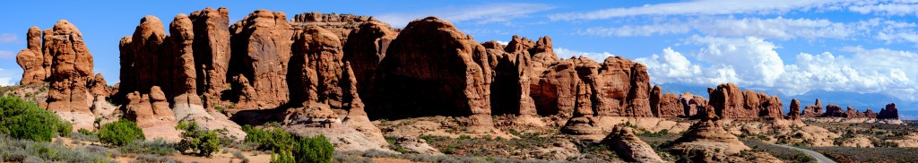
the Elephants on the far right of the panorama 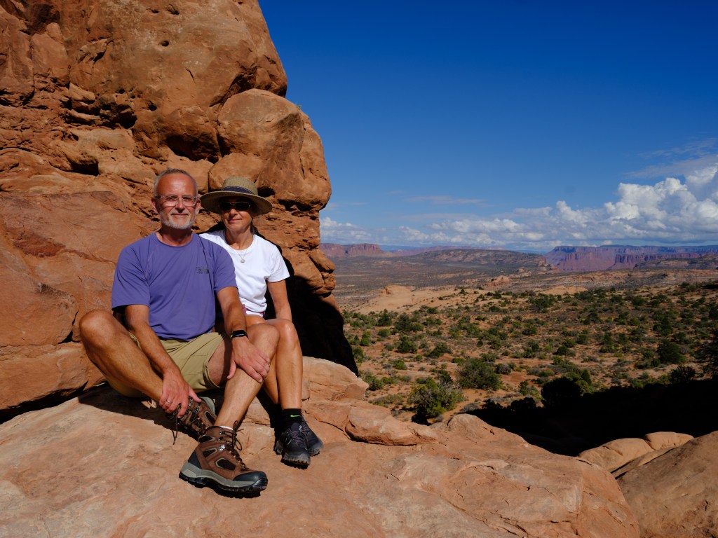
desert dwellers 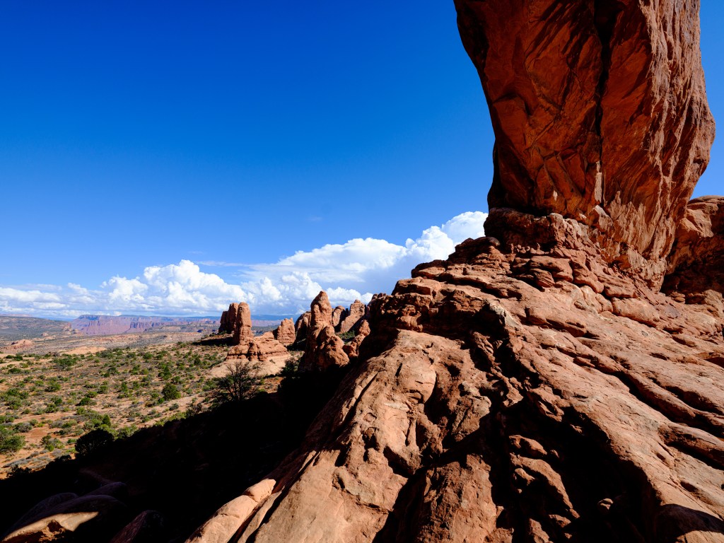
North Window arch 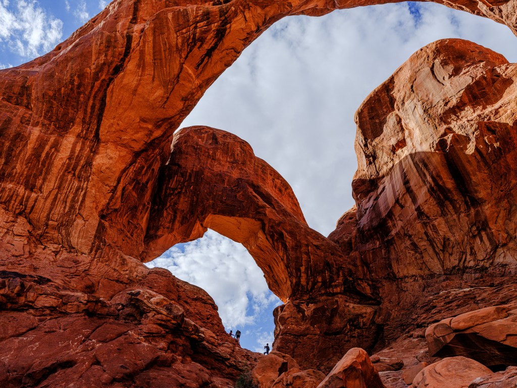
Double arch 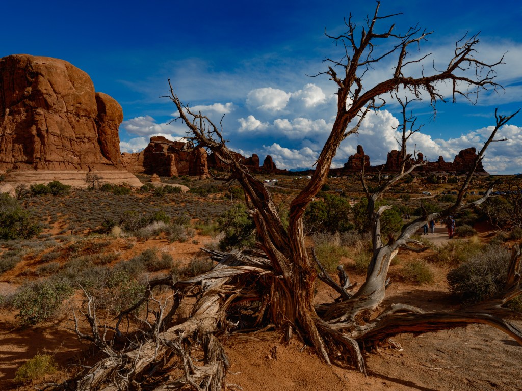
view from the Double Arch towards the parking area and the Windows Arches Finally, finally around 5:00pm we made it to the parking area for our last hike.
The Delicate Arch is the one that is synonymous with the Park. The granddaddy of all Arches.
Its very interesting to photograph, since it has been photographed for so many times and one is constantly wondering whether there is any different angle left; pus there is remarkable arsenal of cameras pointed on the arch at any given moment, and some people shouting to others to hurry up with posing underneath the arch.
We left around 6:30pm, with a thunderstorm approaching. We decided that we don’t want to hike down when the red sand turns into a soapy slippery mass from the rain and cohorts of fellow visitors in sandals might slide and tumble into us.
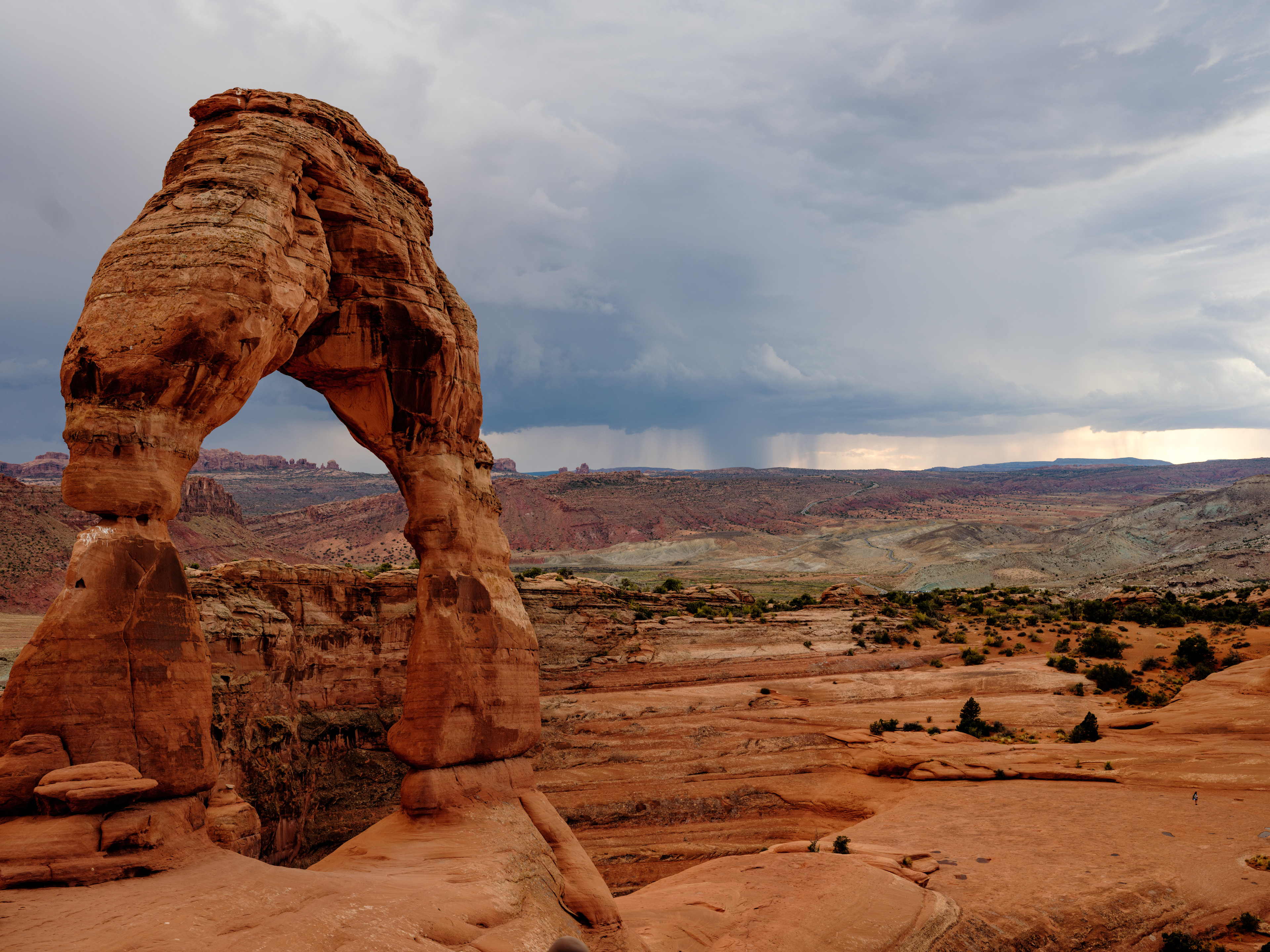
the granddaddy, the Delicate Arch, with a thunderstorm in the background -
Day-23 – The real house(wives) of Grand Junction

Sept. 29
Grand Junction/CO and Palisades/CO
Total driving so far 2,328 miles / 3,725 km.
http://our airbnb in Grand Junction-on-google.maps
http://Palisade/CO-on-google.maps
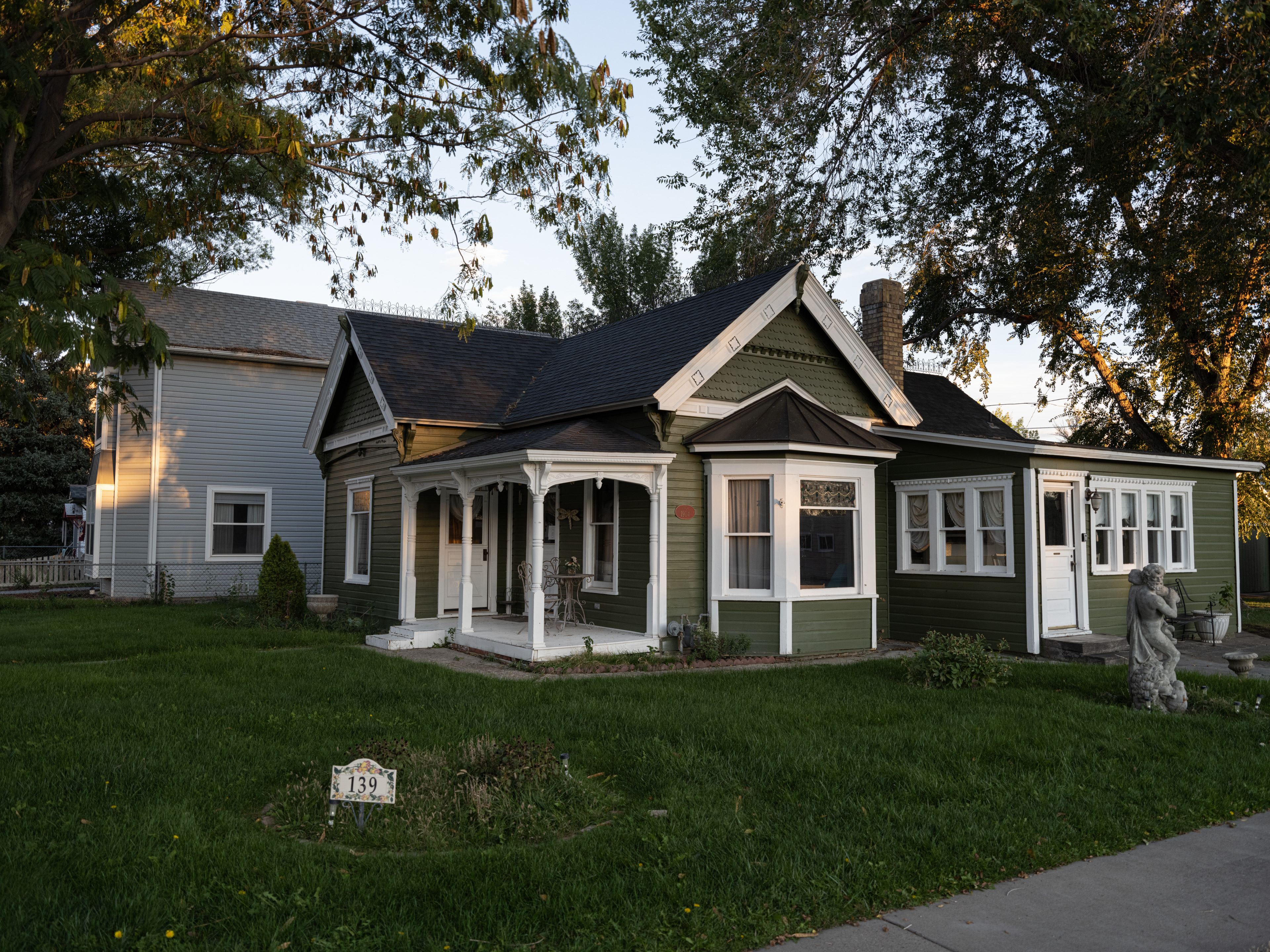
Grand Junction turned out to be a really nice place; a population of about 65,000 people, a small downtown area, which consists of one main road with a few cafes, breweries, restaurants and stores, a Colorado University campus, a college football stadium, a few parks. A clean, friendly, safe town, that word town seems to fit better than ‘city’. Its located in the center of the Grand Valley, which stretches 30 miles along the Colorado River. ‘Junction’ since the Gunnison river runs into the Colorado river right in town.
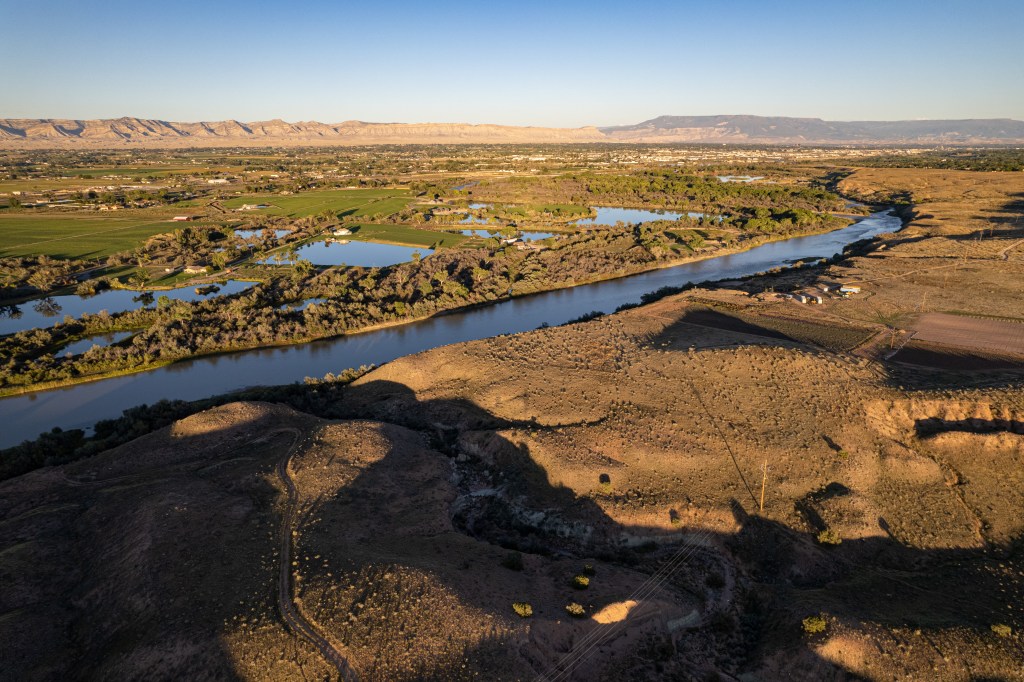
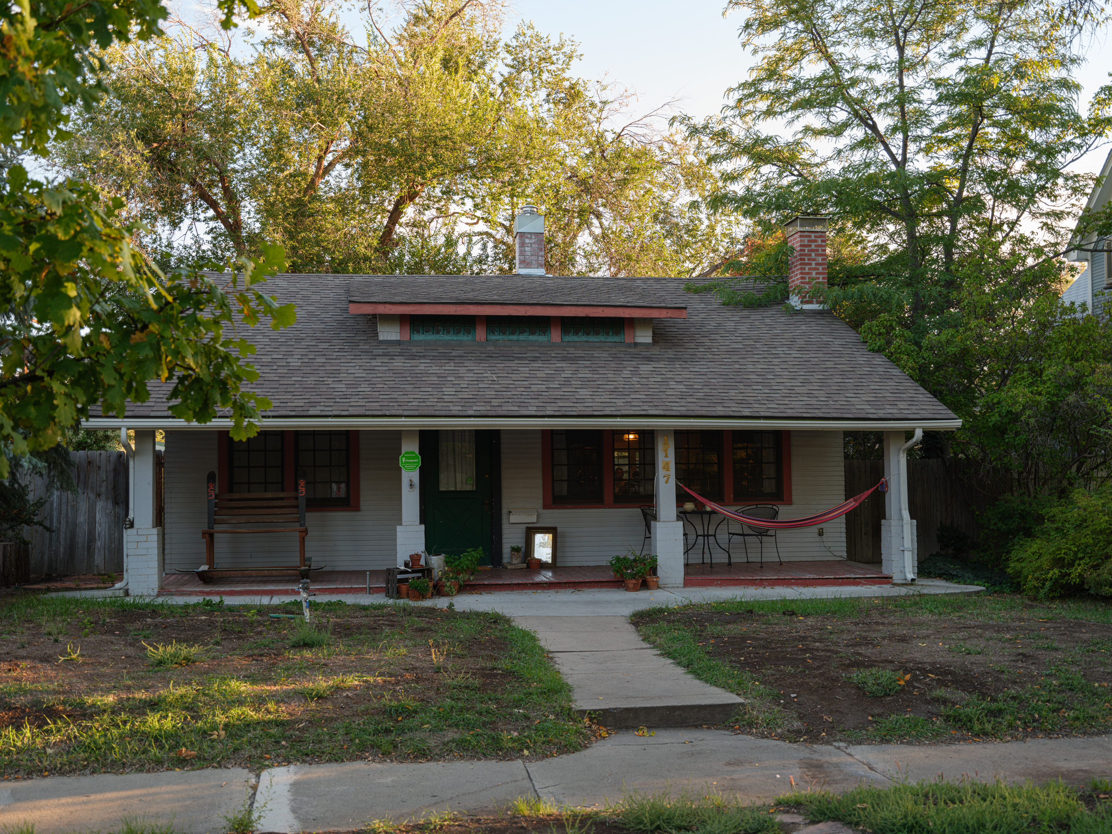
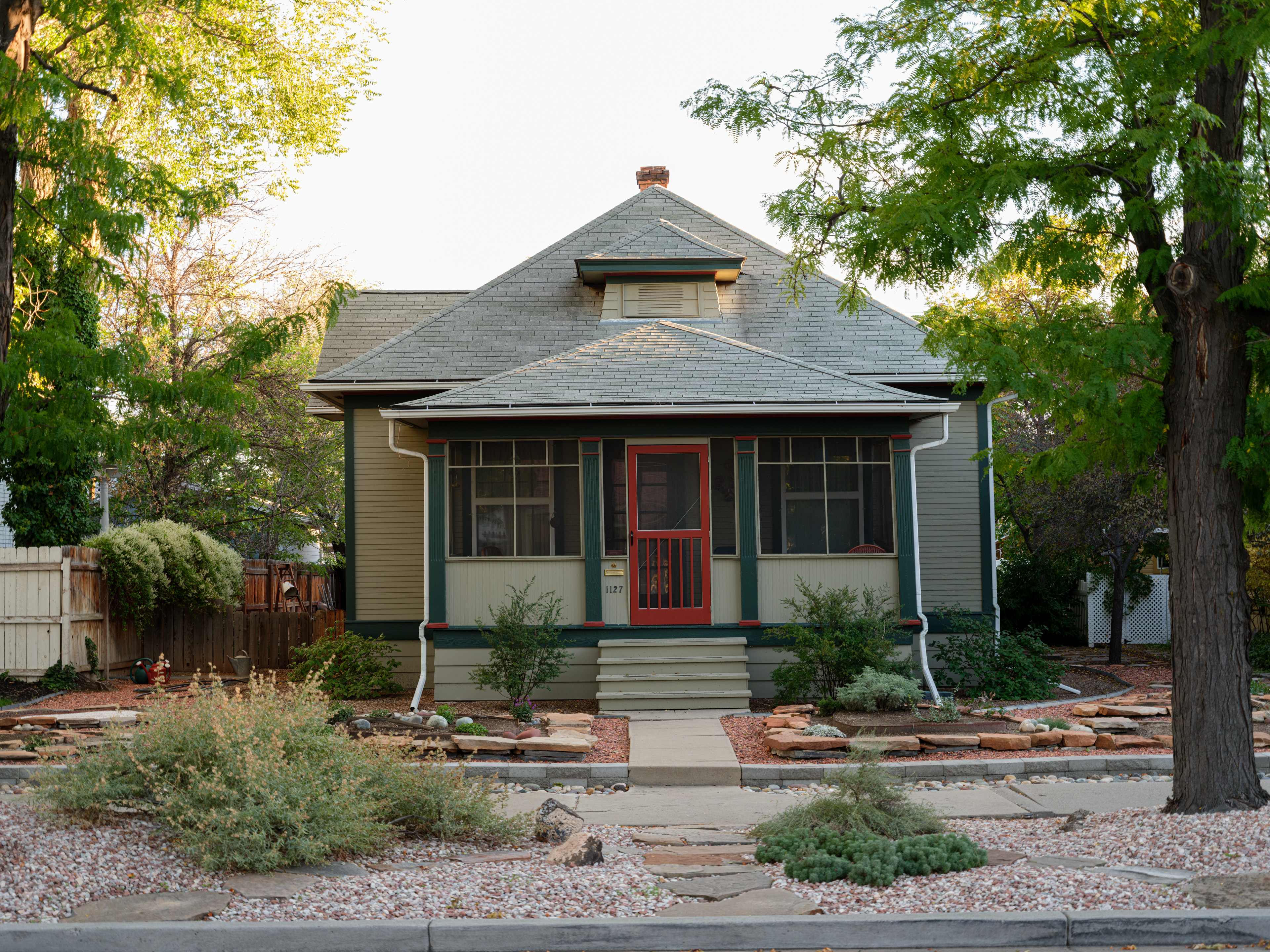
looking at the Colorodo River, Grand Junction being visible on the horizon; the Colorado was suffering from a drought, still is most likely The houses are quite charming, not large and pompous, rather suburban single family homes, but not cookie cutter style. They provide a real neighborhood feeling:

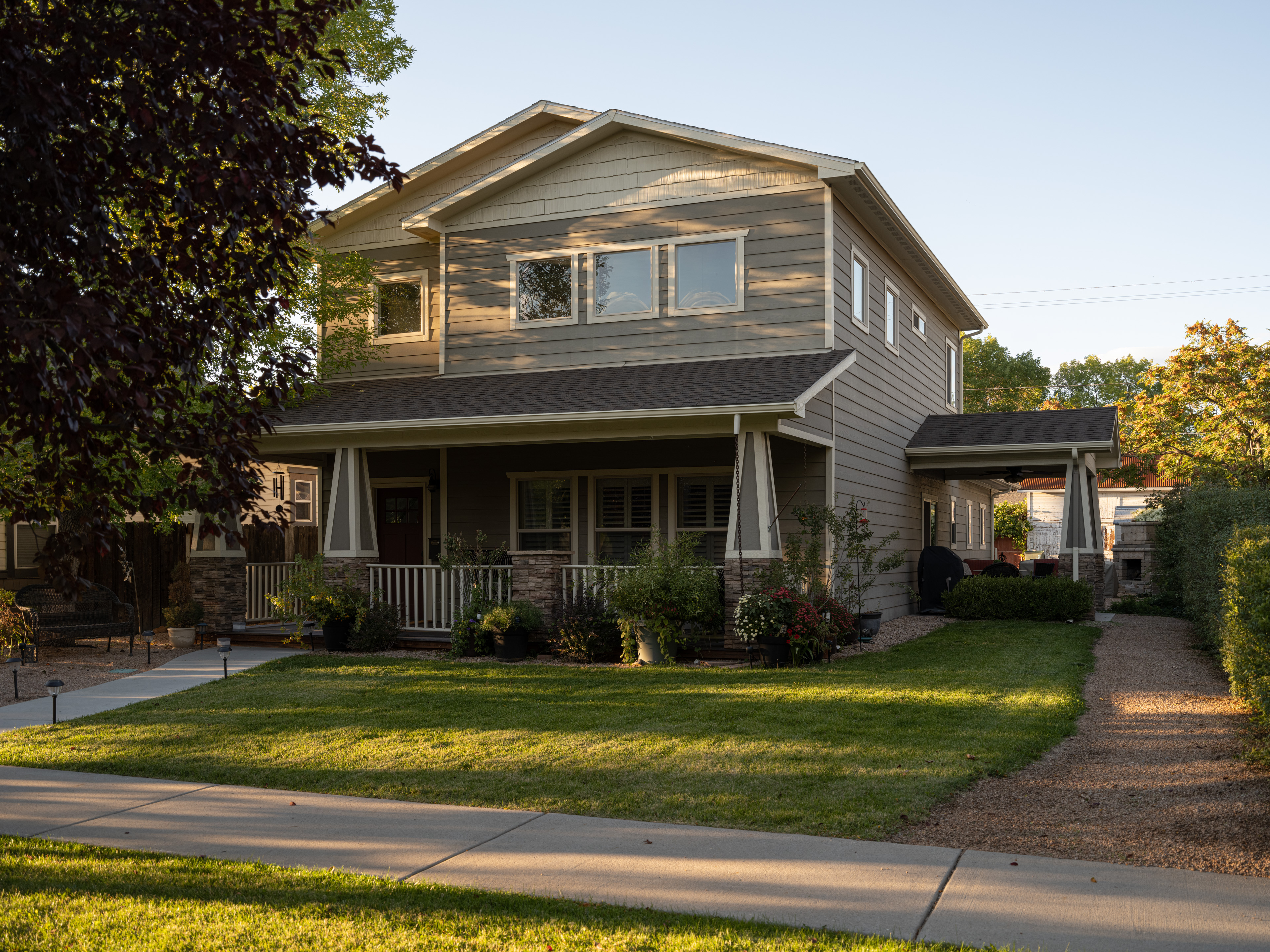

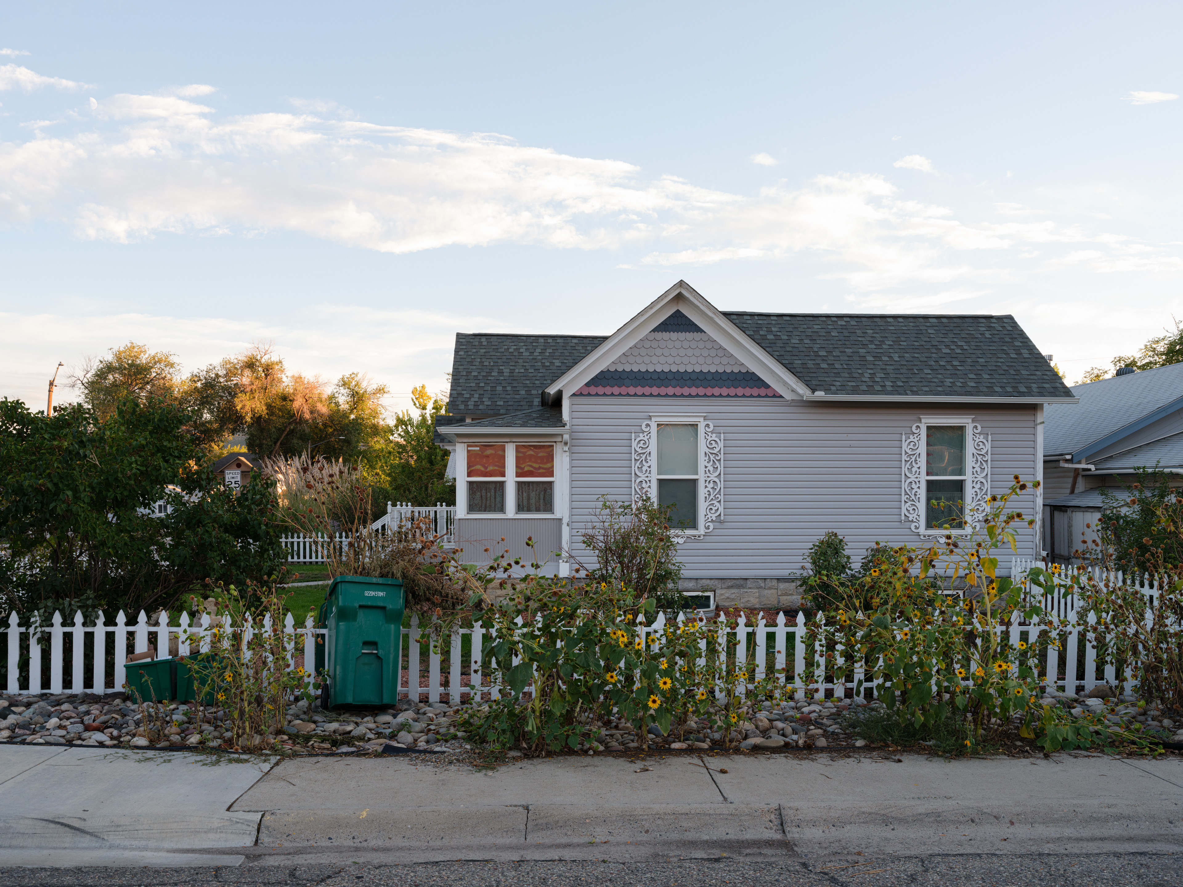
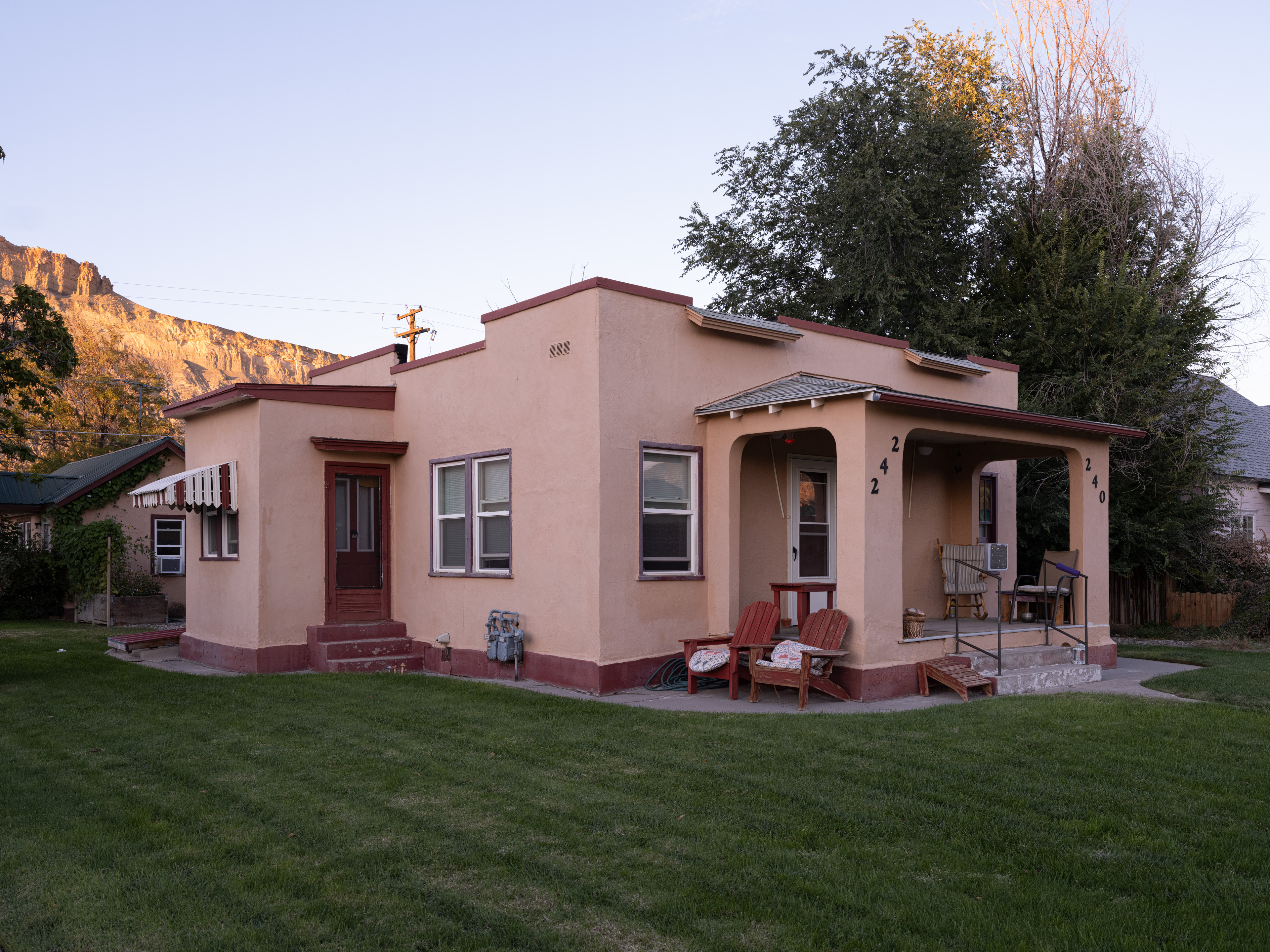
The situation changes completely 10 minutes from town center towards the southern rim of the valley, where the entrance to the Colorado National Monument is located. Right there, at the onset of the cliffs of the National Monument canyons, the houses are large, fancy and expensive.
We decided to stalk them with the drone:
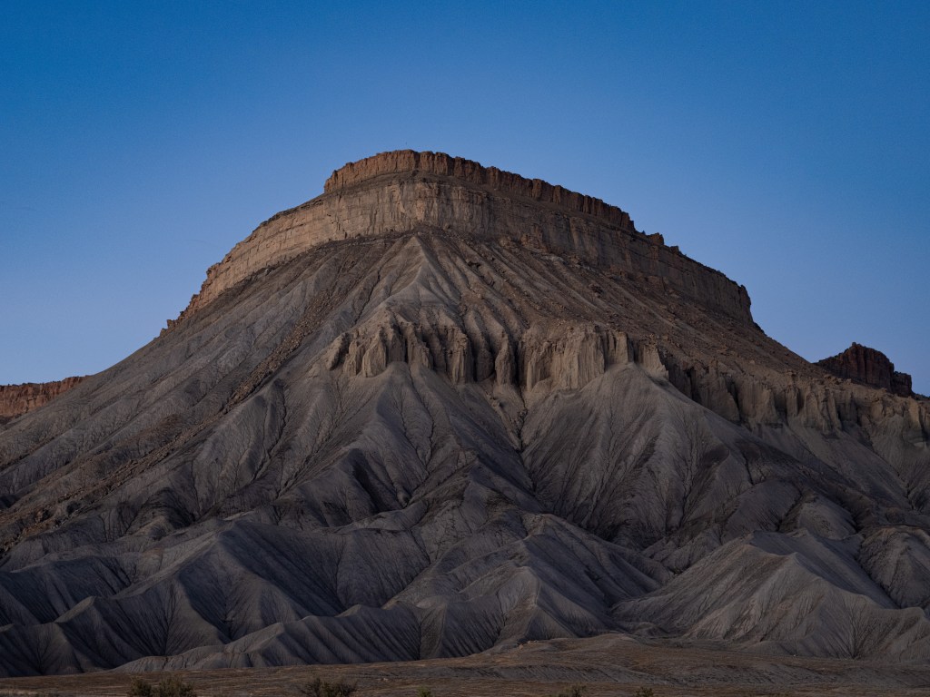
Driving east in the valley, one reaches after 15 minutes a small town named Palisade; its known for its vineyards and peach farms. All farming is depending on the irrigation via the Colorado like everywhere else in the valley.
One can see in the back of the houses the enormous cones of rock and sand, that are characteristic for the whole northern rim of the Grand Valley:
rock and sand cones right on Interstate I70 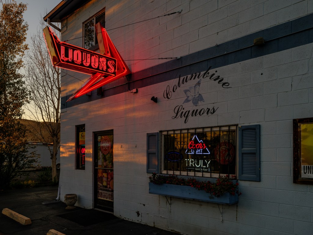
a local liquor store carrying local wine, which tastes quite good So where are the real housewives of Grand Junction?
… they are there for sure, but that tv series has not made it yet to these towns …
-
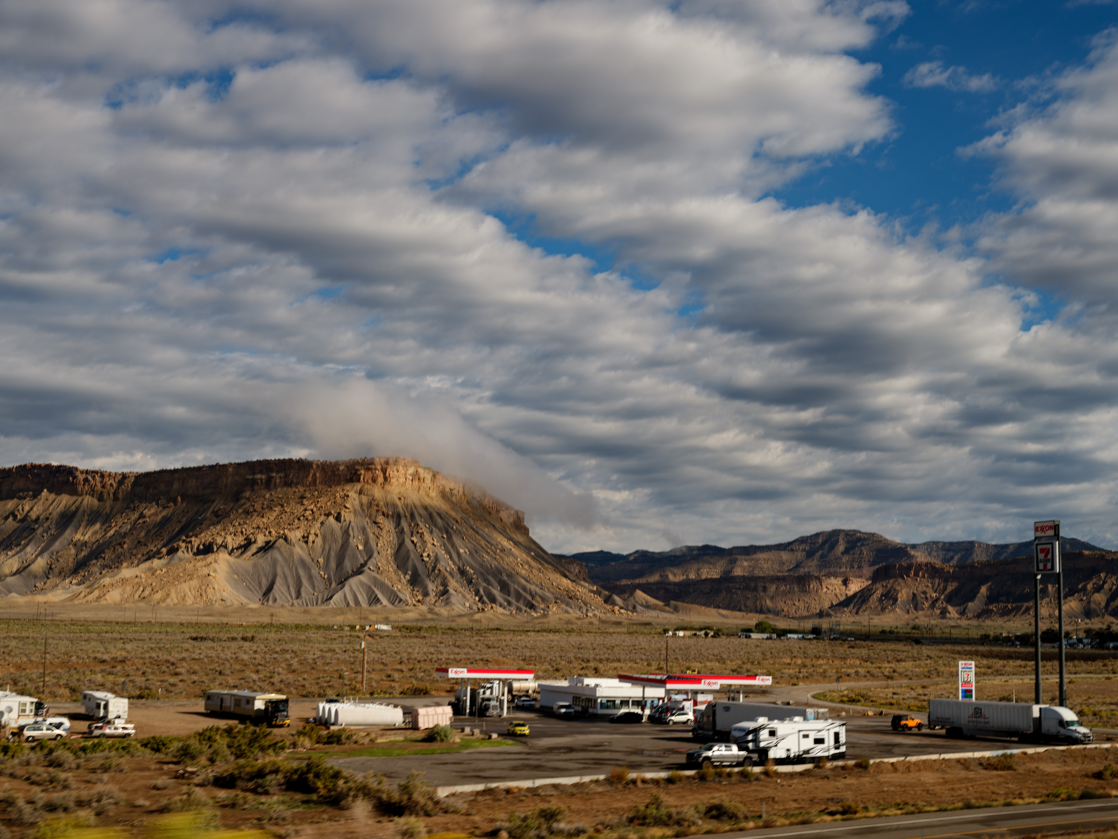
Day 19 cont. – Cattle guards provide the best directions

Sept. 25
Grand Junction/CO
Total driving so far 2,328 miles / 3,725 km.
Glade-Park-epicenter-on-google.maps
Colorado potholes turned out to be different from the New Jersey ones (my pothole BFO – best foe ever – were the ones in Mountain Lakes on Morris Ave rolling down to Powerville; it took years to get those fixed).
We asked the young barista at a coffee shop in Grand Junction about places to swim; the answer was ‘go to the Potholes‘.
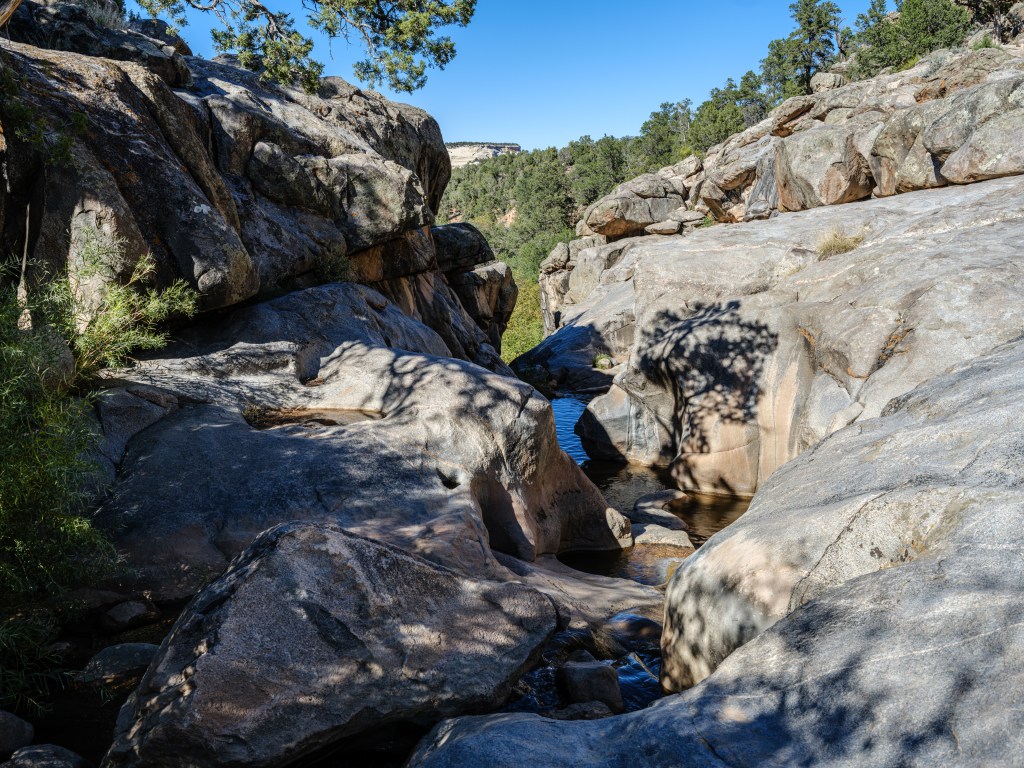
The Potholes turned out to be situated behind the Colorado National Monument park unit area.
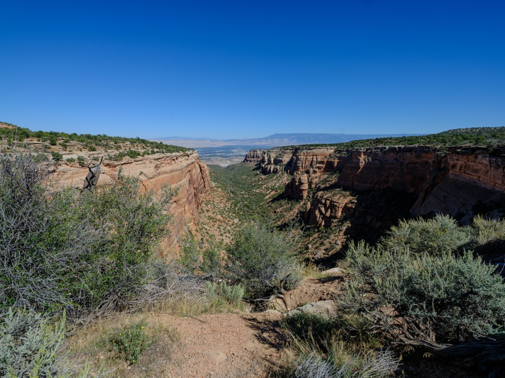
a canyon of the Colorado National Monument; turn around 180 degrees and embark 10 miles further into the wilderness and you uncover Glade Park National parks are typically in remote places, so something tugged behind a remote area is super remote.
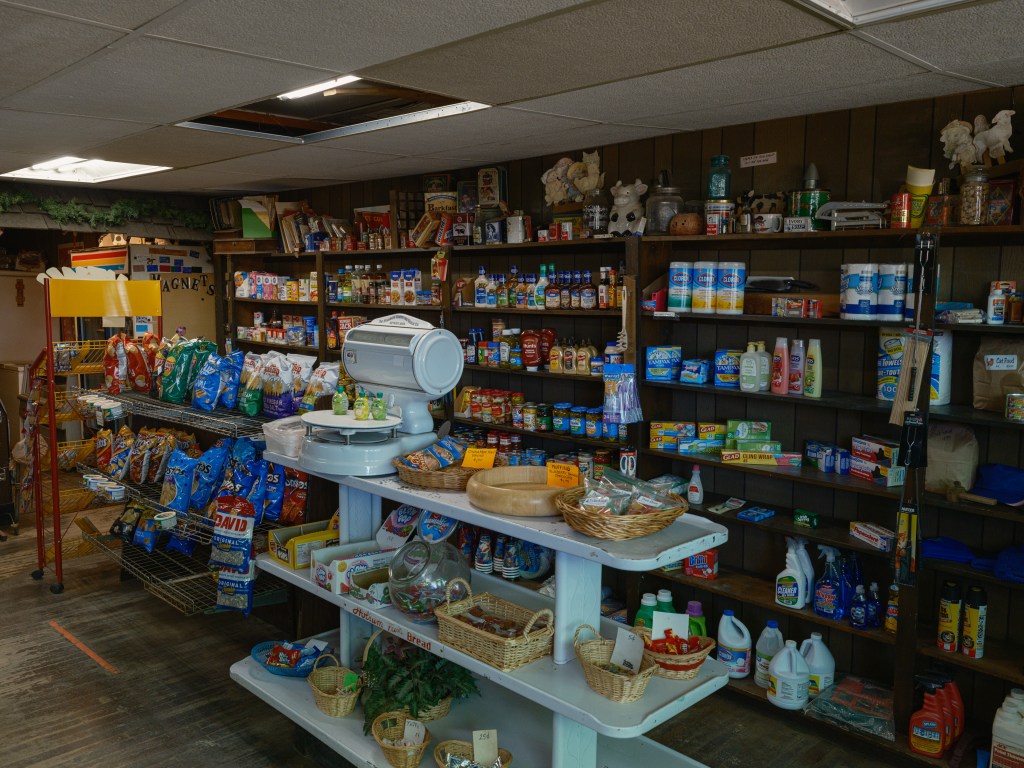
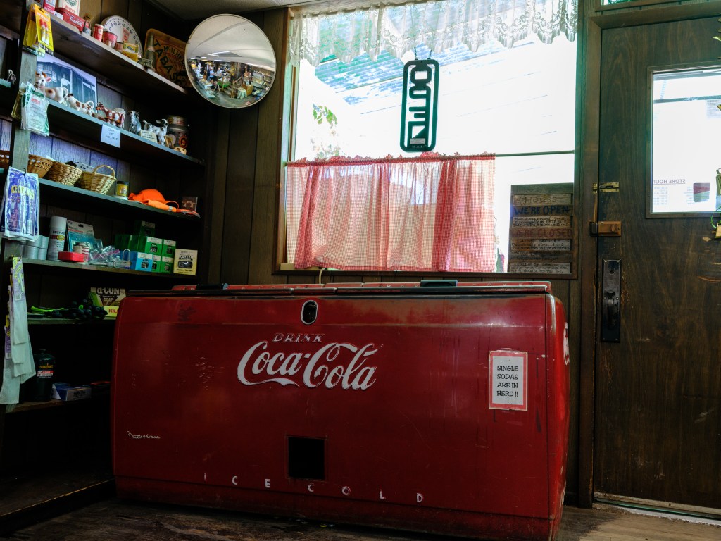
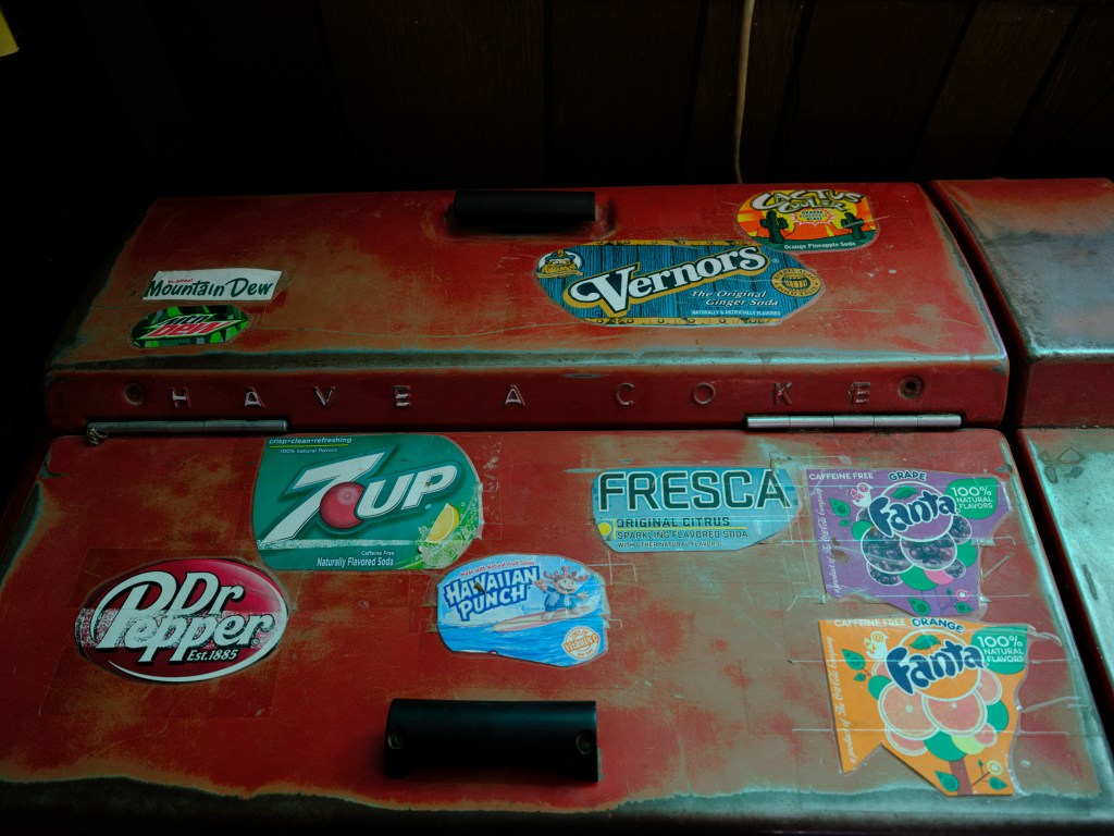
The name of this super remoteness is ‘Glade Park’ and the epicenter of Glade Park is the one and only store there:
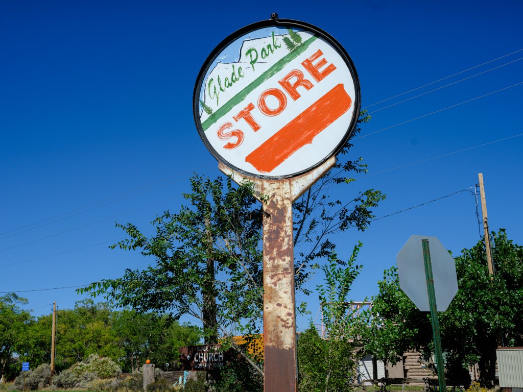
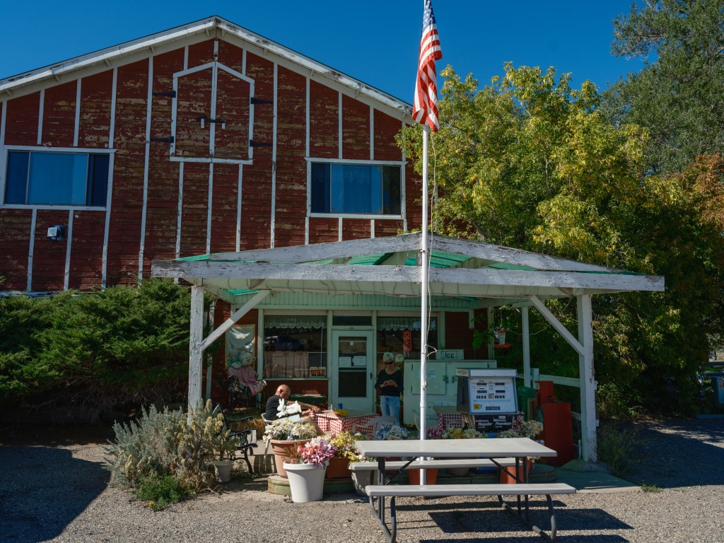
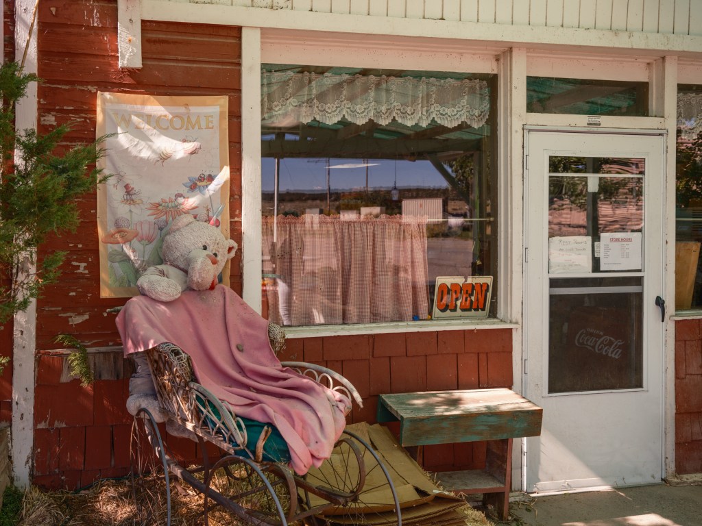
The store is a time capsule, and we bought a honey jar originating from this highland area, and it turned out to be very tasty and high quality.
That Glade Park store The old lady behind the store counter gave us directions for how to find the swimming potholes – 20min straight ahead, turn left into the dirt road, take third turn on the right, drive to the end of that path, then hike the remaining quarter mile. Sounded easy enough. But a turn-right-into-another-dirt-road is a very vague term … what classifies as ‘road’ versus a small opening in the bushes? We got lost and drove too far on a super remote dirt road. Finally a pickup truck showed up, and he told us to go back 3 cattle guards. Now that made sense, cattle guards represent clear directions.
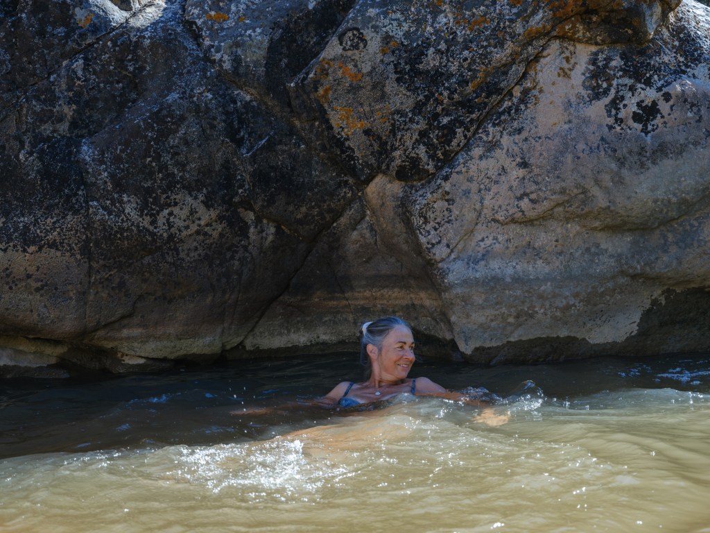
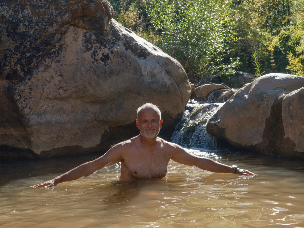
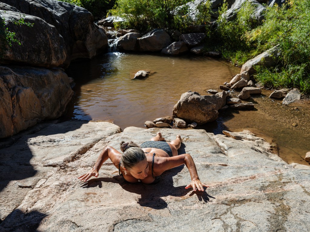
The potholes are quite beautiful, but since the general water level is very low in the Colorado river and all around, one can hop into the water, but swimming isn’t possible:
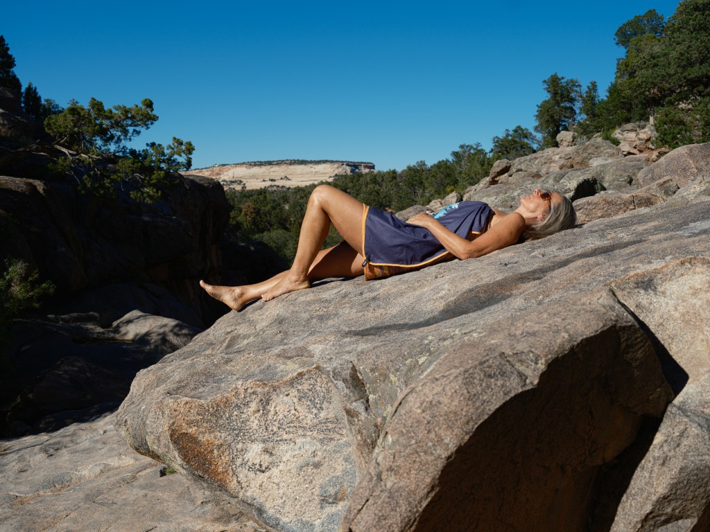
Some interesting life forms, though, soaking up the sun, a bit like in the Galapagos:
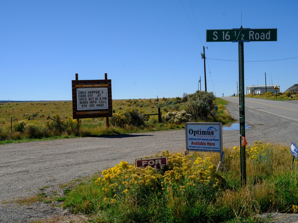
Hey, and when done with the potholes, there is still the option to join the chili supper & cook off – Oct. 15th, 6pm !

-
Subscribe
Subscribed
Already have a WordPress.com account? Log in now.
